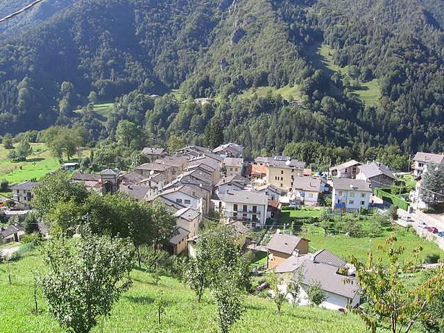
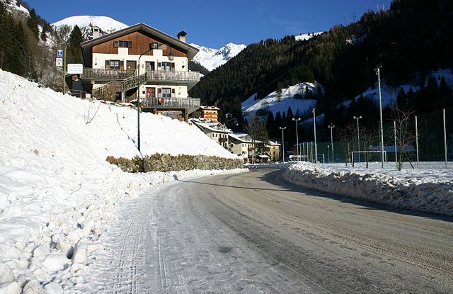
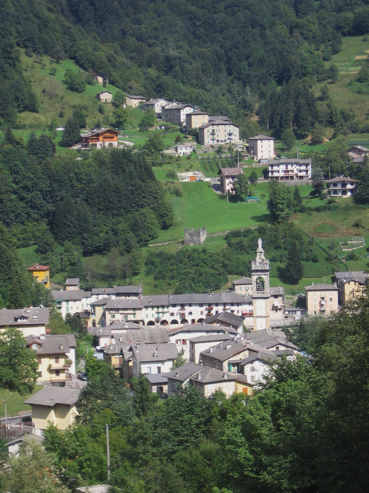
Mezzoldo (Mezzoldo)
.svg)
- Italian comune
 Hiking in Mezzoldo
Mezzoldo is a charming village located in the Lombardy region of Italy, nestled in the Bergamo Alps. It's a wonderful destination for hikers, offering a blend of natural beauty, historical sites, and a variety of trails catering to different skill levels.
Hiking Trails
-
Trail to Pizzo dei Tre Signori: This trail is quite popular and takes you to an elevation where you can enjoy panoramic views of the surrounding mountains. It's a moderately challenging hike, rewarding you with scenic landscapes.
-
Sentiero del Giambellino: A relatively easier trail suitable for families, it leads you through beautiful forests and meadows, showcasing the local flora and fauna.
-
Monte Bue: A more challenging option, this hike offers stunning views over the valleys and allows you to immerse yourself in nature. The trail can be steep in parts, so hikers should be prepared for a workout.
Scenic Views and Nature
The area around Mezzoldo boasts lush forests, alpine meadows, and dramatic mountain landscapes. Wildlife enthusiasts may spot local fauna, including deer and various bird species. The changing seasons also offer a beautiful palette of colors, especially in the fall and spring.
Historical Sites
While hiking, you may come across remnants of ancient paths and structures, giving insight into the region's history. The village itself is quaint, with cobblestone streets and local architecture, providing a glimpse into traditional alpine life.
Tips for Hiking in Mezzoldo
- Weather: Always check the weather conditions before setting out, as mountain weather can be unpredictable.
- Gear: Dress in layers, wear sturdy hiking boots, and carry plenty of water and snacks.
- Maps: It's advisable to have a detailed map or a GPS device since some trails can be less marked.
- Local Regulations: Adhere to local guidelines and regulations regarding wildlife and trail etiquette to ensure a safe and enjoyable experience.
Accessibility
Mezzoldo is generally accessible by road, and it's a good starting point for various hikes in the vicinity, making it an excellent base for hiking enthusiasts.
In summary, Mezzoldo offers a wonderful hiking experience that combines natural beauty, diverse trails, and a touch of history, making it a great destination for both seasoned hikers and beginners alike. Enjoy your adventure!
- Country:

- Postal Code: 24010
- Local Dialing Code: 0345
- Licence Plate Code: BG
- Coordinates: 46° 0' 47" N, 9° 39' 53" E


- GPS tracks (wikiloc): [Link]
- AboveSeaLevel: 835 м m
- Area: 18.84 sq km
- Population: 161
- Web site: http://www.comune.mezzoldo.bg.it
- Wikipedia en: wiki(en)
- Wikipedia: wiki(it)
- Wikidata storage: Wikidata: Q101236
- Wikipedia Commons Gallery: [Link]
- Wikipedia Commons Category: [Link]
- Freebase ID: [/m/0gjb_3]
- GeoNames ID: Alt: [6536144]
- VIAF ID: Alt: [243185341]
- OSM relation ID: [46680]
- TGN ID: [1045368]
- ISTAT ID: 016134
- Italian cadastre code: F186
Shares border with regions:


Olmo al Brembo
- Italian comune
Hiking in Olmo al Brembo
Olmo al Brembo is a charming village located in the Lombardy region of Italy, nestled in the scenic Brembana Valley. It's surrounded by stunning natural landscapes, making it a fantastic destination for hiking enthusiasts. Here are some highlights and tips for hiking in and around Olmo al Brembo:...
- Country:
- Postal Code: 24010
- Local Dialing Code: 0345
- Licence Plate Code: BG
- Coordinates: 45° 58' 20" N, 9° 38' 57" E
- GPS tracks (wikiloc): [Link]
- AboveSeaLevel: 556 м m
- Area: 7.9 sq km
- Population: 500
- Web site: [Link]


Piazzatorre
- Italian comune
Hiking in Piazzatorre
Piazzatorre, located in the Lombardy region of Italy, is a picturesque mountain village that offers a variety of hiking opportunities amidst beautiful natural landscapes. Surrounded by the Bergamasque Alps, it provides stunning views, diverse terrain, and a chance to experience the local flora and fauna....
- Country:
- Postal Code: 24010
- Local Dialing Code: 0345
- Licence Plate Code: BG
- Coordinates: 46° 0' 0" N, 9° 41' 0" E
- GPS tracks (wikiloc): [Link]
- AboveSeaLevel: 868 м m
- Area: 24.24 sq km
- Population: 399
- Web site: [Link]

Piazzolo
- Italian comune
Hiking in Piazzolo
Piazzolo, located in the beautiful region of Italy, particularly near the eastern Alpin Valley, offers stunning landscapes and an array of hiking opportunities. While specific trails may vary, here are some general tips and highlights that can enhance your hiking experience in the area:...
- Country:
- Postal Code: 24010
- Local Dialing Code: 0345
- Licence Plate Code: BG
- Coordinates: 45° 58' 47" N, 9° 40' 14" E
- GPS tracks (wikiloc): [Link]
- AboveSeaLevel: 702 м m
- Area: 4.15 sq km
- Population: 92
- Web site: [Link]

Valleve
- Italian comune
Hiking in Valleve
Valleve, located in the Bergamo province of Italy, offers stunning landscapes and a variety of hiking opportunities for all levels of outdoor enthusiasts. Nestled in the Italian Alps, Valleve is characterized by its picturesque valleys, lush forests, and breathtaking mountain views....
- Country:
- Postal Code: 24010
- Local Dialing Code: 0345
- Licence Plate Code: BG
- Coordinates: 46° 2' 0" N, 9° 45' 0" E
- GPS tracks (wikiloc): [Link]
- AboveSeaLevel: 1141 м m
- Area: 14.76 sq km
- Population: 133
- Web site: [Link]
Tartano
- Italian comune
Hiking in Tartano
Tartano is a mountain area located in the Italian Alps, specifically in the Lombardy region. It offers a range of hiking opportunities for both novice and experienced hikers. The region is known for its breathtaking landscapes, including lush forests, alpine meadows, and stunning panoramic views....
- Country:
- Postal Code: 23010
- Local Dialing Code: 0342
- Licence Plate Code: SO
- Coordinates: 46° 7' 0" N, 9° 41' 0" E
- GPS tracks (wikiloc): [Link]
- AboveSeaLevel: 1210 м m
- Area: 47.27 sq km
- Population: 205
- Web site: [Link]


Albaredo per San Marco
- Italian comune
Hiking in Albaredo per San Marco
Albaredo per San Marco is a charming village located in the province of Sondrio, in the Lombardy region of northern Italy. Nestled within the stunning landscapes of the Valtellina Valley and the surrounding Orobie Alps, it offers a range of beautiful hiking opportunities suitable for various skill levels....
- Country:
- Postal Code: 23010
- Local Dialing Code: 0342
- Licence Plate Code: SO
- Coordinates: 46° 6' 11" N, 9° 35' 26" E
- GPS tracks (wikiloc): [Link]
- AboveSeaLevel: 950 м m
- Area: 18.96 sq km
- Population: 300
- Web site: [Link]

Averara
- Italian comune
Hiking in Averara
Averara is a beautiful destination for hiking enthusiasts, nestled in the Bergamo Alps in the Lombardy region of Italy. This picturesque village offers a range of hiking trails suitable for various skill levels, set against the backdrop of stunning mountain scenery, lush forests, and vibrant flora....
- Country:
- Postal Code: 24010
- Local Dialing Code: 0345
- Licence Plate Code: BG
- Coordinates: 45° 59' 20" N, 9° 37' 53" E
- GPS tracks (wikiloc): [Link]
- AboveSeaLevel: 650 м m
- Area: 10.69 sq km
- Population: 178
- Web site: [Link]