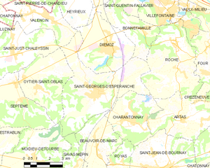
Moidieu-Détourbe (Moidieu-Détourbe)

- commune in Isère, France
 Hiking in Moidieu-Détourbe
Moidieu-Détourbe is a scenic municipality located in the Auvergne-Rhône-Alpes region of France, near the Rhône River. While it might not be as widely known as some other hiking destinations, it offers a beautiful landscape perfect for exploration.
Hiking Opportunities:
-
Countryside Trails: The area around Moidieu-Détourbe features a network of rural trails that weave through fields, forests, and vineyards. These paths provide a peaceful environment for hikers looking to enjoy the region's natural beauty.
-
Nearby Regional Parks: Moidieu-Détourbe is located close to larger natural reserves and regional parks, such as the Pilat Regional Natural Park. This park features varied terrain, from rolling hills to rugged mountain areas, with numerous marked hiking trails ranging from easy walks to more challenging hikes.
-
Lyon's Proximity: The proximity to Lyon means that you can easily access urban hiking trails as well, which may be an option for those looking to combine their outing with cultural activities.
Hiking Tips:
-
Trail Maps: It’s recommended to get detailed trail maps from local tourism offices or online resources to help navigate the paths.
-
Weather Conditions: Be sure to check the weather prior to hiking. The region can experience varying weather conditions, so plan accordingly.
-
Safety Gear: Bring appropriate hiking gear, including sturdy shoes, water, and snacks. It's also important to dress in layers, as temperatures can fluctuate throughout the day.
-
Respect Nature: While enjoying the outdoors, it's crucial to follow Leave No Trace principles and stay on marked trails to protect the natural environment.
Suggested Hiking Duration:
- For casual hikers, a 2-4 hour trek would allow you to explore the beautiful surroundings without overstressing yourself. More experienced hikers may seek out longer or more challenging routes, possibly extending to a full day.
Whether you’re looking for a peaceful walk in nature or a more adventurous hike, Moidieu-Détourbe and its surroundings can provide an enjoyable outdoor experience.
- Country:

- Postal Code: 38440
- Coordinates: 45° 30' 43" N, 5° 0' 58" E


- GPS tracks (wikiloc): [Link]
- Area: 18.04 sq km
- Population: 1832
- Web site: http://www.moidieu-detourbe.fr
- Wikipedia en: wiki(en)
- Wikipedia: wiki(fr)
- Wikidata storage: Wikidata: Q1150829
- Wikipedia Commons Category: [Link]
- Freebase ID: [/m/03nvglm]
- GeoNames ID: Alt: [6433245]
- SIREN number: [213802382]
- BnF ID: [15258050q]
- VIAF ID: Alt: [140878790]
- Library of Congress authority ID: Alt: [n95019852]
- INSEE municipality code: 38238
Shares border with regions:


Savas-Mépin
- commune in Isère, France
Hiking in Savas-Mépin
Savas-Mépin is a small commune located in the Auvergne-Rhône-Alpes region of southeastern France, known for its scenic natural landscapes and outdoor activities, including hiking. While being less well-known than some major hiking destinations in the Alps or the Vercors region, Savas-Mépin offers a peaceful environment for outdoor enthusiasts....
- Country:
- Postal Code: 38440
- Coordinates: 45° 29' 22" N, 5° 4' 16" E
- GPS tracks (wikiloc): [Link]
- Area: 10.43 sq km
- Population: 869
- Web site: [Link]

Saint-Georges-d'Espéranche
- commune in Isère, France
Hiking in Saint-Georges-d'Espéranche
Saint-Georges-d'Espéranche is a charming commune located in the Isère department of the Auvergne-Rhône-Alpes region in southeastern France. While it may not be as widely known as some other hiking destinations in the region, it offers a range of outdoor activities and scenic landscapes that are perfect for hiking enthusiasts....
- Country:
- Postal Code: 38790
- Coordinates: 45° 33' 21" N, 5° 4' 39" E
- GPS tracks (wikiloc): [Link]
- Area: 24.65 sq km
- Population: 3321
- Web site: [Link]


Oytier-Saint-Oblas
- commune in Isère, France
Hiking in Oytier-Saint-Oblas
Oytier-Saint-Oblas, situated in the Auvergne-Rhône-Alpes region of southeastern France, offers beautiful landscapes and a variety of hiking opportunities. Here are some key points to consider if you're planning to hike in this area:...
- Country:
- Postal Code: 38780
- Coordinates: 45° 33' 40" N, 5° 1' 15" E
- GPS tracks (wikiloc): [Link]
- Area: 14.3 sq km
- Population: 1621
- Web site: [Link]


Estrablin
- commune in Isère, France
Hiking in Estrablin
Estrablin, located in the Auvergne-Rhône-Alpes region of southeastern France, offers a charming landscape for hiking enthusiasts. Whether you are looking for a leisurely stroll or a more challenging trek, the area provides various trails that allow hikers to explore the natural beauty around....
- Country:
- Postal Code: 38780
- Coordinates: 45° 31' 1" N, 4° 57' 53" E
- GPS tracks (wikiloc): [Link]
- Area: 20.69 sq km
- Population: 3296

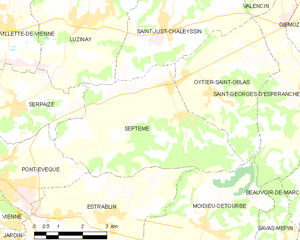
Septème
- commune in Isère, France
Hiking in Septème
Septème is a charming commune located in the Isère department of southeastern France, near the city of Grenoble. The region offers beautiful natural landscapes, which makes it an appealing destination for hiking enthusiasts....
- Country:
- Postal Code: 38780
- Coordinates: 45° 33' 8" N, 5° 0' 15" E
- GPS tracks (wikiloc): [Link]
- Area: 21.55 sq km
- Population: 2004


Eyzin-Pinet
- commune in Isère, France
Hiking in Eyzin-Pinet
Eyzin-Pinet is a charming commune in the Isère department of France, located near the picturesque Rhône-Alpes region. While it may not be as famous as some other hiking destinations in the area, it offers beautiful landscapes and a chance to experience the natural beauty of the surrounding countryside....
- Country:
- Postal Code: 38780
- Coordinates: 45° 28' 23" N, 4° 59' 56" E
- GPS tracks (wikiloc): [Link]
- Area: 28.44 sq km
- Population: 2204
- Web site: [Link]