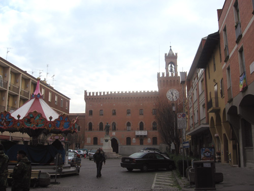
Molinella (Molinella)
.svg)
- Italian comune
 Hiking in Molinella
Molinella is a charming town located in the Emilia-Romagna region of Italy. While it may not be as renowned for hiking as some other areas in Italy, it offers lovely landscapes and opportunities for walking and exploring the countryside.
Hiking Opportunities Around Molinella:
-
Countryside Walks: The flat terrain surrounding Molinella is ideal for leisurely walks and hikes. You can explore the agricultural landscapes, vineyards, and small forests. Look for local trails that connect villages and offer scenic views of the Emilia-Romagna countryside.
-
Parco FSamoggia: Located not too far from Molinella, this park provides scenic trails along the river Samoggia. It’s a great spot for a mix of hiking and nature walks, with opportunities to observe local wildlife and enjoy the tranquility of the river.
-
The Via Emilia: This historic Roman road runs through the Emilia-Romagna region. There are several trails along parts of the Via Emilia that can provide a unique hiking experience while taking in the historical significance of the area.
-
Nearby Parks and Trails: Consider exploring other natural parks in the vicinity, such as the Abbazia di Monteveglio Natural Regional Park or the Parco Regionale dei Gessi Bolognesi, both of which offer more rugged hiking experiences.
-
Cultural Hikes: Combine hiking with cultural experiences by planning routes that include visits to historical sites, local restaurants, and traditional farms where you can experience the local cuisine and hospitality.
Tips for Hiking in Molinella:
- Weather Considerations: Check the weather forecast before heading out, as conditions can vary, especially in the spring and fall.
- Local Maps: Use local maps or hiking apps to find walking paths and ensure you're on well-marked trails.
- Stay Hydrated: Bring plenty of water, especially on warmer days, and consider packing some snacks.
- Respect Nature: Follow local guidelines for wildlife, and stay on marked paths to preserve the natural beauty of the area.
While Molinella might not be a hiking hotspot, its countryside and the surrounding area's charm make it a lovely destination for those looking to enjoy a peaceful hike and connect with nature.
- Country:

- Postal Code: 40062
- Local Dialing Code: 051
- Licence Plate Code: BO
- Coordinates: 44° 37' 3" N, 11° 40' 2" E


- GPS tracks (wikiloc): [Link]
- AboveSeaLevel: 8 м m
- Area: 127.84 sq km
- Population: 15642
- Web site: http://www.comune.molinella.bo.it/
- Wikipedia en: wiki(en)
- Wikipedia: wiki(it)
- Wikidata storage: Wikidata: Q94960
- Wikipedia Commons Gallery: [Link]
- Wikipedia Commons Category: [Link]
- Freebase ID: [/m/0gkhn4]
- GeoNames ID: Alt: [6538471]
- BnF ID: [12092516j]
- VIAF ID: Alt: [153601238]
- OSM relation ID: [43345]
- MusicBrainz area ID: [ba935828-109e-4598-8ce3-6bb5c6467631]
- UN/LOCODE: [ITZME]
- Enciclopedia Italiana ID: [molinella]
- ISTAT ID: 037039
- Italian cadastre code: F288
Shares border with regions:


Baricella
- Italian comune
Hiking in Baricella
Baricella is a small town located in the province of Bologna in the Emilia-Romagna region of Italy. While it may not be as widely recognized for hiking as some of the larger national parks or mountainous regions, it offers some charming paths and routes for those looking to enjoy nature....
- Country:
- Postal Code: 40052
- Local Dialing Code: 051
- Licence Plate Code: BO
- Coordinates: 44° 38' 51" N, 11° 32' 7" E
- GPS tracks (wikiloc): [Link]
- AboveSeaLevel: 11 м m
- Area: 45.48 sq km
- Population: 7030
- Web site: [Link]

Budrio
- Italian comune
Hiking in Budrio
Budrio, located in the Emilia-Romagna region of Italy, is a charming town known for its rich history and beautiful landscapes. While Budrio itself is not a major hiking destination like the nearby Apennines, there are still several opportunities for walking and exploring the natural scenery in and around the area....
- Country:
- Postal Code: 40054
- Local Dialing Code: 051
- Licence Plate Code: BO
- Coordinates: 44° 32' 15" N, 11° 32' 4" E
- GPS tracks (wikiloc): [Link]
- AboveSeaLevel: 26 м m
- Area: 120.18 sq km
- Population: 18440
- Web site: [Link]
Medicina
- Italian comune
Hiking in Medicina
Medicina, located in the Emilia-Romagna region of Italy, is not primarily known as a hiking destination, but it is surrounded by beautiful landscapes that can provide a variety of hiking opportunities. The region's rich history, charming countryside, and proximity to the Apennine Mountains make it an appealing area for outdoor enthusiasts....
- Country:
- Postal Code: 40059
- Local Dialing Code: 051
- Licence Plate Code: BO
- Coordinates: 44° 29' 0" N, 11° 38' 0" E
- GPS tracks (wikiloc): [Link]
- AboveSeaLevel: 25 м m
- Area: 159.11 sq km
- Population: 16768
- Web site: [Link]


Argenta
- Italian comune
Hiking in Argenta
Argenta, located in the Emilia-Romagna region of Italy, is primarily known for its rich natural landscapes and historical sites. While it may not be a major hiking destination compared to other mountainous areas in Italy, it offers opportunities for exploring nature and enjoying the surrounding environment....
- Country:
- Postal Code: 44048; 44040; 44016; 44014; 44011; 44010
- Local Dialing Code: 0532
- Licence Plate Code: FE
- Coordinates: 44° 36' 47" N, 11° 50' 11" E
- GPS tracks (wikiloc): [Link]
- AboveSeaLevel: 4 м m
- Area: 311.67 sq km
- Population: 21521
- Web site: [Link]