Mondon (Mondon)

- commune in Doubs, France
 Hiking in Mondon
It seems there may be a typo in your request regarding "Mondon." If you are referring to a specific location, please clarify the name or provide more details. If it's a region or trail within a broader area or country, I can provide more relevant information.
However, if you meant "Mondoñedo," which is a town in the province of Lugo in Spain, or another location, please let me know, and I’d be happy to share tips, best trails, and general hiking information for that area!
- Country:

- Postal Code: 25680
- Coordinates: 47° 26' 27" N, 6° 18' 42" E


- GPS tracks (wikiloc): [Link]
- Area: 4.5 sq km
- Population: 92
- Wikipedia en: wiki(en)
- Wikipedia: wiki(fr)
- Wikidata storage: Wikidata: Q905930
- Wikipedia Commons Category: [Link]
- Freebase ID: [/m/03mhbgz]
- Freebase ID: [/m/03mhbgz]
- GeoNames ID: Alt: [6429883]
- GeoNames ID: Alt: [6429883]
- SIREN number: [212503841]
- SIREN number: [212503841]
- BnF ID: [15252610p]
- BnF ID: [15252610p]
- INSEE municipality code: 25384
- INSEE municipality code: 25384
Shares border with regions:


Puessans
- commune in Doubs, France
Hiking in Puessans
It seems there might be a typo or misunderstanding in your request, as "Puessans" doesn't appear to correspond to a well-known hiking area or location. If you meant "Puslinch", located in Ontario, Canada, or perhaps "Puget Sound" in Washington state, I can provide information on those areas....
- Country:
- Postal Code: 25680
- Coordinates: 47° 25' 47" N, 6° 19' 23" E
- GPS tracks (wikiloc): [Link]
- Area: 3.59 sq km
- Population: 32

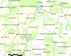
Rougemont
- commune in Doubs, France
Hiking in Rougemont
Rougemont, located in the Doubs department of France, is a picturesque destination that offers excellent hiking opportunities amidst beautiful natural landscapes. Here's an overview of what you can expect when hiking in this area:...
- Country:
- Postal Code: 25680
- Coordinates: 47° 28' 52" N, 6° 21' 18" E
- GPS tracks (wikiloc): [Link]
- Area: 18.33 sq km
- Population: 1173
- Web site: [Link]


Montagney-Servigney
- commune in Doubs, France
- Country:
- Postal Code: 25680
- Coordinates: 47° 28' 52" N, 6° 18' 23" E
- GPS tracks (wikiloc): [Link]
- AboveSeaLevel: 280 м m
- Area: 6.55 sq km
- Population: 126


Montussaint
- commune in Doubs, France
Hiking in Montussaint
Montussaint is not a well-known hiking destination, but it might refer to Mont Saint-Michel or a similar name. If you are looking for hiking opportunities around Mont Saint-Michel, you can enjoy stunning views of the tidal island and its historic abbey. The area offers several walking paths and trails along the bay and through the surrounding countryside....
- Country:
- Postal Code: 25680
- Coordinates: 47° 26' 1" N, 6° 17' 32" E
- GPS tracks (wikiloc): [Link]
- Area: 3.04 sq km
- Population: 60