Montagney-Servigney (Montagney-Servigney)
- commune in Doubs, France
- Country:

- Postal Code: 25680
- Coordinates: 47° 28' 52" N, 6° 18' 23" E


- GPS tracks (wikiloc): [Link]
- AboveSeaLevel: 280 м m
- Area: 6.55 sq km
- Population: 126
- Wikipedia en: wiki(en)
- Wikipedia: wiki(fr)
- Wikidata storage: Wikidata: Q904897
- Wikipedia Commons Category: [Link]
- Freebase ID: [/m/03mgxwy]
- Freebase ID: [/m/03mgxwy]
- GeoNames ID: Alt: [2993125]
- GeoNames ID: Alt: [2993125]
- SIREN number: [212503858]
- SIREN number: [212503858]
- BnF ID: [152526111]
- BnF ID: [152526111]
- PACTOLS thesaurus ID: [pcrtSmSdNINiP3]
- PACTOLS thesaurus ID: [pcrtSmSdNINiP3]
- INSEE municipality code: 25385
- INSEE municipality code: 25385
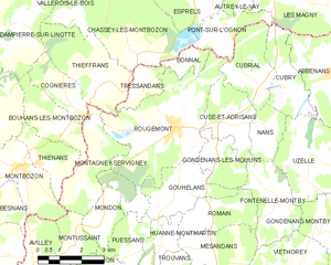
Shares border with regions:


Thieffrans
- commune in Haute-Saône, France
- Country:

- Postal Code: 70230
- Coordinates: 47° 30' 3" N, 6° 18' 59" E


- GPS tracks (wikiloc): [Link]
- Area: 9.36 sq km
- Population: 175


Bouhans-lès-Montbozon
- commune in Haute-Saône, France
- Country:

- Postal Code: 70230
- Coordinates: 47° 28' 58" N, 6° 17' 7" E


- GPS tracks (wikiloc): [Link]
- Area: 5.15 sq km
- Population: 136


Rougemont
- commune in Doubs, France
Rougemont, located in the Doubs department of France, is a picturesque destination that offers excellent hiking opportunities amidst beautiful natural landscapes. Here's an overview of what you can expect when hiking in this area:...
- Country:

- Postal Code: 25680
- Coordinates: 47° 28' 52" N, 6° 21' 18" E


- GPS tracks (wikiloc): [Link]
- Area: 18.33 sq km
- Population: 1173
- Web site: [Link]


Cognières
- commune in Haute-Saône, France
- Country:

- Postal Code: 70230
- Coordinates: 47° 29' 29" N, 6° 17' 36" E


- GPS tracks (wikiloc): [Link]
- Area: 3.93 sq km
- Population: 91


Mondon
- commune in Doubs, France
It seems there may be a typo in your request regarding "Mondon." If you are referring to a specific location, please clarify the name or provide more details. If it's a region or trail within a broader area or country, I can provide more relevant information....
- Country:

- Postal Code: 25680
- Coordinates: 47° 26' 27" N, 6° 18' 42" E


- GPS tracks (wikiloc): [Link]
- Area: 4.5 sq km
- Population: 92


Montussaint
- commune in Doubs, France
Montussaint is not a well-known hiking destination, but it might refer to Mont Saint-Michel or a similar name. If you are looking for hiking opportunities around Mont Saint-Michel, you can enjoy stunning views of the tidal island and its historic abbey. The area offers several walking paths and trails along the bay and through the surrounding countryside....
- Country:

- Postal Code: 25680
- Coordinates: 47° 26' 1" N, 6° 17' 32" E


- GPS tracks (wikiloc): [Link]
- Area: 3.04 sq km
- Population: 60


Thiénans
- commune in Haute-Saône, France
- Country:

- Postal Code: 70230
- Coordinates: 47° 28' 2" N, 6° 16' 20" E


- GPS tracks (wikiloc): [Link]
- Area: 4.11 sq km
- Population: 93


Montbozon
- commune in Haute-Saône, France
- Country:

- Postal Code: 70230
- Coordinates: 47° 27' 58" N, 6° 15' 32" E


- GPS tracks (wikiloc): [Link]
- Area: 8.63 sq km
- Population: 596

