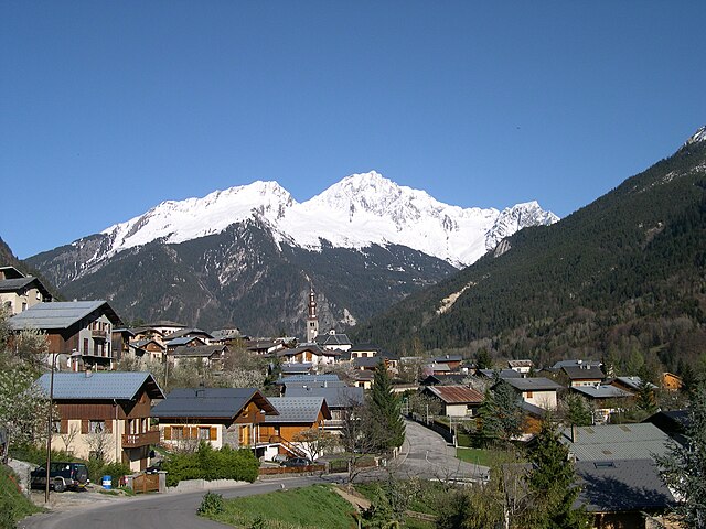
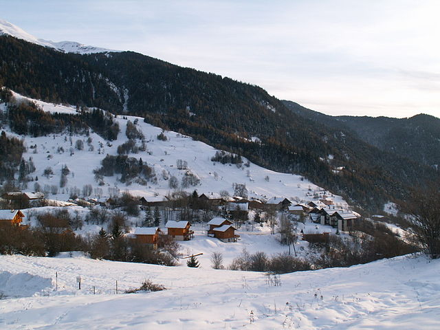
Montagny (Montagny)

- commune in Savoie, France
 Hiking in Montagny
Montagny, located in the Savoie region of the French Alps, is an excellent destination for hiking enthusiasts. Nestled amid stunning mountainous scenery, it offers a variety of trails suitable for different skill levels, ranging from leisurely walks to challenging hikes. Here are some highlights about hiking in the area:
Scenic Trails
-
Alpine Landscapes: The trails around Montagny provide breathtaking views of the surrounding peaks, valleys, and often include picturesque alpine meadows filled with wildflowers in the summer months.
-
Lac de Saint-Guérin: A beautiful hiking route leads to this tranquil lake, perfect for a scenic picnic or simply enjoying the serene natural surroundings.
-
Mont Charvin: For a more challenging hike, consider the ascent to Mont Charvin. This trek offers stunning panoramic views and an opportunity to experience the unique alpine environment.
Wildlife and Flora
As you hike in the Montagny area, you'll likely encounter a variety of wildlife, including marmots and chamois, as well as an array of alpine flowers and plants unique to the region.
Best Times to Hike
- Summer (June to September): This is the most popular time for hiking, with trails accessible and wildflowers in full bloom.
- When to Avoid: During winter months, many trails may be covered in snow and not suitable for hiking unless you have snowshoeing or climbing experience.
Practical Tips
- Gear: Make sure to wear sturdy hiking shoes, dress in layers, and bring essentials such as water, snacks, a first aid kit, and navigation tools (like maps or a GPS).
- Local Guidance: Consider hiring a local guide or joining a hiking group if you are unfamiliar with the area, as they can provide valuable insights and safety tips.
- Respect Nature: Stay on marked trails and follow Leave No Trace principles to preserve the natural beauty of the surroundings.
Getting There
Montagny is accessible by car and is a reasonable distance from larger towns such as Albertville. Public transportation options may also be available, but checking local schedules in advance is recommended.
With its beautiful landscapes, diverse trails, and serene ambiance, hiking in Montagny is sure to offer a memorable outdoor experience. Enjoy your adventure!
- Country:

- Postal Code: 73350
- Coordinates: 45° 27' 22" N, 6° 35' 31" E


- GPS tracks (wikiloc): [Link]
- Area: 13.26 sq km
- Population: 662
- Wikipedia en: wiki(en)
- Wikipedia: wiki(fr)
- Wikidata storage: Wikidata: Q1222630
- Wikipedia Commons Category: [Link]
- Freebase ID: [/m/03qlmr5]
- GeoNames ID: Alt: [6454648]
- SIREN number: [217301613]
- BnF ID: [15274094s]
- INSEE municipality code: 73161
Shares border with regions:


Brides-les-Bains
- commune in Savoie, France
Hiking in Brides-les-Bains
Brides-les-Bains, a charming village located in the French Alps, is a fantastic destination for hiking enthusiasts. Situated near the Trois Vallées, one of the largest ski areas in the world, Brides-les-Bains offers a variety of trails that cater to different skill levels, both in summer and winter....
- Country:
- Postal Code: 73570
- Coordinates: 45° 27' 9" N, 6° 34' 0" E
- GPS tracks (wikiloc): [Link]
- Area: 2.63 sq km
- Population: 517

Bozel
- commune in Savoie, France
Hiking in Bozel
Bozel is a charming village located in the Savoie region of the French Alps, close to the renowned ski resorts of Courchevel and Les 3 Vallées. While it's popular for winter sports, Bozel also offers fantastic hiking opportunities in the warmer months, attracting outdoor enthusiasts to explore its beautiful landscapes....
- Country:
- Postal Code: 73350
- Coordinates: 45° 26' 34" N, 6° 38' 56" E
- GPS tracks (wikiloc): [Link]
- Area: 28.8 sq km
- Population: 1959
- Web site: [Link]


Feissons-sur-Salins
- commune in Savoie, France
Hiking in Feissons-sur-Salins
Feissons-sur-Salins is a charming village located in the Savoie region of France, nestled within the beautiful backdrop of the Alps. It offers several hiking opportunities that cater to various skill levels and take advantage of the stunning scenery....
- Country:
- Postal Code: 73350
- Coordinates: 45° 28' 14" N, 6° 33' 37" E
- GPS tracks (wikiloc): [Link]
- Area: 4.8 sq km
- Population: 190


Saint-Bon-Tarentaise
- former commune in Savoie, France
Hiking in Saint-Bon-Tarentaise
Saint-Bon-Tarentaise is a stunning region located in the French Alps, known for its breathtaking mountain scenery and a variety of outdoor activities, especially hiking. Here are some key points about hiking in this beautiful area:...
- Country:
- Postal Code: 73120
- Coordinates: 45° 26' 2" N, 6° 38' 13" E
- GPS tracks (wikiloc): [Link]
- Area: 58.94 sq km
- Population: 1901
- Web site: [Link]


La Perrière
- former commune in Savoie, France
Hiking in La Perrière
La Perrière, located in the Savoie region of the French Alps, offers some stunning hiking opportunities that appeal to a variety of skill levels. The region is characterized by its breathtaking mountain landscapes, alpine meadows, and rich biodiversity, making it a fantastic destination for outdoor enthusiasts....
- Country:
- Postal Code: 73600
- Coordinates: 45° 26' 42" N, 6° 35' 38" E
- GPS tracks (wikiloc): [Link]
- Area: 9.96 sq km
- Population: 469

Notre-Dame-du-Pré
- commune in Savoie, France
Hiking in Notre-Dame-du-Pré
Notre-Dame-du-Pré is a charming Alpine village located in the Savoie region of France, nestled in the breathtaking landscapes of the French Alps. It's a great destination for hikers of various skill levels, offering stunning views and well-marked trails....
- Country:
- Postal Code: 73600
- Coordinates: 45° 30' 43" N, 6° 35' 37" E
- GPS tracks (wikiloc): [Link]
- Area: 18.2 sq km
- Population: 256