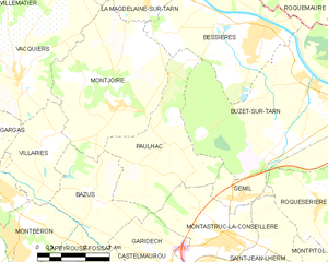
Montastruc-la-Conseillère (Montastruc-la-Conseillère)

- commune in Haute-Garonne, France
- Country:

- Postal Code: 31380
- Coordinates: 43° 43' 3" N, 1° 35' 25" E


- GPS tracks (wikiloc): [Link]
- Area: 15.49 sq km
- Population: 3326
- Web site: http://www.mairie-montastruc.fr
- Wikipedia en: wiki(en)
- Wikipedia: wiki(fr)
- Wikidata storage: Wikidata: Q689528
- Wikipedia Commons Category: [Link]
- Freebase ID: [/m/03nq27y]
- Freebase ID: [/m/03nq27y]
- GeoNames ID: Alt: [6431698]
- GeoNames ID: Alt: [6431698]
- SIREN number: [213103583]
- SIREN number: [213103583]
- BnF ID: [15255353v]
- BnF ID: [15255353v]
- VIAF ID: Alt: [135321355]
- VIAF ID: Alt: [135321355]
- Library of Congress authority ID: Alt: [nr97029432]
- Library of Congress authority ID: Alt: [nr97029432]
- PACTOLS thesaurus ID: [pcrtOtGufcd847]
- PACTOLS thesaurus ID: [pcrtOtGufcd847]
- INSEE municipality code: 31358
- INSEE municipality code: 31358
Shares border with regions:
Roquesérière
- commune in Haute-Garonne, France
- Country:
- Postal Code: 31380
- Coordinates: 43° 44' 3" N, 1° 38' 17" E
- GPS tracks (wikiloc): [Link]
- Area: 10.64 sq km
- Population: 717
- Web site: [Link]


Gémil
- commune in Haute-Garonne, France
- Country:
- Postal Code: 31380
- Coordinates: 43° 44' 8" N, 1° 35' 27" E
- GPS tracks (wikiloc): [Link]
- Area: 2.81 sq km
- Population: 274
- Web site: [Link]

Paulhac
- commune in Haute-Garonne, France
- Country:
- Postal Code: 31380
- Coordinates: 43° 45' 20" N, 1° 33' 22" E
- GPS tracks (wikiloc): [Link]
- Area: 14.03 sq km
- Population: 1235
- Web site: [Link]
Montpitol
- commune in Haute-Garonne, France
- Country:
- Postal Code: 31380
- Coordinates: 43° 42' 17" N, 1° 38' 58" E
- GPS tracks (wikiloc): [Link]
- Area: 5.96 sq km
- Population: 396
- Web site: [Link]


Gragnague
- commune in Haute-Garonne, France
- Country:
- Postal Code: 31380
- Coordinates: 43° 40' 57" N, 1° 34' 59" E
- GPS tracks (wikiloc): [Link]
- Area: 13.04 sq km
- Population: 1746
- Web site: [Link]


Saint-Jean-Lherm
- commune in Haute-Garonne, France
- Country:
- Postal Code: 31380
- Coordinates: 43° 42' 13" N, 1° 36' 36" E
- GPS tracks (wikiloc): [Link]
- Area: 7.92 sq km
- Population: 361
- Web site: [Link]


Garidech
- commune in Haute-Garonne, France
- Country:
- Postal Code: 31380
- Coordinates: 43° 42' 29" N, 1° 33' 39" E
- GPS tracks (wikiloc): [Link]
- AboveSeaLevel: 173.0 м m
- Area: 7.11 sq km
- Population: 1741
- Web site: [Link]