Montbel (Montbel)
- commune in Ariège, France
- Country:

- Postal Code: 09600
- Coordinates: 42° 58' 33" N, 1° 58' 36" E


- GPS tracks (wikiloc): [Link]
- Area: 17.36 sq km
- Population: 118
- Wikipedia en: wiki(en)
- Wikipedia: wiki(fr)
- Wikidata storage: Wikidata: Q1871538
- Wikipedia Commons Category: [Link]
- Freebase ID: [/m/03m916n]
- GeoNames ID: Alt: [6615225]
- SIREN number: [210902003]
- INSEE municipality code: 09200
Shares border with regions:


Rivel
- commune in Aude, France
- Country:
- Postal Code: 11230
- Coordinates: 42° 56' 40" N, 2° 0' 1" E
- GPS tracks (wikiloc): [Link]
- Area: 24.3 sq km
- Population: 196

Belloc
- commune in Ariège, France
- Country:
- Postal Code: 09600
- Coordinates: 43° 0' 47" N, 1° 55' 51" E
- GPS tracks (wikiloc): [Link]
- Area: 9.54 sq km
- Population: 70


Sainte-Colombe-sur-l'Hers
- commune in Aude, France
- Country:
- Postal Code: 11230
- Coordinates: 42° 57' 9" N, 1° 57' 58" E
- GPS tracks (wikiloc): [Link]
- Area: 10.61 sq km
- Population: 447

Le Peyrat
- commune in Ariège, France
- Country:
- Postal Code: 09600
- Coordinates: 42° 57' 24" N, 1° 55' 14" E
- GPS tracks (wikiloc): [Link]
- Area: 6.13 sq km
- Population: 480

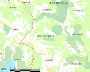
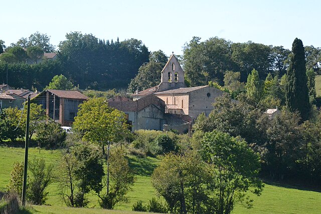
Sonnac-sur-l'Hers
- commune in Aude, France
- Country:
- Postal Code: 11230
- Coordinates: 43° 0' 14" N, 1° 59' 35" E
- GPS tracks (wikiloc): [Link]
- Area: 13.74 sq km
- Population: 146
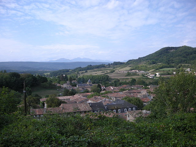

Chalabre
- commune in Aude, France
- Country:
- Postal Code: 11230
- Coordinates: 42° 59' 2" N, 2° 0' 23" E
- GPS tracks (wikiloc): [Link]
- Area: 15.49 sq km
- Population: 1111

Léran
- commune in Ariège, France
- Country:
- Postal Code: 09600
- Coordinates: 42° 59' 19" N, 1° 54' 37" E
- GPS tracks (wikiloc): [Link]
- Area: 11.92 sq km
- Population: 595


Camon
- commune in Ariège, France
- Country:
- Postal Code: 09500
- Coordinates: 43° 1' 18" N, 1° 58' 0" E
- GPS tracks (wikiloc): [Link]
- AboveSeaLevel: 454 м m
- Area: 10.25 sq km
- Population: 143
- Web site: [Link]