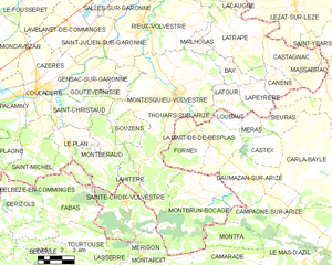
Montberaud (Montberaud)

- commune in Haute-Garonne, France
- Country:

- Postal Code: 31220
- Coordinates: 43° 9' 18" N, 1° 8' 35" E


- GPS tracks (wikiloc): [Link]
- Area: 15.87 sq km
- Population: 211
- Wikipedia en: wiki(en)
- Wikipedia: wiki(fr)
- Wikidata storage: Wikidata: Q1428858
- Wikipedia Commons Category: [Link]
- Freebase ID: [/m/03nq299]
- Freebase ID: [/m/03nq299]
- GeoNames ID: Alt: [6431701]
- GeoNames ID: Alt: [6431701]
- SIREN number: [213103625]
- SIREN number: [213103625]
- BnF ID: [152553577]
- BnF ID: [152553577]
- PACTOLS thesaurus ID: [pcrt3W3Rc5NoYF]
- PACTOLS thesaurus ID: [pcrt3W3Rc5NoYF]
- INSEE municipality code: 31362
- INSEE municipality code: 31362
Shares border with regions:

Montesquieu-Volvestre
- commune in Haute-Garonne, France
- Country:
- Postal Code: 31310
- Coordinates: 43° 12' 28" N, 1° 13' 47" E
- GPS tracks (wikiloc): [Link]
- Area: 59.82 sq km
- Population: 3080
- Web site: [Link]

Sainte-Croix-Volvestre
- commune in Ariège, France
- Country:
- Postal Code: 09230
- Coordinates: 43° 7' 33" N, 1° 10' 27" E
- GPS tracks (wikiloc): [Link]
- Area: 19.66 sq km
- Population: 634
- Web site: [Link]
Saint-Christaud
- commune in Haute-Garonne, France
- Country:
- Postal Code: 31310
- Coordinates: 43° 11' 21" N, 1° 7' 44" E
- GPS tracks (wikiloc): [Link]
- Area: 10.87 sq km
- Population: 251


Lahitère
- commune in Haute-Garonne, France
- Country:
- Postal Code: 31310
- Coordinates: 43° 8' 20" N, 1° 11' 32" E
- GPS tracks (wikiloc): [Link]
- Area: 3.9 sq km
- Population: 54
Gouzens
- commune in Haute-Garonne, France
- Country:
- Postal Code: 31310
- Coordinates: 43° 11' 10" N, 1° 11' 18" E
- GPS tracks (wikiloc): [Link]
- Area: 5.7 sq km
- Population: 86


Le Plan
- commune in Haute-Garonne, France
- Country:
- Postal Code: 31220
- Coordinates: 43° 10' 1" N, 1° 7' 13" E
- GPS tracks (wikiloc): [Link]
- Area: 8.02 sq km
- Population: 459