Montecalvo in Foglia (Montecalvo in Foglia)
.svg)
- Italian comune
 Hiking in Montecalvo in Foglia
Montecalvo in Foglia is a small municipality located in the Marche region of Italy. Surrounded by picturesque landscapes and rolling hills, this area offers a variety of hiking opportunities suitable for different skill levels.
Hiking Trails
-
Creations of Nature: The region is characterized by beautiful nature trails that wind through forests, vineyards, and olive groves. The scenic views are a highlight, providing perfect photo opportunities.
-
Local Parks: Explore nearby natural parks or reserves, which often feature well-marked trails that guide you through the best of the area's flora and fauna.
-
Cultural Routes: Some hikes may also include stops at historical sites, small villages, and local farms, giving you a taste of the local culture and cuisine.
Tips for Hiking in Montecalvo in Foglia
- Footwear: Wear comfortable and sturdy hiking boots to deal with the varying terrains.
- Weather Check: Always check the weather before your hike, as conditions can change quickly.
- Hydrate: Bring plenty of water and snacks, especially for longer hikes.
- Local Information: Stop by local tourist information centers for maps and recommendations on the best trails.
Duration and Difficulty
Trails in this area can range from easy walks suitable for families to moderate hikes that may require a bit more stamina. Typical hike durations can vary from a couple of hours to half a day, depending on the chosen route.
Conclusion
Hiking in Montecalvo in Foglia offers an opportunity to immerse yourself in the tranquil landscapes of the Marche region, making it a delightful experience for nature lovers and adventure seekers alike. Whether you're looking for a leisurely stroll or a more challenging hike, you'll find plenty of options to explore and enjoy.
- Country:

- Postal Code: 61020
- Local Dialing Code: 0722
- Licence Plate Code: PU
- Coordinates: 43° 48' 42" N, 12° 37' 54" E


- GPS tracks (wikiloc): [Link]
- AboveSeaLevel: 345 м m
- Area: 18.25 sq km
- Population: 2750
- Web site: http://www.comune.montecalvo.pu.it/
- Wikipedia en: wiki(en)
- Wikipedia: wiki(it)
- Wikidata storage: Wikidata: Q207372
- Wikipedia Commons Category: [Link]
- Freebase ID: [/m/0gl4hb]
- GeoNames ID: Alt: [6536767]
- OSM relation ID: [42650]
- WOEID: [718778]
- UN/LOCODE: [ITZNH]
- ISTAT ID: 041030
- Italian cadastre code: F450
Shares border with regions:


Mondaino
- Italian comune
Hiking in Mondaino
Mondaino, a charming village in the Emilia-Romagna region of Italy, offers a variety of hiking opportunities amidst stunning landscapes. Nestled in the hills of the Marche region, Mondaino is known for its picturesque views, historical sites, and rich natural surroundings. Here are some highlights for hiking in and around Mondaino:...
- Country:
- Postal Code: 47836
- Local Dialing Code: 0541
- Licence Plate Code: RN
- Coordinates: 43° 51' 21" N, 12° 40' 17" E
- GPS tracks (wikiloc): [Link]
- AboveSeaLevel: 420 м m
- Area: 19.84 sq km
- Population: 1390
- Web site: [Link]


Tavullia
- Italian comune
Hiking in Tavullia
Tavullia, located in the Marche region of Italy, is known for its beautiful landscapes and rolling hills, making it a wonderful destination for hiking. Here are some key points to consider when hiking in Tavullia:...
- Country:
- Postal Code: 61010
- Local Dialing Code: 0721
- Licence Plate Code: PU
- Coordinates: 43° 53' 53" N, 12° 45' 11" E
- GPS tracks (wikiloc): [Link]
- AboveSeaLevel: 170 м m
- Area: 42.07 sq km
- Population: 7961
- Web site: [Link]
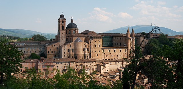

Urbino
- city in the Marche region of Italy
Hiking in Urbino
Urbino, a historic city in the Marche region of Italy, is surrounded by beautiful landscapes and offers various hiking opportunities for outdoor enthusiasts. Here are some key points about hiking in and around Urbino:...
- Country:
- Postal Code: 61029
- Local Dialing Code: 0722
- Licence Plate Code: PU
- Coordinates: 43° 43' 31" N, 12° 38' 14" E
- GPS tracks (wikiloc): [Link]
- AboveSeaLevel: 451 м m
- Area: 226.5 sq km
- Population: 14558
- Web site: [Link]