Mondaino (Mondaino)
.svg)
- Italian comune
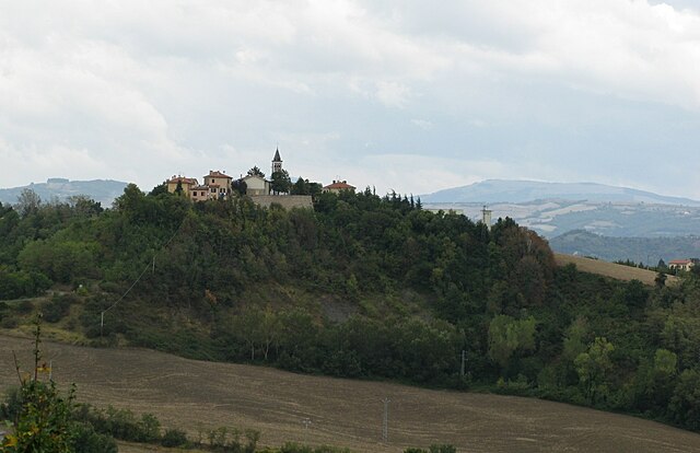
 Hiking in Mondaino
Mondaino, a charming village in the Emilia-Romagna region of Italy, offers a variety of hiking opportunities amidst stunning landscapes. Nestled in the hills of the Marche region, Mondaino is known for its picturesque views, historical sites, and rich natural surroundings. Here are some highlights for hiking in and around Mondaino:
Trails and Scenery
-
Nature Trails: The area around Mondaino features various trails that wind through rolling hills, vineyards, olive groves, and forested areas. The trails range in difficulty, making them suitable for both novice and experienced hikers.
-
Historical Insights: Many trails lead to historical landmarks, such as ancient ruins, medieval castles, and churches. The blend of nature and history makes hiking in the area an enriching experience.
-
Panoramic Views: As you hike, you can enjoy breathtaking views of the surrounding countryside, including the Adriatic Sea to the east and the Apennine Mountains to the west on clear days.
-
Nearby Parks: The Monte San Bartolo Natural Park is a short drive away and offers more extensive hiking options, including coastal trails with stunning views of the Adriatic Sea.
Practical Tips
-
Best Time to Visit: Spring (April to June) and early autumn (September to October) are ideal for hiking, as the weather is generally mild, and the landscapes are particularly beautiful during these seasons.
-
Gear: Wear sturdy hiking boots, and bring plenty of water, snacks, and a map or GPS device. It's advisable to check local trail maps and guides for the latest information on trail conditions.
-
Local Guidance: Consider hiring a local guide or joining a hiking group to discover hidden gems and learn about the area's ecology and history.
Cultural Aspects
-
Local Cuisine: After a day of hiking, treat yourself to local specialties such as piadina (a type of flatbread) and regional wines. Many agriturismos (farm stays) in the area provide authentic dining experiences.
-
Community Events: Keep an eye out for local festivals celebrating the region's culture, history, and cuisine, as these can often add an extra layer of enjoyment to your visit.
Conclusion
Hiking in Mondaino offers a wonderful mix of natural beauty and cultural richness, making it a rewarding experience for outdoor enthusiasts and those looking to immerse themselves in the charm of rural Italy. Whether you're in it for the scenery, the history, or the food, Mondaino has something to offer every hiker.
- Country:

- Postal Code: 47836
- Local Dialing Code: 0541
- Licence Plate Code: RN
- Coordinates: 43° 51' 21" N, 12° 40' 17" E


- GPS tracks (wikiloc): [Link]
- AboveSeaLevel: 420 м m
- Area: 19.84 sq km
- Population: 1390
- Web site: http://www.mondaino.com
- Wikipedia en: wiki(en)
- Wikipedia: wiki(it)
- Wikidata storage: Wikidata: Q111824
- Wikipedia Commons Category: [Link]
- Freebase ID: [/m/0gr6gv]
- GeoNames ID: Alt: [6543696]
- VIAF ID: Alt: [138447949]
- OSM relation ID: [42660]
- UN/LOCODE: [ITMO7]
- ISTAT ID: 099006
- Italian cadastre code: F346
Shares border with regions:


Montefiore Conca
- Italian comune
Hiking in Montefiore Conca
Montefiore Conca is a charming hilltop village located in the Emilia-Romagna region of Italy, known for its stunning landscapes and historical significance. The surrounding area offers several hiking opportunities that cater to various skill levels, with trails that provide breathtaking views of the countryside, rolling hills, and medieval architecture....
- Country:
- Postal Code: 47834
- Local Dialing Code: 0541
- Licence Plate Code: RN
- Coordinates: 43° 53' 0" N, 12° 37' 0" E
- GPS tracks (wikiloc): [Link]
- AboveSeaLevel: 385 м m
- Area: 22.32 sq km
- Population: 2278
- Web site: [Link]


Montegridolfo
- Italian comune
Hiking in Montegridolfo
Montegridolfo is a charming village located in the Marche region of Italy, known for its beautiful landscapes, medieval architecture, and rich history. Hiking in this area offers a unique blend of natural beauty and cultural experiences. Here are some highlights and tips for hiking around Montegridolfo:...
- Country:
- Postal Code: 47837
- Local Dialing Code: 0541
- Licence Plate Code: RN
- Coordinates: 43° 52' 0" N, 12° 41' 0" E
- GPS tracks (wikiloc): [Link]
- AboveSeaLevel: 290 м m
- Area: 6.94 sq km
- Population: 1003
- Web site: [Link]


Saludecio
- Italian comune
Hiking in Saludecio
Saludecio, a charming village in the Emilia-Romagna region of Italy, offers beautiful hiking opportunities that showcase the stunning landscapes of the area. Located in the hills overlooking the Adriatic Sea, hikers can enjoy a variety of trails that cater to different skill levels, ranging from leisurely strolls to more challenging routes....
- Country:
- Postal Code: 47835
- Local Dialing Code: 0541
- Licence Plate Code: RN
- Coordinates: 43° 52' 22" N, 12° 40' 7" E
- GPS tracks (wikiloc): [Link]
- AboveSeaLevel: 350 м m
- Area: 34.27 sq km
- Population: 3063
- Web site: [Link]

Montecalvo in Foglia
- Italian comune
Hiking in Montecalvo in Foglia
Montecalvo in Foglia is a small municipality located in the Marche region of Italy. Surrounded by picturesque landscapes and rolling hills, this area offers a variety of hiking opportunities suitable for different skill levels....
- Country:
- Postal Code: 61020
- Local Dialing Code: 0722
- Licence Plate Code: PU
- Coordinates: 43° 48' 42" N, 12° 37' 54" E
- GPS tracks (wikiloc): [Link]
- AboveSeaLevel: 345 м m
- Area: 18.25 sq km
- Population: 2750
- Web site: [Link]


Tavoleto
- Italian comune
Hiking in Tavoleto
Tavoleto is a picturesque village located in the Marche region of Italy, surrounded by beautiful landscapes ideal for hiking. The area is characterized by rolling hills, lush forests, and stunning views of the surrounding countryside, making it a great destination for outdoor enthusiasts....
- Country:
- Postal Code: 61020
- Local Dialing Code: 0722
- Licence Plate Code: PU
- Coordinates: 43° 50' 45" N, 12° 35' 33" E
- GPS tracks (wikiloc): [Link]
- AboveSeaLevel: 426 м m
- Area: 12.41 sq km
- Population: 871
- Web site: [Link]


Tavullia
- Italian comune
Hiking in Tavullia
Tavullia, located in the Marche region of Italy, is known for its beautiful landscapes and rolling hills, making it a wonderful destination for hiking. Here are some key points to consider when hiking in Tavullia:...
- Country:
- Postal Code: 61010
- Local Dialing Code: 0721
- Licence Plate Code: PU
- Coordinates: 43° 53' 53" N, 12° 45' 11" E
- GPS tracks (wikiloc): [Link]
- AboveSeaLevel: 170 м m
- Area: 42.07 sq km
- Population: 7961
- Web site: [Link]
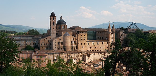

Urbino
- city in the Marche region of Italy
Hiking in Urbino
Urbino, a historic city in the Marche region of Italy, is surrounded by beautiful landscapes and offers various hiking opportunities for outdoor enthusiasts. Here are some key points about hiking in and around Urbino:...
- Country:
- Postal Code: 61029
- Local Dialing Code: 0722
- Licence Plate Code: PU
- Coordinates: 43° 43' 31" N, 12° 38' 14" E
- GPS tracks (wikiloc): [Link]
- AboveSeaLevel: 451 м m
- Area: 226.5 sq km
- Population: 14558
- Web site: [Link]