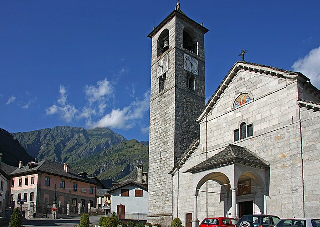
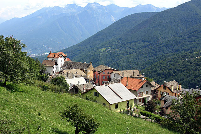
Montescheno (Montescheno)
- Italian comune
 Hiking in Montescheno
Montescheno is a picturesque village located in the Piedmont region of northern Italy, nestled in the Ossola Valley. The area is known for its stunning landscapes, rich biodiversity, and charming old-world architecture, making it a great destination for hiking enthusiasts.
Hiking Opportunities in Montescheno
-
Scenic Trails: There are various hiking trails that cater to different skill levels. The trails often lead through dense forests, past waterfalls, and along mountain streams, offering breathtaking views of the surrounding peaks.
-
Cultural Hikes: Some trails take you through historical sites and small hamlets, allowing hikers to experience the local culture and architecture. Keep an eye out for traditional stone houses and remnants of old farming practices.
-
Monte Fario: A popular hike in the area is to Monte Fario. The trail offers a moderately challenging ascent, rewarding hikers with panoramic views of the Ossola Valley and the surrounding mountains.
-
Flora and Fauna: The region's diverse ecosystems are home to a variety of plant and animal species. You may encounter wildflowers, various bird species, and even the occasional deer or chamois.
-
Seasonal Considerations: Spring and autumn are ideal times for hiking in Montescheno, as the weather is generally mild, and the natural scenery is particularly beautiful during these seasons. Be mindful of snow in the higher elevations during winter, as some trails may be inaccessible.
-
Preparation: Always ensure you have the appropriate gear, including hiking boots, clothing suitable for the weather, and enough water and snacks for the trek. It’s advisable to carry a map or a GPS device, as some trails may not be well-marked.
-
Guided Tours: If you're unfamiliar with the area or want a more in-depth experience, consider joining a guided hike. Local guides can provide valuable insights into the ecology, history, and geology of the region.
Tips for Hiking in Montescheno
- Stay on Marked Trails: To preserve the landscape and ensure your safety, stick to defined paths.
- Leave No Trace: As with any hiking destination, respect nature by carrying out all trash and minimizing your impact.
- Check Weather Conditions: Before heading out, make sure to check the local weather forecast.
Overall, Montescheno offers a unique blend of natural beauty and cultural history, making it an excellent location for outdoor adventurers looking to explore Italy's scenic landscapes.
- Country:

- Postal Code: 28843
- Local Dialing Code: 0324
- Licence Plate Code: VB
- Coordinates: 46° 4' 0" N, 8° 14' 0" E


- GPS tracks (wikiloc): [Link]
- AboveSeaLevel: 512 м m
- Area: 22.17 sq km
- Population: 398
- Web site: http://www.comune.montescheno.vb.it
- Wikipedia en: wiki(en)
- Wikipedia: wiki(it)
- Wikidata storage: Wikidata: Q23655
- Wikipedia Commons Category: [Link]
- Freebase ID: [/m/0gr8lc]
- GeoNames ID: Alt: [6542827]
- VIAF ID: Alt: [245440429]
- OSM relation ID: [46815]
- ISTAT ID: 103047
- Italian cadastre code: F639
Shares border with regions:
Antrona Schieranco
- Italian comune
Hiking in Antrona Schieranco
Antrona Schieranco is a beautiful area located in the Ossola Valley in the Piedmont region of northern Italy. It’s known for its stunning natural landscapes, featuring mountains, valleys, waterfalls, and lakes, making it a fantastic destination for hiking enthusiasts. Here are some highlights and tips for hiking in Antrona Schieranco:...
- Country:
- Postal Code: 28030
- Local Dialing Code: 0324
- Licence Plate Code: VB
- Coordinates: 46° 4' 0" N, 8° 7' 0" E
- GPS tracks (wikiloc): [Link]
- AboveSeaLevel: 902 м m
- Area: 100.18 sq km
- Population: 426
- Web site: [Link]
Bognanco
- Italian comune
Hiking in Bognanco
Bognanco is a charming village located in the Ossola Valley in the Piedmont region of Italy, known for its beautiful natural landscapes and rich cultural heritage. Hiking in and around Bognanco can be a wonderful experience, thanks to its scenic trails, lush forests, and stunning mountain views....
- Country:
- Postal Code: 28042
- Local Dialing Code: 0324
- Licence Plate Code: VB
- Coordinates: 46° 7' 34" N, 8° 12' 0" E
- GPS tracks (wikiloc): [Link]
- AboveSeaLevel: 980 м m
- Area: 58 sq km
- Population: 200
- Web site: [Link]
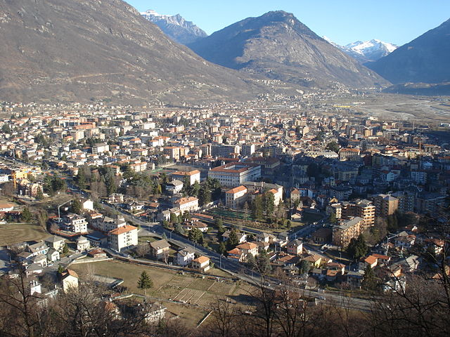
Domodossola
- Italian comune
Hiking in Domodossola
Domodossola, located in the Ossola Valley in northern Italy, is surrounded by stunning natural landscapes, making it a fantastic destination for hiking enthusiasts. Here are some key points about hiking in the area:...
- Country:
- Postal Code: 28845; CH-3907
- Local Dialing Code: 0324
- Licence Plate Code: VB
- Coordinates: 46° 6' 0" N, 8° 18' 0" E
- GPS tracks (wikiloc): [Link]
- AboveSeaLevel: 272 м m
- Area: 36.89 sq km
- Population: 18237
- Web site: [Link]

Villadossola
- Italian comune
Hiking in Villadossola
Villadossola, located in the Piedmont region of northern Italy, is an excellent base for hiking enthusiasts. Nestled in the Val d'Ossola, it offers a variety of trails that cater to different skill levels, from beginners to experienced hikers. The stunning natural scenery includes lush forests, alpine meadows, and impressive mountain views, particularly of the nearby Alps....
- Country:
- Postal Code: 28844
- Local Dialing Code: 0324
- Licence Plate Code: VB
- Coordinates: 46° 4' 25" N, 8° 16' 1" E
- GPS tracks (wikiloc): [Link]
- AboveSeaLevel: 257 м m
- Area: 18.73 sq km
- Population: 6617
- Web site: [Link]