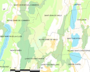
Monteynard (Monteynard)

- commune in Isère, France
 Hiking in Monteynard
Monteynard, located in the Isère department of southeastern France, is known for its stunning landscapes, particularly the beautiful turquoise waters of the Lake Monteynard-Avignonet and the surrounding mountainous terrain. Hiking in this area offers a variety of trails that cater to different skill levels, providing opportunities for both leisurely strolls and more challenging hikes.
Here are some aspects to consider when hiking in Monteynard:
1. :
- The region boasts breathtaking panoramas of the lake, the mountains, and the surrounding countryside. Hikers can enjoy dramatic cliffs, lush forests, and the unique sight of the lake's vibrant colors.
2. :
- There are several marked hiking trails ranging from easy to moderate difficulty. One popular route is the trail around the lake, which allows hikers to experience the best views while remaining relatively flat.
- More challenging trails lead to the surrounding peaks, offering rewarding vistas at higher altitudes.
3. :
- Besides hiking, the area is also popular for other outdoor activities, including mountain biking, paragliding, and kayaking on the lake, which add to the overall experience.
4. :
- The area is accessible from nearby towns and cities, making it an excellent day trip destination for both locals and tourists. It’s advisable to check the weather and trail conditions before heading out, especially in spring or autumn.
5. :
- Hikers may encounter diverse flora and fauna. The region is home to various animals and plant species, making it a great spot for nature enthusiasts and photographers.
6. :
- Always carry sufficient water, wear appropriate footwear, and let someone know your hiking route if you're going solo. Weather conditions can change rapidly in mountainous areas, so be prepared.
7. :
- In addition to the hiking, consider exploring nearby villages and cultural sites. The region has charming local markets and eateries where you can taste regional cuisine.
Conclusion:
Hiking in Monteynard provides an opportunity to immerse yourself in nature while enjoying some of the best views in the French Alps. Whether you’re an experienced hiker or just looking for a leisurely walk, Monteynard has something to offer everyone. Enjoy the journey!
- Country:

- Postal Code: 38770
- Coordinates: 44° 58' 33" N, 5° 42' 18" E


- GPS tracks (wikiloc): [Link]
- Area: 10.72 sq km
- Population: 498
- Web site: http://monteynard.fr
- Wikipedia en: wiki(en)
- Wikipedia: wiki(fr)
- Wikidata storage: Wikidata: Q1150803
- Wikipedia Commons Category: [Link]
- Freebase ID: [/m/03g_109]
- GeoNames ID: Alt: [6433255]
- SIREN number: [213802549]
- BnF ID: [152580663]
- INSEE municipality code: 38254
Shares border with regions:


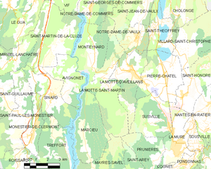
Avignonet
- commune in Isère, France
Hiking in Avignonet
Avignonet is a charming locality that offers beautiful hiking opportunities, especially for those who appreciate scenic landscapes and historical surroundings. Here are some key highlights about hiking in and around Avignonet:...
- Country:
- Postal Code: 38650
- Coordinates: 44° 57' 32" N, 5° 39' 25" E
- GPS tracks (wikiloc): [Link]
- Area: 8.41 sq km
- Population: 189
- Web site: [Link]

Notre-Dame-de-Vaulx
- commune in Isère, France
Hiking in Notre-Dame-de-Vaulx
Notre-Dame-de-Vaulx is a picturesque area located in the Auvergne-Rhône-Alpes region of France. While not as widely known as other hiking destinations, it offers several opportunities for outdoor enthusiasts to explore its natural beauty and serene landscapes....
- Country:
- Postal Code: 38144
- Coordinates: 44° 59' 11" N, 5° 44' 56" E
- GPS tracks (wikiloc): [Link]
- Area: 7.88 sq km
- Population: 510
- Web site: [Link]


Notre-Dame-de-Commiers
- commune in Isère, France
Hiking in Notre-Dame-de-Commiers
Notre-Dame-de-Commiers, located in the French Alps near Grenoble, is a beautiful destination for hiking enthusiasts. Nestled at the foot of the Chartreuse Mountains, the area offers a variety of trails that cater to different skill levels and preferences....
- Country:
- Postal Code: 38450
- Coordinates: 45° 0' 36" N, 5° 42' 0" E
- GPS tracks (wikiloc): [Link]
- Area: 4.79 sq km
- Population: 479
- Web site: [Link]

La Motte-Saint-Martin
- commune in Isère, France
Hiking in La Motte-Saint-Martin
La Motte-Saint-Martin is a charming village located in the Vosges department in northeastern France, surrounded by beautiful natural landscapes that are perfect for hiking enthusiasts. The area is characterized by its rolling hills, lush forests, and scenic views, making it an excellent destination for outdoor activities. Here are some highlights of hiking in and around La Motte-Saint-Martin:...
- Country:
- Postal Code: 38770
- Coordinates: 44° 57' 1" N, 5° 43' 4" E
- GPS tracks (wikiloc): [Link]
- Area: 14.64 sq km
- Population: 432
- Web site: [Link]


Saint-Martin-de-la-Cluze
- commune in Isère, France
Hiking in Saint-Martin-de-la-Cluze
Saint-Martin-de-la-Cluze is a picturesque village located in the French Alps, specifically in the Isère department. Its stunning natural scenery and diverse topography make it a fantastic destination for hiking enthusiasts....
- Country:
- Postal Code: 38650
- Coordinates: 44° 58' 58" N, 5° 39' 31" E
- GPS tracks (wikiloc): [Link]
- AboveSeaLevel: 760 м m
- Area: 16.26 sq km
- Population: 705
- Web site: [Link]