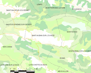
Montferrand-la-Fare (Montferrand-la-Fare)

- commune in Drôme, France
 Hiking in Montferrand-la-Fare
Montferrand-la-Fare is a charming commune located in the Provence-Alpes-Côte d'Azur region of southeastern France, particularly known for its picturesque landscapes and natural beauty. Hiking in this area can provide you with a wonderful experience, as it combines scenic views with the tranquility of rural France.
Key Highlights for Hiking in Montferrand-la-Fare:
-
Scenic Trails: The region around Montferrand-la-Fare offers a variety of hiking trails suited for different skill levels. Routes may take you through lush forests, vineyards, and rolling hills, providing stunning views of the surrounding countryside.
-
Natural Beauty: The area is known for its diverse flora and fauna. Hikers can enjoy the sight of local wildlife, particularly birds and wildflowers, especially in the spring and summer months.
-
Cultural Aspects: While hiking, you may encounter traditional Provençal villages and historical sites. This can add an enriching cultural layer to your outdoor experience.
-
Best Time to Hike: Spring (April to June) and fall (September to October) are generally the best times to hike in Montferrand-la-Fare because of the mild weather and beautiful natural scenery. Summer can be hot, while winters can be chilly and potentially snowy at higher elevations.
-
Preparation: As with any hiking adventure, it's important to prepare adequately. Make sure to bring plenty of water, snacks, and appropriate gear, including sturdy hiking boots and weather-appropriate clothing.
-
Maps and Guides: Consider obtaining local hiking maps or guides, as they can help you discover the best routes, points of interest, and any trail-specific information you might need.
-
Local Amenities: After a rewarding hike, you can explore local dining options to enjoy regional cuisine, which is a delightful way to end your day of hiking.
If you’re planning a hiking trip to Montferrand-la-Fare, make sure to take in the beautiful scenery and enjoy the peaceful environment. Happy hiking!
- Country:

- Postal Code: 26510
- Coordinates: 44° 21' 36" N, 5° 26' 59" E


- GPS tracks (wikiloc): [Link]
- AboveSeaLevel: 670 м m
- Area: 11.24 sq km
- Population: 31
- Wikipedia en: wiki(en)
- Wikipedia: wiki(fr)
- Wikidata storage: Wikidata: Q606597
- Wikipedia Commons Category: [Link]
- Freebase ID: [/m/03mgjyj]
- GeoNames ID: Alt: [6616257]
- SIREN number: [212601991]
- BnF ID: [15253060t]
- INSEE municipality code: 26199
Shares border with regions:

Rosans
- commune in Hautes-Alpes, France
Hiking in Rosans
Rosans is a charming village located in the Hautes-Alpes region of southeastern France, known for its picturesque landscapes, diverse flora, and a range of hiking opportunities. Here are some key points about hiking in and around Rosans:...
- Country:
- Postal Code: 05150
- Coordinates: 44° 23' 30" N, 5° 28' 12" E
- GPS tracks (wikiloc): [Link]
- Area: 30.39 sq km
- Population: 492
- Web site: [Link]

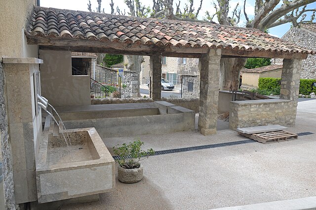
Saint-Auban-sur-l'Ouvèze
- commune in Drôme, France
Hiking in Saint-Auban-sur-l'Ouvèze
Saint-Auban-sur-l'Ouvèze is a charming village located in the Drôme department in southeastern France, known for its picturesque landscapes and diverse hiking opportunities. Nestled in the Vercors Regional Natural Park, it offers a range of trails suitable for different skill levels, making it an excellent destination for hikers. Here are some key points to consider if you're planning a hiking trip there:...
- Country:
- Postal Code: 26170
- Coordinates: 44° 17' 18" N, 5° 24' 59" E
- GPS tracks (wikiloc): [Link]
- Area: 16.55 sq km
- Population: 216

Saint-André-de-Rosans
- commune in Hautes-Alpes, France
Hiking in Saint-André-de-Rosans
Saint-André-de-Rosans is a charming village located in the Hautes-Alpes region of southeastern France. It's a fantastic area for hikers, offering a variety of trails that cater to different skill levels and preferences. Here are some highlights about hiking in this picturesque location:...
- Country:
- Postal Code: 05150
- Coordinates: 44° 22' 38" N, 5° 30' 52" E
- GPS tracks (wikiloc): [Link]
- Area: 36.61 sq km
- Population: 145

Saint-Sauveur-Gouvernet
- commune in Drôme, France
Hiking in Saint-Sauveur-Gouvernet
Saint-Sauveur-Gouvernet is a charming commune located in the Auvergne-Rhône-Alpes region of France. It is known for its beautiful natural surroundings, making it an excellent destination for hiking enthusiasts. Here are some highlights about hiking in and around Saint-Sauveur-Gouvernet:...
- Country:
- Postal Code: 26110
- Coordinates: 44° 20' 14" N, 5° 21' 3" E
- GPS tracks (wikiloc): [Link]
- Area: 19.32 sq km
- Population: 184


Lemps
- commune in Drôme, France
Hiking in Lemps
Lemps, located in the Drôme department of France, offers a charming setting for hiking enthusiasts with its picturesque landscapes and varied terrain. The region is characterized by rolling hills, vineyards, and small villages, providing a peaceful backdrop for outdoor adventures....
- Country:
- Postal Code: 26510
- Coordinates: 44° 21' 4" N, 5° 25' 8" E
- GPS tracks (wikiloc): [Link]
- AboveSeaLevel: 774 м m
- Area: 16.04 sq km
- Population: 47


Roussieux
- commune in Drôme, France
Hiking in Roussieux
Roussieux is a charming village located in the Drôme department of the Auvergne-Rhône-Alpes region in southeastern France. It's surrounded by beautiful landscapes, characterized by rolling hills, forests, and rivers, offering great opportunities for hiking enthusiasts....
- Country:
- Postal Code: 26510
- Coordinates: 44° 19' 59" N, 5° 28' 25" E
- GPS tracks (wikiloc): [Link]
- Area: 9.42 sq km
- Population: 23