Roussieux (Roussieux)

- commune in Drôme, France
 Hiking in Roussieux
Roussieux is a charming village located in the Drôme department of the Auvergne-Rhône-Alpes region in southeastern France. It's surrounded by beautiful landscapes, characterized by rolling hills, forests, and rivers, offering great opportunities for hiking enthusiasts.
Hiking in Roussieux
-
Scenic Trails: The area around Roussieux features a variety of hiking trails that cater to different skill levels. You'll find well-marked paths that take you through picturesque countryside, woodlands, and vineyards. The trails often provide stunning views of the surrounding hills.
-
Nature Exploration: The region boasts rich biodiversity, and hikers may have the chance to spot various flora and fauna, particularly in the nearby natural reserves. Birdwatching can also be a rewarding experience here.
-
Cultural Points: As you hike, you can encounter historical sites, such as ancient ruins or quaint villages, adding a cultural aspect to your outdoor adventures. Exploring local architecture and traditional farms can enhance your experience.
-
Local Recommendations: To make the most of your hiking experience in Roussieux, consider stopping by local tourist offices for maps and current trail conditions. Engaging with local hikers or guides can provide valuable insights and tips.
-
Best Times to Hike: The best times for hiking in this region are typically during spring (April to June) and fall (September to October) when the weather is mild, and the landscapes are particularly beautiful.
-
Safety Tips: Always check the weather forecast, ensure you have adequate supplies (water, snacks, appropriate footwear), and inform someone about your hiking plans. Be mindful of trail markers and local wildlife.
Whether you're looking for a short stroll or a more challenging hike, Roussieux and its surroundings offer a delightful experience for nature lovers and hikers alike!
- Country:

- Postal Code: 26510
- Coordinates: 44° 19' 59" N, 5° 28' 25" E


- GPS tracks (wikiloc): [Link]
- Area: 9.42 sq km
- Population: 23
- Wikipedia en: wiki(en)
- Wikipedia: wiki(fr)
- Wikidata storage: Wikidata: Q936247
- Wikipedia Commons Category: [Link]
- Freebase ID: [/m/03mhjr3]
- GeoNames ID: Alt: [6612189]
- SIREN number: [212602866]
- BnF ID: [15253146j]
- INSEE municipality code: 26286
Shares border with regions:

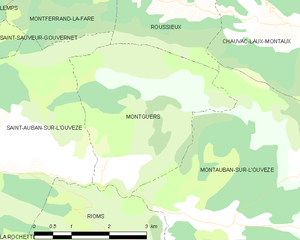
Montguers
- commune in Drôme, France
Hiking in Montguers
Montguers is a picturesque site in the French Pyrenees, known for its stunning landscapes and rich history. This beautiful area is especially popular among hiking enthusiasts due to its diverse terrains, well-marked trails, and breathtaking views. Here are some key points to consider if you're planning a hike in Montguers:...
- Country:
- Postal Code: 26170
- Coordinates: 44° 17' 13" N, 5° 27' 31" E
- GPS tracks (wikiloc): [Link]
- Area: 11.06 sq km
- Population: 42

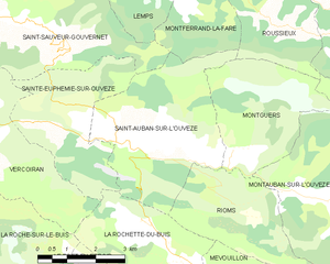
Saint-Auban-sur-l'Ouvèze
- commune in Drôme, France
Hiking in Saint-Auban-sur-l'Ouvèze
Saint-Auban-sur-l'Ouvèze is a charming village located in the Drôme department in southeastern France, known for its picturesque landscapes and diverse hiking opportunities. Nestled in the Vercors Regional Natural Park, it offers a range of trails suitable for different skill levels, making it an excellent destination for hikers. Here are some key points to consider if you're planning a hiking trip there:...
- Country:
- Postal Code: 26170
- Coordinates: 44° 17' 18" N, 5° 24' 59" E
- GPS tracks (wikiloc): [Link]
- Area: 16.55 sq km
- Population: 216

Saint-André-de-Rosans
- commune in Hautes-Alpes, France
Hiking in Saint-André-de-Rosans
Saint-André-de-Rosans is a charming village located in the Hautes-Alpes region of southeastern France. It's a fantastic area for hikers, offering a variety of trails that cater to different skill levels and preferences. Here are some highlights about hiking in this picturesque location:...
- Country:
- Postal Code: 05150
- Coordinates: 44° 22' 38" N, 5° 30' 52" E
- GPS tracks (wikiloc): [Link]
- Area: 36.61 sq km
- Population: 145


Montauban-sur-l'Ouvèze
- commune in Drôme, France
Hiking in Montauban-sur-l'Ouvèze
Montauban-sur-l'Ouvèze is a charming village located in the Drôme department in southeastern France, nestled in the picturesque region of the Vercors. The area is known for its stunning natural landscapes, making it a great destination for hiking enthusiasts....
- Country:
- Postal Code: 26170
- Coordinates: 44° 16' 28" N, 5° 30' 8" E
- GPS tracks (wikiloc): [Link]
- Area: 32.29 sq km
- Population: 107


Montferrand-la-Fare
- commune in Drôme, France
Hiking in Montferrand-la-Fare
Montferrand-la-Fare is a charming commune located in the Provence-Alpes-Côte d'Azur region of southeastern France, particularly known for its picturesque landscapes and natural beauty. Hiking in this area can provide you with a wonderful experience, as it combines scenic views with the tranquility of rural France....
- Country:
- Postal Code: 26510
- Coordinates: 44° 21' 36" N, 5° 26' 59" E
- GPS tracks (wikiloc): [Link]
- AboveSeaLevel: 670 м m
- Area: 11.24 sq km
- Population: 31


Chauvac-Laux-Montaux
- commune in Drôme, France
Hiking in Chauvac-Laux-Montaux
Chauvac-Laux-Montaux is a beautiful area located in the Dauphiné Alps of France, known for its stunning landscapes, diverse wildlife, and excellent hiking opportunities. The region is characterized by its mountainous terrain, picturesque valleys, and a variety of trails suitable for hikers of different levels....
- Country:
- Postal Code: 26510
- Coordinates: 44° 19' 17" N, 5° 31' 32" E
- GPS tracks (wikiloc): [Link]
- Area: 24.24 sq km
- Population: 44