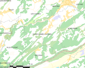
Montlebon (Montlebon)

- commune in Doubs, France
 Hiking in Montlebon
Montlebon, situated in the Doubs region of eastern France, offers picturesque landscapes ideal for hiking. Nestled in the Jura Mountains, it is surrounded by lush forests, rolling hills, and stunning viewpoints. Here are some highlights of hiking in Montlebon:
Trails and Routes
-
Local Trails: Montlebon provides access to various local hiking trails that cater to different skill levels. You can find well-marked paths that meander through the valleys and forests, offering both easy walks and more challenging hikes.
-
Sentiers de Grande Randonnée (GR): The area is close to several Grande Randonnée trails, which are national long-distance hiking trails in France. These trails allow hikers to explore wider areas of the Jura region and beyond.
-
Viewpoints: Many trails lead to scenic viewpoints, such as those overlooking the Doubs Valley and the surrounding mountains. These spots are perfect for resting and taking in the beautiful natural scenery.
Flora and Fauna
Montlebon's diverse ecosystems are home to a variety of plant and animal species. As you hike, you may encounter local wildlife like deer, foxes, various bird species, and an array of wildflowers, especially in spring and summer.
Best Hiking Seasons
- Spring and Summer: This is the most popular time for hiking due to the mild weather and blooming flora. It's advisable to start early in the day to avoid crowds and make the most of daylight hours.
- Fall: Autumn provides beautiful foliage and cooler temperatures, making it a lovely time to hike as well. Just be prepared for occasional rain.
Preparation Tips
- Maps and Guides: It’s a good idea to have a detailed map or a hiking app to guide you through the trails. While many routes are marked, some may be less frequented.
- Gear: Wear good hiking boots and bring waterproof clothing, snacks, and enough water, especially on longer hikes.
- Local Information: Check with local guides or tourism offices for any specific trail conditions, suggested routes, or guided hikes.
Safety Considerations
- Always inform someone of your plans before heading out, especially if you’re venturing on a less-trafficked trail.
- Be aware of the weather forecasts, as conditions can change rapidly in mountainous terrain.
- Follow Leave No Trace principles to help preserve the natural beauty of the area.
Conclusion
Montlebon is an excellent destination for outdoor enthusiasts looking to explore the Jura Mountains. With its rich natural beauty and varied hiking options, it provides a serene escape for all types of hikers. Enjoy your adventure!
- Country:

- Postal Code: 25500
- Coordinates: 47° 2' 30" N, 6° 36' 27" E


- GPS tracks (wikiloc): [Link]
- Area: 27.27 sq km
- Population: 2024
- Wikipedia en: wiki(en)
- Wikipedia: wiki(fr)
- Wikidata storage: Wikidata: Q601398
- Wikipedia Commons Category: [Link]
- Freebase ID: [/m/03mhblr]
- Freebase ID: [/m/03mhblr]
- GeoNames ID: Alt: [6429899]
- GeoNames ID: Alt: [6429899]
- SIREN number: [212504039]
- SIREN number: [212504039]
- BnF ID: [152526293]
- BnF ID: [152526293]
- INSEE municipality code: 25403
- INSEE municipality code: 25403
Shares border with regions:


Morteau
- commune in Doubs, France
Hiking in Morteau
Morteau, a charming town located in the Doubs department of France, is surrounded by beautiful landscapes that are perfect for hiking enthusiasts. Nestled near the Jura Mountains and the border with Switzerland, Morteau offers a variety of trails suitable for different skill levels and preferences....
- Country:
- Postal Code: 25500
- Coordinates: 47° 3' 29" N, 6° 36' 22" E
- GPS tracks (wikiloc): [Link]
- Area: 14.11 sq km
- Population: 6849
- Web site: [Link]


Villers-le-Lac
- commune in Doubs, France
Hiking in Villers-le-Lac
Villers-le-Lac is a charming village located in the Doubs department in the Franche-Comté region of eastern France. It's an ideal base for hiking enthusiasts due to its stunning natural surroundings, including the Jura Mountains and proximity to the Swiss border....
- Country:
- Postal Code: 25130
- Coordinates: 47° 3' 39" N, 6° 40' 13" E
- GPS tracks (wikiloc): [Link]
- Area: 30.17 sq km
- Population: 4819
- Web site: [Link]

Grand'Combe-Châteleu
- commune in Doubs, France
Hiking in Grand'Combe-Châteleu
Grand'Combe-Châteleu is a beautiful and less-known destination for hikers in the Jura Mountains of France. The region is characterized by its rolling hills, dense forests, and scenic vistas, making it a great spot for outdoor enthusiasts. Here are some key points to consider when hiking in this area:...
- Country:
- Postal Code: 25570
- Coordinates: 47° 1' 34" N, 6° 34' 12" E
- GPS tracks (wikiloc): [Link]
- Area: 21.46 sq km
- Population: 1477
- Web site: [Link]


Les Fins
- commune in Doubs, France
Hiking in Les Fins
Les Fins is a charming village located in the Doubs department of the Bourgogne-Franche-Comté region in eastern France, near the Swiss border. The area is known for its beautiful natural landscapes, rolling hills, and rich flora and fauna, making it a great destination for hiking enthusiasts....
- Country:
- Postal Code: 25500
- Coordinates: 47° 4' 51" N, 6° 37' 42" E
- GPS tracks (wikiloc): [Link]
- Area: 25.39 sq km
- Population: 3055