Montmeyran (Montmeyran)
- commune in Drôme, France
Montmeyran, located in the Drôme department of southeastern France, offers various hiking opportunities for both beginners and experienced hikers. The region is characterized by its picturesque landscapes, rolling hills, and diverse flora and fauna.
Hiking Trails:
-
Local Trails: The area around Montmeyran has several marked trails that allow for exploration of the surrounding countryside. These trails often wind through vineyards, forests, and along the banks of the Rhône River, offering beautiful views.
-
GR Trails: The nearby Grande Randonnée (GR) trails provide longer hiking routes that can lead to more challenging hikes, connecting Montmeyran with other towns and scenic spots.
-
Nature Parks: Explore nearby natural attractions and parks that may offer guided hikes or education about the local ecosystem.
Tips for Hiking in Montmeyran:
- Weather Preparedness: Always check the weather before heading out, as conditions can change rapidly.
- Gear: Wear appropriate hiking shoes, and consider hiking poles for uneven terrain. Bring water, snacks, and a map or GPS device.
- Wildlife Awareness: Be mindful of local wildlife and stick to marked trails to protect both the environment and yourself.
- Respect Nature: Follow the Leave No Trace principles, ensuring the area remains pristine for others to enjoy.
Best Times to Hike:
- Spring and Fall are ideal for hiking in Montmeyran, as temperatures are mild and the scenery is particularly beautiful with blooming flowers in spring and vibrant autumn colors.
Guided Hikes:
If you're unfamiliar with the area or prefer a structured experience, consider joining a guided hiking tour, which can provide insights into the local history and geography.
Whether you're looking for a leisurely stroll or a more strenuous hike, Montmeyran offers a beautiful backdrop to experience nature and enjoy the outdoors.
- Country:

- Postal Code: 26120
- Coordinates: 44° 49' 59" N, 4° 58' 30" E


- GPS tracks (wikiloc): [Link]
- Area: 24.1 sq km
- Population: 2866
- Web site: http://www.montmeyran.fr
- Wikipedia en: wiki(en)
- Wikipedia: wiki(fr)
- Wikidata storage: Wikidata: Q579858
- Wikipedia Commons Category: [Link]
- Freebase ID: [/m/03mgjw3]
- GeoNames ID: Alt: [2992249]
- SIREN number: [212602064]
- BnF ID: [152530677]
- VIAF ID: Alt: [249117059]
- OSM relation ID: [79740]
- INSEE municipality code: 26206
Shares border with regions:


Ourches
- commune in Drôme, France
Ourches is a lesser-known location for hiking, and detailed information about specific trails may be limited. However, if you are referring to a specific area or region (such as Ourches in France), I'd recommend looking for local hiking resources as well as national park guidance if applicable....
- Country:

- Postal Code: 26120
- Coordinates: 44° 48' 17" N, 5° 2' 29" E


- GPS tracks (wikiloc): [Link]
- Area: 9.23 sq km
- Population: 247

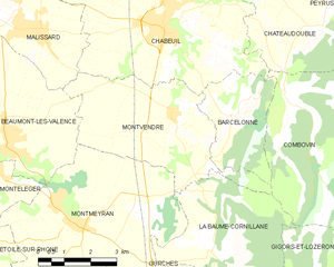
Montvendre
- commune in Drôme, France
Montvendre is a beautiful area located in the Auvergne-Rhône-Alpes region of France, known for its stunning landscapes, rolling hills, and diverse trails suitable for hikers of all levels. Here are some important aspects to consider when hiking in Montvendre:...
- Country:

- Postal Code: 26120
- Coordinates: 44° 52' 18" N, 5° 1' 21" E


- GPS tracks (wikiloc): [Link]
- Area: 17.24 sq km
- Population: 1140
- Web site: [Link]


Montéléger
- commune in Drôme, France
Montéléger is a small commune located in the Drôme department in the Auvergne-Rhône-Alpes region of France. While it may not be one of the most renowned hiking destinations, it can offer beautiful scenery and a chance to explore the natural beauty of the surrounding areas....
- Country:

- Postal Code: 26760
- Coordinates: 44° 51' 12" N, 4° 56' 0" E


- GPS tracks (wikiloc): [Link]
- Area: 9.45 sq km
- Population: 1786


Upie
- commune in Drôme, France
Upie is a beautiful destination for hiking enthusiasts, offering access to diverse landscapes and trails that cater to various skill levels. While it may not be as well-known as some other hiking spots, it still provides a wonderful opportunity to explore nature and enjoy scenic views....
- Country:

- Postal Code: 26120
- Coordinates: 44° 48' 17" N, 4° 58' 43" E


- GPS tracks (wikiloc): [Link]
- Area: 19.53 sq km
- Population: 1530
- Web site: [Link]

La Baume-Cornillane
- commune in Drôme, France
La Baume-Cornillane is a picturesque hiking area located near Valence in the Auvergne-Rhône-Alpes region of France. The scenery is characterized by rolling hills, forests, and diverse flora and fauna, making it an appealing destination for outdoor enthusiasts. Here are some key points to consider when hiking in La Baume-Cornillane:...
- Country:

- Postal Code: 26120
- Coordinates: 44° 49' 25" N, 5° 2' 25" E


- GPS tracks (wikiloc): [Link]
- Area: 14.42 sq km
- Population: 442
- Web site: [Link]

Montoison
- commune in Drôme, France
Montoison, located in the Drôme department of France, is a picturesque area that offers various opportunities for hiking enthusiasts. The region is characterized by its stunning natural landscapes, including rolling hills, vineyards, and serene countryside, making it an ideal spot for both leisurely walks and more challenging hikes....
- Country:

- Postal Code: 26800
- Coordinates: 44° 47' 52" N, 4° 56' 25" E


- GPS tracks (wikiloc): [Link]
- Area: 16.11 sq km
- Population: 1908

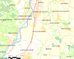
Étoile-sur-Rhône
- commune in Drôme, France
Étoile-sur-Rhône is a charming commune located in the Drôme department of southeastern France. Surrounded by the picturesque landscapes of the Rhône Valley, it serves as a great starting point for various hiking adventures....
- Country:

- Postal Code: 26800
- Coordinates: 44° 50' 13" N, 4° 53' 38" E


- GPS tracks (wikiloc): [Link]
- Area: 42.79 sq km
- Population: 5347
- Web site: [Link]

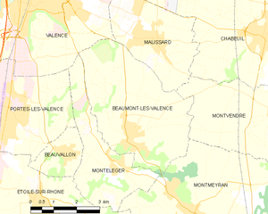
Beaumont-lès-Valence
- commune in Drôme, France
 Hiking in Beaumont-lès-Valence
Beaumont-lès-Valence is a charming commune located in the Drôme department in southeastern France. The area around Beaumont-lès-Valence offers a range of hiking opportunities, particularly appealing for nature lovers and those looking to explore the scenic landscapes of the Rhône-Alpes region....
- Country:

- Postal Code: 26760
- Coordinates: 44° 51' 43" N, 4° 56' 34" E


- GPS tracks (wikiloc): [Link]
- Area: 17.61 sq km
- Population: 3621
