
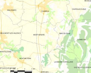
La Baume-Cornillane (La Baume-Cornillane)

- commune in Drôme, France
 Hiking in La Baume-Cornillane
La Baume-Cornillane is a picturesque hiking area located near Valence in the Auvergne-Rhône-Alpes region of France. The scenery is characterized by rolling hills, forests, and diverse flora and fauna, making it an appealing destination for outdoor enthusiasts. Here are some key points to consider when hiking in La Baume-Cornillane:
Trails and Routes
- Diverse Trails: The area offers a variety of trails suitable for different skill levels, from easy walks through forests to more challenging hikes that provide stunning views of the surrounding landscape.
- Signposted Paths: Many trails are well-marked, making navigation easier for hikers. It’s advisable to carry a map or a GPS device for reference.
Natural Features
- Scenic Views: The hikes often lead to elevated points that provide panoramic views of the Drôme valley and the surrounding mountains, particularly the Vercors range.
- Flora and Fauna: The area is rich in biodiversity, with opportunities to see various plant species and wildlife, including birds and small mammals.
Best Practices
- Prepare Accordingly: Make sure to check weather conditions before heading out, as the terrain can vary widely. Wear appropriate hiking gear and bring plenty of water and snacks.
- Respect Nature: Follow Leave No Trace principles to preserve the natural beauty of the area. Stay on marked trails and avoid disturbing wildlife.
Accessibility
- Transportation: Depending on your starting point, public transportation or a car might be necessary to reach the trailheads. Check local resources for bus routes if you’re relying on public transport.
- Visitor Information: Local tourist offices or hiking clubs can provide valuable insights, including recommended routes and any seasonal considerations.
Nearby Attractions
- Villages and Culture: Consider exploring nearby towns for local culture, cuisine, and historical sites. The region is known for its charming villages and markets.
- Historic Sites: There may be historical landmarks or monuments along some of the hiking routes, adding a cultural aspect to your adventure.
Hiking in La Baume-Cornillane offers a wonderful blend of nature, tranquility, and exploration, making it an ideal spot for both casual walkers and serious hikers. Enjoy your adventure!
- Country:

- Postal Code: 26120
- Coordinates: 44° 49' 25" N, 5° 2' 25" E


- GPS tracks (wikiloc): [Link]
- Area: 14.42 sq km
- Population: 442
- Web site: http://www.labaumecornillane.fr
- Wikipedia en: wiki(en)
- Wikipedia: wiki(fr)
- Wikidata storage: Wikidata: Q383140
- Wikipedia Commons Category: [Link]
- Freebase ID: [/m/03mglcm]
- GeoNames ID: Alt: [6456791]
- SIREN number: [212600324]
- BnF ID: [15252893r]
- INSEE municipality code: 26032
Shares border with regions:


Ourches
- commune in Drôme, France
Hiking in Ourches
Ourches is a lesser-known location for hiking, and detailed information about specific trails may be limited. However, if you are referring to a specific area or region (such as Ourches in France), I'd recommend looking for local hiking resources as well as national park guidance if applicable....
- Country:
- Postal Code: 26120
- Coordinates: 44° 48' 17" N, 5° 2' 29" E
- GPS tracks (wikiloc): [Link]
- Area: 9.23 sq km
- Population: 247

Montvendre
- commune in Drôme, France
Hiking in Montvendre
Montvendre is a beautiful area located in the Auvergne-Rhône-Alpes region of France, known for its stunning landscapes, rolling hills, and diverse trails suitable for hikers of all levels. Here are some important aspects to consider when hiking in Montvendre:...
- Country:
- Postal Code: 26120
- Coordinates: 44° 52' 18" N, 5° 1' 21" E
- GPS tracks (wikiloc): [Link]
- Area: 17.24 sq km
- Population: 1140
- Web site: [Link]


Montmeyran
- commune in Drôme, France
Hiking in Montmeyran
Montmeyran, located in the Drôme department of southeastern France, offers various hiking opportunities for both beginners and experienced hikers. The region is characterized by its picturesque landscapes, rolling hills, and diverse flora and fauna....
- Country:
- Postal Code: 26120
- Coordinates: 44° 49' 59" N, 4° 58' 30" E
- GPS tracks (wikiloc): [Link]
- Area: 24.1 sq km
- Population: 2866
- Web site: [Link]

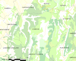
Combovin
- commune in Drôme, France
Hiking in Combovin
Combovin is a charming village located in the Drôme department of the Auvergne-Rhône-Alpes region in southeastern France. It is known for its picturesque landscapes, making it a delightful destination for hiking enthusiasts. Here are some key points about hiking in and around Combovin:...
- Country:
- Postal Code: 26120
- Coordinates: 44° 52' 26" N, 5° 4' 41" E
- GPS tracks (wikiloc): [Link]
- Area: 35.86 sq km
- Population: 405


Gigors-et-Lozeron
- commune in Drôme, France
Hiking in Gigors-et-Lozeron
Gigors-et-Lozeron is a beautiful commune located in the Auvergne-Rhône-Alpes region of France, nestled in the picturesque landscape of the French Alps. While it's a relatively small area, its proximity to larger mountain ranges and natural parks offers excellent hiking opportunities for outdoor enthusiasts....
- Country:
- Postal Code: 26400
- Coordinates: 44° 47' 38" N, 5° 6' 29" E
- GPS tracks (wikiloc): [Link]
- Area: 35.27 sq km
- Population: 163