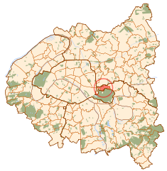
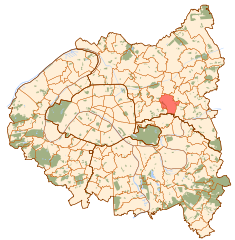
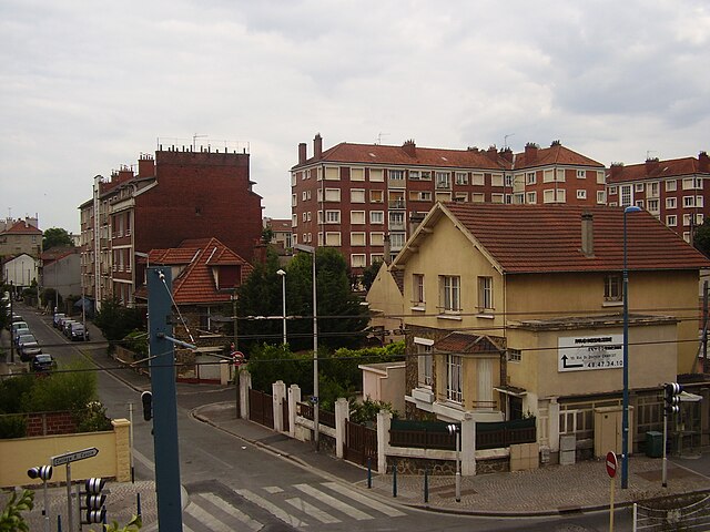
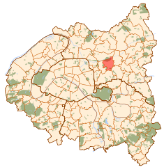
.jpg)
Montreuil (Montreuil)

- commune in Seine-Saint-Denis, France
- Country:

- Postal Code: 93100
- Coordinates: 48° 51' 37" N, 2° 26' 35" E


- GPS tracks (wikiloc): [Link]
- Area: 8.92 sq km
- Population: 106691
- Web site: http://www.montreuil.fr
- Wikipedia en: wiki(en)
- Wikipedia: wiki(fr)
- Wikidata storage: Wikidata: Q193370
- Wikipedia Commons Category: [Link]
- Wikipedia Commons Maps Category: [Link]
- Freebase ID: [/m/02jbj_]
- Freebase ID: [/m/02jbj_]
- Freebase ID: [/m/02jbj_]
- Freebase ID: [/m/02jbj_]
- GeoNames ID: Alt: [2992090]
- GeoNames ID: Alt: [2992090]
- GeoNames ID: Alt: [2992090]
- GeoNames ID: Alt: [2992090]
- SIREN number: [219300480]
- SIREN number: [219300480]
- SIREN number: [219300480]
- SIREN number: [219300480]
- BnF ID: [15280300p]
- BnF ID: [15280300p]
- BnF ID: [15280300p]
- BnF ID: [15280300p]
- VIAF ID: Alt: [169876902]
- VIAF ID: Alt: [169876902]
- VIAF ID: Alt: [169876902]
- VIAF ID: Alt: [169876902]
- OSM relation ID: [129423]
- OSM relation ID: [129423]
- OSM relation ID: [129423]
- OSM relation ID: [129423]
- GND ID: Alt: [4341625-1]
- GND ID: Alt: [4341625-1]
- GND ID: Alt: [4341625-1]
- GND ID: Alt: [4341625-1]
- archINFORM location ID: [9246]
- archINFORM location ID: [9246]
- archINFORM location ID: [9246]
- archINFORM location ID: [9246]
- Library of Congress authority ID: Alt: [n82152256]
- Library of Congress authority ID: Alt: [n82152256]
- Library of Congress authority ID: Alt: [n82152256]
- Library of Congress authority ID: Alt: [n82152256]
- MusicBrainz area ID: [1d767961-7a0b-4ae2-8a15-be2ea66ad253]
- MusicBrainz area ID: [1d767961-7a0b-4ae2-8a15-be2ea66ad253]
- MusicBrainz area ID: [1d767961-7a0b-4ae2-8a15-be2ea66ad253]
- MusicBrainz area ID: [1d767961-7a0b-4ae2-8a15-be2ea66ad253]
- SUDOC authorities ID: [026392860]
- SUDOC authorities ID: [026392860]
- SUDOC authorities ID: [026392860]
- SUDOC authorities ID: [026392860]
- Twitter username: Alt: [montreuil]
- Twitter username: Alt: [montreuil]
- Twitter username: Alt: [montreuil]
- Twitter username: Alt: [montreuil]
- NKCR AUT ID: [ge989053]
- NKCR AUT ID: [ge989053]
- NKCR AUT ID: [ge989053]
- NKCR AUT ID: [ge989053]
- YouTube channel ID: [UCdS5Beyd0TieRctxq3Kliyg]
- YouTube channel ID: [UCdS5Beyd0TieRctxq3Kliyg]
- YouTube channel ID: [UCdS5Beyd0TieRctxq3Kliyg]
- YouTube channel ID: [UCdS5Beyd0TieRctxq3Kliyg]
- INSEE municipality code: 93048
- INSEE municipality code: 93048
- INSEE municipality code: 93048
- INSEE municipality code: 93048
Shares border with regions:


Saint-Mandé
- commune in Val-de-Marne, France
- Country:
- Postal Code: 94160
- Coordinates: 48° 50' 29" N, 2° 25' 4" E
- GPS tracks (wikiloc): [Link]
- AboveSeaLevel: 42 м m
- Area: 0.92 sq km
- Population: 22401
- Web site: [Link]

Vincennes
- commune in Val-de-Marne, France
- Country:
- Postal Code: 94300
- Coordinates: 48° 50' 52" N, 2° 26' 21" E
- GPS tracks (wikiloc): [Link]
- AboveSeaLevel: 55 м m
- Area: 1.91 sq km
- Population: 49461
- Web site: [Link]


Fontenay-sous-Bois
- commune in Val-de-Marne, France
- Country:
- Postal Code: 94120
- Coordinates: 48° 51' 6" N, 2° 28' 38" E
- GPS tracks (wikiloc): [Link]
- Area: 5.58 sq km
- Population: 53649
- Web site: [Link]


Bagnolet
- commune in Seine-Saint-Denis, France
- Country:
- Postal Code: 93170
- Coordinates: 48° 52' 1" N, 2° 25' 1" E
- GPS tracks (wikiloc): [Link]
- Area: 2.57 sq km
- Population: 35881
- Web site: [Link]

Rosny-sous-Bois
- commune in Seine-Saint-Denis, France
- Country:
- Postal Code: 93110
- Coordinates: 48° 52' 23" N, 2° 29' 7" E
- GPS tracks (wikiloc): [Link]
- AboveSeaLevel: 69 м m
- Area: 5.91 sq km
- Population: 44728
- Web site: [Link]
Noisy-le-Sec
- commune in Seine-Saint-Denis, France
- Country:
- Postal Code: 93130
- Coordinates: 48° 53' 27" N, 2° 27' 13" E
- GPS tracks (wikiloc): [Link]
- AboveSeaLevel: 57 м m
- Area: 5.04 sq km
- Population: 43390
- Web site: [Link]


Romainville
- commune in Seine-Saint-Denis, France
- Country:
- Postal Code: 93230
- Coordinates: 48° 53' 1" N, 2° 26' 10" E
- GPS tracks (wikiloc): [Link]
- AboveSeaLevel: 117 м m
- Area: 3.44 sq km
- Population: 26031
- Web site: [Link]

Paris
- capital and largest city of France
- Country:
- Postal Code: 75020; 75019; 75018; 75017; 75016; 75015; 75014; 75013; 75012; 75011; 75010; 75009; 75008; 75007; 75006; 75005; 75004; 75003; 75002; 75001; 75116
- Local Dialing Code: 1
- Licence Plate Code: 75
- Coordinates: 48° 51' 24" N, 2° 21' 7" E
- GPS tracks (wikiloc): [Link]
- AboveSeaLevel: 28 м m
- Area: 105.4 sq km
- Population: 2206488
- Web site: [Link]