Montriond (Montriond)

- commune in Haute-Savoie, France
 Hiking in Montriond
Montriond, located in the French Alps near Morzine, is a beautiful destination for hiking enthusiasts. The area offers a range of trails with stunning views of the surrounding mountains, lush valleys, and crystal-clear lakes. Here are some key points about hiking in Montriond:
Trail Variety
- Difficulty Levels: There are trails suitable for all levels, from beginner to advanced. Beginners can enjoy gentler paths around the lake, while experienced hikers can tackle more challenging mountain ascents.
- Scenic Routes: Many trails boast breathtaking scenery. The route around Montriond Lake is particularly popular, providing easy access to nature with beautiful reflections in the water and opportunities for picnicking.
Notable Hikes
- Lac de Montriond: A relatively easy hike that circles the lake. It's about 2.5 km and takes roughly 1-2 hours. Ideal for families and those looking for a leisurely stroll.
- Le Mont de Grange: For a more challenging hike, consider this ascent. It provides stunning panoramic views from the top.
- Col de la Joux Verte: This trail offers an opportunity to explore higher altitudes and take in expansive views of the region.
Best Time to Hike
- Summer (June to September): This is the best time for hiking, as the weather is typically pleasant, and trails are open after snowmelt. Flowers are blooming, and the landscapes are vibrant.
- Fall (October): Early October can offer beautiful fall foliage, but prepare for cooler temperatures and possible snow at higher elevations.
Tips for Hiking in Montriond
- Preparation: Always check the weather forecast, and consider bringing layers for changing conditions.
- Hydration: Stay hydrated, especially on longer hikes. Bring enough water and snacks.
- Footwear: Wear sturdy hiking boots for good grip and support, particularly on rocky or uneven trails.
- Maps and Navigation: While many trails are well-marked, carrying a map or GPS device is advisable, especially for less popular routes.
Whether you are looking for a simple day hike or a more serious trekking adventure, Montriond has a variety of options to explore the natural beauty of the French Alps. Enjoy your hiking!
- Country:

- Postal Code: 74110
- Coordinates: 46° 11' 50" N, 6° 41' 39" E


- GPS tracks (wikiloc): [Link]
- Area: 24.71 sq km
- Population: 902
- Web site: http://www.mairie-montriond.fr
- Wikipedia en: wiki(en)
- Wikipedia: wiki(fr)
- Wikidata storage: Wikidata: Q848698
- Wikipedia Commons Category: [Link]
- Freebase ID: [/m/03ntzy4]
- GeoNames ID: Alt: [6443002]
- SIREN number: [217401884]
- BnF ID: [152744461]
- VIAF ID: Alt: [245024122]
- INSEE municipality code: 74188
Shares border with regions:


Abondance, Haute-Savoie
- commune in Haute-Savoie, France
Hiking in Abondance, Haute-Savoie
Abondance, located in the Haute-Savoie region of the French Alps, is a beautiful destination for hiking enthusiasts. This charming village is well-known for its stunning mountain landscapes, lush valleys, and rich cultural heritage....
- Country:
- Postal Code: 74360
- Coordinates: 46° 16' 44" N, 6° 43' 19" E
- GPS tracks (wikiloc): [Link]
- Area: 58.84 sq km
- Population: 1377
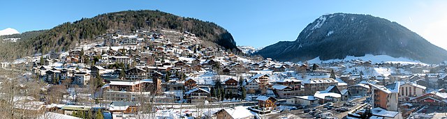

Morzine
- commune in Haute-Savoie, France
Hiking in Morzine
Morzine is a beautiful alpine town located in the French Alps, part of the Portes du Soleil ski area, which is well-known for both winter sports and summer hiking opportunities. The region offers a diverse range of trails and breathtaking landscapes, making it ideal for hikers of all levels. Here’s what you need to know about hiking in Morzine:...
- Country:
- Postal Code: 74110
- Coordinates: 46° 10' 48" N, 6° 42' 33" E
- GPS tracks (wikiloc): [Link]
- AboveSeaLevel: 1000 м m
- Area: 44.1 sq km
- Population: 2870
- Web site: [Link]

Essert-Romand
- commune in Haute-Savoie, France
Hiking in Essert-Romand
Essert-Romand is a picturesque village located in the French Alps, near the popular resort town of Morzine. It offers stunning views, lush landscapes, and a variety of hiking trails suitable for different levels of hikers....
- Country:
- Postal Code: 74110
- Coordinates: 46° 12' 6" N, 6° 40' 16" E
- GPS tracks (wikiloc): [Link]
- Area: 6.78 sq km
- Population: 509
- Web site: [Link]
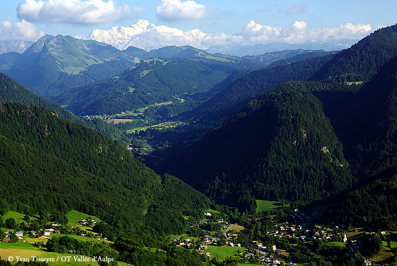

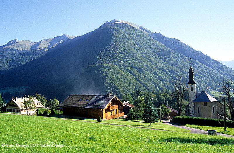
Saint-Jean-d'Aulps
- commune in Haute-Savoie, France
Hiking in Saint-Jean-d'Aulps
Saint-Jean-d'Aulps is a beautiful mountain resort located in the Rhône-Alpes region of France, within the wider Portes du Soleil area. It’s an excellent destination for hiking enthusiasts, offering a range of trails and stunning alpine scenery....
- Country:
- Postal Code: 74430
- Coordinates: 46° 14' 5" N, 6° 39' 20" E
- GPS tracks (wikiloc): [Link]
- Area: 40.19 sq km
- Population: 1241
- Web site: [Link]