
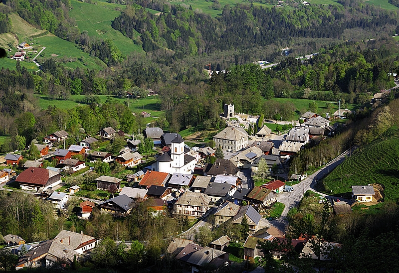
Abondance, Haute-Savoie (Abondance)

- commune in Haute-Savoie, France
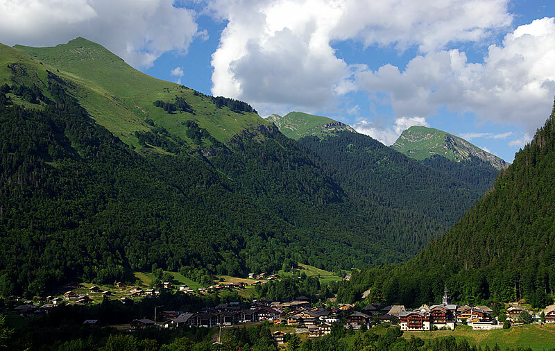
 Hiking in Abondance, Haute-Savoie
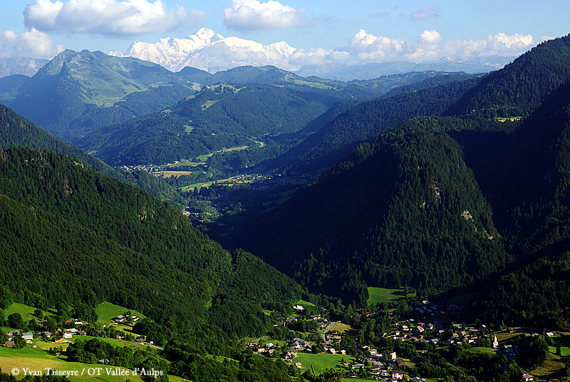
Abondance, located in the Haute-Savoie region of the French Alps, is a beautiful destination for hiking enthusiasts. This charming village is well-known for its stunning mountain landscapes, lush valleys, and rich cultural heritage.
Hiking Trails:
-
Chemin des Buvettes: This is a relatively easy hike suitable for families. The trail meanders through pastures and forests, offering panoramic views of the surrounding mountains and the valley below. It’s a great opportunity to discover local flora and fauna.
-
Col de la Plagne: A moderate hike that takes you to the Col de la Plagne, providing breathtaking views of the surrounding peaks. This trail can be quite popular, especially during the summer months, as it connects several mountain pastures.
-
Circuit des Chalets d’Abondance: This loop trail introduces hikers to several traditional chalets while showcasing the local alpine environment. The trail is well-marked and features various terrains, from meadows to rocky paths.
-
Mont de Grange: For those seeking a more challenging experience, the Mont de Grange hike is demanding but offers stunning rewards. The summit provides an incredible panorama over Lake Geneva and the surrounding Alps.
Preparation and Tips:
-
Best Time to Visit: The ideal time for hiking in Abondance is between late spring and early autumn, typically from May to October when the trails are clear of snow.
-
Gear: Wear sturdy hiking boots and bring layered clothing, as weather conditions can change rapidly in the mountains. Always carry sufficient water, snacks, and a first-aid kit.
-
Maps and Guides: While many trails are well-marked, carrying a map or using a GPS device can be helpful. Local tourist offices often provide detailed maps and guides.
-
Wildlife: Be respectful of the local wildlife and environment. It's common to spot various animals, so maintaining a safe distance is important.
-
Acclimatization: If you are not used to high altitudes, ensure that you allow your body time to adjust, especially on longer or higher elevation hikes.
Local Culture:
- Don't miss the chance to experience the local culture, including cheese production, particularly the famous Abondance cheese. Consider taking a tour of a local farm if you have time.
Abondance is a picturesque destination with a range of hiking options for all skill levels, making it a perfect spot for a hiking adventure in the French Alps! Enjoy your hike!
- Country:

- Postal Code: 74360
- Coordinates: 46° 16' 44" N, 6° 43' 19" E


- GPS tracks (wikiloc): [Link]
- Area: 58.84 sq km
- Population: 1377
- Wikipedia en: wiki(en)
- Wikipedia: wiki(fr)
- Wikidata storage: Wikidata: Q322895
- Wikipedia Commons Category: [Link]
- Freebase ID: [/m/02prz40]
- GeoNames ID: Alt: [6452511]
- SIREN number: [217400019]
- BnF ID: [15274261c]
- GND ID: Alt: [4569031-5]
- PACTOLS thesaurus ID: [pcrtZWksO3q1E6]
- INSEE municipality code: 74001
Shares border with regions:

Le Biot
- commune in Haute-Savoie, France
Hiking in Le Biot
Le Biot is a charming village located in the Haute-Savoie region of France, nestled in the French Alps. It's a great destination for hikers due to its stunning natural scenery and variety of trails that cater to different skill levels. Here are some key points to consider when hiking in Le Biot:...
- Country:
- Postal Code: 74430
- Coordinates: 46° 15' 46" N, 6° 37' 57" E
- GPS tracks (wikiloc): [Link]
- Area: 13.18 sq km
- Population: 576
- Web site: [Link]


Châtel, Haute-Savoie
- commune in Haute-Savoie, France
Hiking in Châtel, Haute-Savoie
Châtel, located in the Haute-Savoie region of the French Alps, is a fantastic destination for hiking enthusiasts. With its stunning mountain scenery, diverse trails, and access to both the Portes du Soleil ski area and the surrounding natural parks, Châtel offers a variety of hiking experiences suitable for all levels....
- Country:
- Postal Code: 74390
- Coordinates: 46° 16' 0" N, 6° 50' 28" E
- GPS tracks (wikiloc): [Link]
- Area: 32.19 sq km
- Population: 1224
- Web site: [Link]

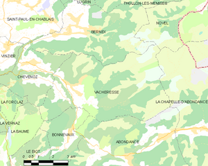
Vacheresse
- commune in Haute-Savoie, France
Hiking in Vacheresse
Vacheresse is a charming village situated in the Haute-Savoie region of France, nestled in the heart of the French Alps. It's a great location for hiking enthusiasts who want to explore the stunning natural beauty of the area. Here are some key points about hiking in Vacheresse:...
- Country:
- Postal Code: 74360
- Coordinates: 46° 19' 28" N, 6° 40' 25" E
- GPS tracks (wikiloc): [Link]
- Area: 31.02 sq km
- Population: 807
- Web site: [Link]

Bonnevaux
- commune in Haute-Savoie, France
Hiking in Bonnevaux
Hiking in Bonnevaux, located in the Haute-Savoie region of the French Alps, offers breathtaking scenery, a variety of trails, and an opportunity to experience the natural beauty of the Alps. Here are some highlights about hiking in this area:...
- Country:
- Postal Code: 74360
- Coordinates: 46° 17' 49" N, 6° 40' 13" E
- GPS tracks (wikiloc): [Link]
- Area: 7.82 sq km
- Population: 265


La Chapelle-d'Abondance
- commune in Haute-Savoie, France
Hiking in La Chapelle-d'Abondance
La Chapelle-d'Abondance is a picturesque village located in the French Alps, specifically within the Haute-Savoie region. It's part of the Portes du Soleil ski area but also offers excellent hiking opportunities during the summer months. Here are some highlights for hiking in La Chapelle-d'Abondance:...
- Country:
- Postal Code: 74360
- Coordinates: 46° 17' 43" N, 6° 47' 15" E
- GPS tracks (wikiloc): [Link]
- Area: 37.85 sq km
- Population: 886
- Web site: [Link]

Montriond
- commune in Haute-Savoie, France
Hiking in Montriond
Montriond, located in the French Alps near Morzine, is a beautiful destination for hiking enthusiasts. The area offers a range of trails with stunning views of the surrounding mountains, lush valleys, and crystal-clear lakes. Here are some key points about hiking in Montriond:...
- Country:
- Postal Code: 74110
- Coordinates: 46° 11' 50" N, 6° 41' 39" E
- GPS tracks (wikiloc): [Link]
- Area: 24.71 sq km
- Population: 902
- Web site: [Link]

Saint-Jean-d'Aulps
- commune in Haute-Savoie, France
Hiking in Saint-Jean-d'Aulps
Saint-Jean-d'Aulps is a beautiful mountain resort located in the Rhône-Alpes region of France, within the wider Portes du Soleil area. It’s an excellent destination for hiking enthusiasts, offering a range of trails and stunning alpine scenery....
- Country:
- Postal Code: 74430
- Coordinates: 46° 14' 5" N, 6° 39' 20" E
- GPS tracks (wikiloc): [Link]
- Area: 40.19 sq km
- Population: 1241
- Web site: [Link]