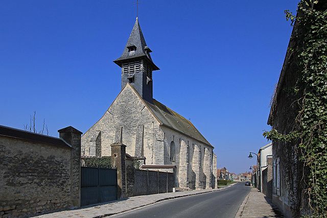
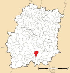
Morigny-Champigny (Morigny-Champigny)
- commune in Essonne, France
- Country:

- Postal Code: 91150
- Coordinates: 48° 26' 47" N, 2° 11' 0" E


- GPS tracks (wikiloc): [Link]
- Area: 30.85 sq km
- Population: 4373
- Web site: http://www.morignychampigny.fr
- Wikipedia en: wiki(en)
- Wikipedia: wiki(fr)
- Wikidata storage: Wikidata: Q594652
- Wikipedia Commons Category: [Link]
- Freebase ID: [/m/03mg_l6]
- Freebase ID: [/m/03mg_l6]
- GeoNames ID: Alt: [2991792]
- GeoNames ID: Alt: [2991792]
- SIREN number: [219104338]
- SIREN number: [219104338]
- BnF ID: [15280168r]
- BnF ID: [15280168r]
- VIAF ID: Alt: [242180236]
- VIAF ID: Alt: [242180236]
- Library of Congress authority ID: Alt: [n85148567]
- Library of Congress authority ID: Alt: [n85148567]
- PACTOLS thesaurus ID: [pcrtrvZd3LORci]
- PACTOLS thesaurus ID: [pcrtrvZd3LORci]
- INSEE municipality code: 91433
- INSEE municipality code: 91433
Shares border with regions:


La Forêt-Sainte-Croix
- commune in Essonne, France
- Country:

- Postal Code: 91150
- Coordinates: 48° 23' 5" N, 2° 13' 50" E


- GPS tracks (wikiloc): [Link]
- Area: 5.36 sq km
- Population: 163


Brières-les-Scellés
- commune in Essonne, France
- Country:

- Postal Code: 91150
- Coordinates: 48° 27' 27" N, 2° 8' 21" E


- GPS tracks (wikiloc): [Link]
- Area: 8.65 sq km
- Population: 1207


Puiselet-le-Marais
- commune in Essonne, France
- Country:

- Postal Code: 91150
- Coordinates: 48° 24' 19" N, 2° 15' 44" E


- GPS tracks (wikiloc): [Link]
- Area: 11.27 sq km
- Population: 283


Étampes
- commune in Essonne, France
- Country:

- Postal Code: 91150
- Coordinates: 48° 26' 6" N, 2° 9' 44" E


- GPS tracks (wikiloc): [Link]
- Area: 40.92 sq km
- Population: 24271
- Web site: [Link]


Bouville
- commune in Essonne, France
- Country:

- Postal Code: 91880
- Coordinates: 48° 25' 53" N, 2° 16' 10" E


- GPS tracks (wikiloc): [Link]
- Area: 20.53 sq km
- Population: 650
- Web site: [Link]


Étréchy
- commune in Essonne, France
- Country:

- Postal Code: 91580
- Coordinates: 48° 29' 35" N, 2° 11' 28" E


- GPS tracks (wikiloc): [Link]
- Area: 14.06 sq km
- Population: 6517
- Web site: [Link]


Auvers-Saint-Georges
- commune in Essonne, France
- Country:

- Postal Code: 91580
- Coordinates: 48° 29' 33" N, 2° 13' 9" E


- GPS tracks (wikiloc): [Link]
- Area: 12.99 sq km
- Population: 1305
- Web site: [Link]
