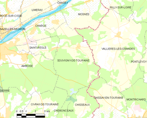
Mosnes (Mosnes)

- commune in Indre-et-Loire, France
- Country:

- Postal Code: 37530
- Coordinates: 47° 27' 20" N, 1° 6' 3" E


- GPS tracks (wikiloc): [Link]
- Area: 14.5 sq km
- Population: 787
- Wikipedia en: wiki(en)
- Wikipedia: wiki(fr)
- Wikidata storage: Wikidata: Q1170947
- Wikipedia Commons Category: [Link]
- Freebase ID: [/m/03nvfx8]
- GeoNames ID: Alt: [6433063]
- SIREN number: [213701618]
- BnF ID: [15257712v]
- archINFORM location ID: [46092]
- WOEID: [613376]
- INSEE municipality code: 37161
Shares border with regions:


Cangey
- commune in Indre-et-Loire, France
- Country:
- Postal Code: 37530
- Coordinates: 47° 28' 4" N, 1° 3' 37" E
- GPS tracks (wikiloc): [Link]
- Area: 22.98 sq km
- Population: 1068
- Web site: [Link]


Veuves
- former commune in Loir-et-Cher, France
- Country:
- Postal Code: 41150
- Coordinates: 47° 28' 17" N, 1° 7' 29" E
- GPS tracks (wikiloc): [Link]
- Area: 8.07 sq km
- Population: 215


Rilly-sur-Loire
- commune in Loir-et-Cher, France
- Country:
- Postal Code: 41150
- Coordinates: 47° 27' 57" N, 1° 8' 5" E
- GPS tracks (wikiloc): [Link]
- Area: 10.22 sq km
- Population: 470

Souvigny-de-Touraine
- commune in Indre-et-Loire, France
- Country:
- Postal Code: 37530
- Coordinates: 47° 24' 41" N, 1° 5' 22" E
- GPS tracks (wikiloc): [Link]
- Area: 26.18 sq km
- Population: 386
Vallières-les-Grandes
- commune in Loir-et-Cher, France
- Country:
- Postal Code: 41400
- Coordinates: 47° 25' 22" N, 1° 8' 49" E
- GPS tracks (wikiloc): [Link]
- Area: 40.75 sq km
- Population: 916


Chargé
- commune in Indre-et-Loire, France
- Country:
- Postal Code: 37530
- Coordinates: 47° 25' 57" N, 1° 1' 50" E
- GPS tracks (wikiloc): [Link]
- Area: 8.46 sq km
- Population: 1293
- Web site: [Link]