Motta Montecorvino (Motta Montecorvino)
.svg)
- Italian comune
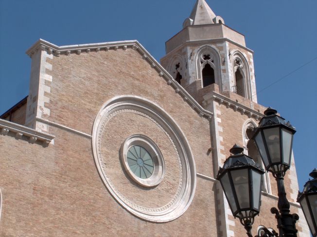
 Hiking in Motta Montecorvino
Motta Montecorvino is a beautiful area in the province of Foggia, located in the Apennine Mountains of southern Italy. This region is known for its scenic landscapes, rich flora and fauna, and historical significance. Hiking in Motta Montecorvino can be a rewarding experience for both beginner and experienced hikers.
Hiking Trails
There are several trails in and around Motta Montecorvino that cater to different skill levels. Here are some aspects to consider:
-
Trail Variety: You can find a mix of easy walks and challenging hikes. Many trails are well-marked and take you through forests, rolling hills, and viewpoints offering stunning panoramas.
-
Nature: The area is abundant with diverse plant species and wildlife. Keep an eye out for local flora, including Mediterranean shrubs and trees, as well as various bird species.
-
Historical Sites: Along some hiking routes, you may encounter ancient ruins and charming stone villages that highlight the region's history.
-
Local Culture: The trails often provide opportunities to experience local culture, including traditional cuisine in small towns or villages you may pass through.
Best Time to Hike
The best times to hike in Motta Montecorvino are during spring (April to June) and fall (September to October) when the weather is mild and enjoyable. Summers can be hot, making hikes less comfortable, while winter may bring snow to higher elevations.
Safety and Preparation
- Gear: Make sure to wear sturdy hiking boots, dress in layers, and carry a reliable backpack with water, snacks, a map, and a basic first aid kit.
- Navigation: While many trails are marked, having a map or a GPS device can help you stay on course, especially in less traveled areas.
- Weather: Check the weather forecast before heading out, as conditions can change rapidly in mountainous regions.
Local Guides
If you're unfamiliar with the area or want to explore more challenging hikes, consider hiring a local guide who can provide insight into the landscape, history, and safety tips.
Hiking in Motta Montecorvino offers a fantastic opportunity to connect with nature and explore the stunning Italian countryside while immersing yourself in the local culture. Enjoy your adventure!
- Country:

- Postal Code: 71030
- Local Dialing Code: 0881
- Licence Plate Code: FG
- Coordinates: 41° 30' 0" N, 15° 7' 0" E


- GPS tracks (wikiloc): [Link]
- AboveSeaLevel: 662 м m
- Area: 19.94 sq km
- Population: 712
- Web site: http://www.comune.mottadaffermo.me.it
- Wikipedia en: wiki(en)
- Wikipedia: wiki(it)
- Wikidata storage: Wikidata: Q51937
- Wikipedia Commons Category: [Link]
- Freebase ID: [/m/0fz62b]
- GeoNames ID: Alt: [6537540]
- VIAF ID: Alt: [256023722]
- OSM relation ID: [41356]
- ISTAT ID: 071034
- Italian cadastre code: F777
Shares border with regions:
Pietramontecorvino
- Italian comune
Hiking in Pietramontecorvino
Pietramontecorvino is a charming hilltop village located in the province of Foggia, in the Apulia region of southern Italy. Surrounded by beautiful landscapes, it offers excellent hiking opportunities for nature enthusiasts....
- Country:
- Postal Code: 71038
- Local Dialing Code: 0881
- Licence Plate Code: FG
- Coordinates: 41° 33' 0" N, 15° 8' 0" E
- GPS tracks (wikiloc): [Link]
- AboveSeaLevel: 456 м m
- Area: 71.65 sq km
- Population: 2671
- Web site: [Link]
Celenza Valfortore
- Italian comune
Hiking in Celenza Valfortore
Celenza Valfortore, a charming village located in the Province of Foggia in the Apulia region of Italy, is nestled in the picturesque landscape of the Apennine Mountains. The area offers diverse hiking opportunities, suitable for various skill levels, from beginners to experienced hikers....
- Country:
- Postal Code: 71035
- Local Dialing Code: 0881
- Licence Plate Code: FG
- Coordinates: 41° 34' 0" N, 14° 59' 0" E
- GPS tracks (wikiloc): [Link]
- AboveSeaLevel: 480 м m
- Area: 65.42 sq km
- Population: 1530
- Web site: [Link]

Lucera
- Italian comune
Hiking in Lucera
Lucera, located in the Apulia region of southern Italy, offers a variety of hiking opportunities that allow you to experience the beautiful landscapes, historical sites, and unique flora and fauna of the area. Here are some key points to consider for hiking in and around Lucera:...
- Country:
- Postal Code: 71036
- Local Dialing Code: 0881
- Licence Plate Code: FG
- Coordinates: 41° 30' 0" N, 15° 20' 0" E
- GPS tracks (wikiloc): [Link]
- AboveSeaLevel: 50 м m
- Area: 339.79 sq km
- Population: 33085
- Web site: [Link]


Volturara Appula
- Italian comune
Hiking in Volturara Appula
Volturara Appula is a quaint village located in the Apulia region of Italy, known for its beautiful landscapes and rich history. Hiking in and around Volturara Appula can offer a unique blend of natural beauty, cultural heritage, and adventure....
- Country:
- Postal Code: 71030
- Local Dialing Code: 0881
- Licence Plate Code: FG
- Coordinates: 41° 30' 0" N, 15° 3' 0" E
- GPS tracks (wikiloc): [Link]
- AboveSeaLevel: 510 м m
- Area: 52 sq km
- Population: 401
- Web site: [Link]


Volturino
- Italian comune
Hiking in Volturino
Hiking in Volturino, located in the Apennine Mountains of Italy, offers a wonderful opportunity to experience stunning landscapes, rich biodiversity, and a taste of the local culture. The area is known for its beautiful trails that wind through forests, past waterfalls, and up to panoramic viewpoints....
- Country:
- Postal Code: 71030
- Local Dialing Code: 0881
- Licence Plate Code: FG
- Coordinates: 41° 29' 0" N, 15° 7' 0" E
- GPS tracks (wikiloc): [Link]
- AboveSeaLevel: 735 м m
- Area: 58.35 sq km
- Population: 1679
- Web site: [Link]