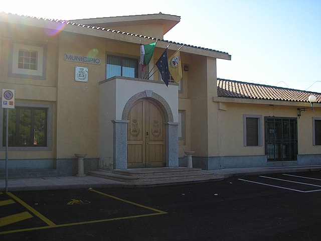
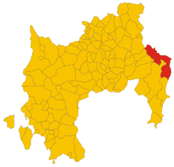
Muravera (Muravera)
%20-%202016.svg)
- Italian comune
 Hiking in Muravera
Muravera is a beautiful town located on the southeastern coast of Sardinia, Italy. Known for its stunning landscapes, beautiful beaches, and lush countryside, it offers an array of hiking opportunities that appeal to both novice and experienced outdoors enthusiasts. Here’s an overview of what you can expect when you consider hiking in and around Muravera:
Trails and Landscapes
-
Coastal Trails: The coastline near Muravera features several scenic trails that run along the beach and cliffs, providing breathtaking views of the Mediterranean Sea. The nearby beaches, such as Scivu Beach, are great starting points for coastal hikes.
-
Natural Reserves: The Costa Rei and Sarrabus areas nearby offer beautiful natural reserves with a variety of trails. You can expect to see diverse flora and fauna, as well as opportunities to spot wildlife.
-
Mountains and Hills: The region surrounding Muravera includes hilly and mountainous terrain. Trails in the Monte Nai area provide a more rugged hiking experience with panoramic views that can be enjoyed from higher elevations.
-
Agricultural Landscapes: Explore the terraced hillsides where local farmers cultivate olives, vineyards, and other crops. These trails often provide insight into the local culture and agriculture.
Difficulty Levels
The trails around Muravera vary in difficulty, from easy walks suitable for families to more challenging hikes that require a good level of fitness. Make sure to choose trails that match your skill level, and always be prepared with the right gear.
Best Time to Hike
The best time to hike in Muravera is during the spring (April to June) and fall (September to October) when temperatures are mild, and the landscapes are lush and vibrant. Summers can be hot, particularly in July and August, making midday hikes less comfortable.
Tips for Hiking in Muravera
- Stay Hydrated: Bring plenty of water, especially during warmer months.
- Wear Appropriate Gear: Good hiking shoes, sun protection, and layered clothing are essential.
- Follow Local Guidelines: Respect nature and local wildlife; stick to marked trails and carry out any trash.
- Local Guides: Consider hiring a local guide to enhance your experience, as they can provide insights into the area's history and ecology.
Conclusion
Hiking in Muravera offers a unique blend of stunning coastal views, rich agricultural landscapes, and opportunities for wildlife spotting. Whether you're looking for a leisurely walk or an adventurous hike, you'll find plenty of beautiful trails to explore in this charming part of Sardinia.
- Country:

- Postal Code: 09043
- Local Dialing Code: 070
- Licence Plate Code: SU
- Coordinates: 39° 25' 11" N, 9° 34' 35" E


- GPS tracks (wikiloc): [Link]
- AboveSeaLevel: 9 м m
- Area: 93.51 sq km
- Population: 5273
- Web site: http://www.comune.muravera.ca.it/
- Wikipedia en: wiki(en)
- Wikipedia: wiki(it)
- Wikidata storage: Wikidata: Q284363
- Wikipedia Commons Category: [Link]
- Freebase ID: [/m/0gqxmg]
- Freebase ID: [/m/0gqxmg]
- GeoNames ID: Alt: [6539290]
- GeoNames ID: Alt: [6539290]
- VIAF ID: Alt: [239202008]
- VIAF ID: Alt: [239202008]
- OSM relation ID: [49117]
- OSM relation ID: [49117]
- UN/LOCODE: [ITMVR]
- UN/LOCODE: [ITMVR]
- Digital Atlas of the Roman Empire ID: [36478]
- Digital Atlas of the Roman Empire ID: [36478]
- ISTAT ID: 111042
- ISTAT ID: 111042
- Italian cadastre code: F808
- Italian cadastre code: F808
Shares border with regions:
Ballao
- Italian comune
Hiking in Ballao
Ballao is a small town located in the province of Cagliari in Sardinia, Italy. It is surrounded by beautiful landscapes that are ideal for hiking enthusiasts. While it may not be as well-known as some other hiking destinations, it offers a variety of trails that cater to different skill levels and preferences....
- Country:
- Postal Code: 09040
- Local Dialing Code: 070
- Licence Plate Code: SU
- Coordinates: 39° 32' 56" N, 9° 21' 46" E
- GPS tracks (wikiloc): [Link]
- AboveSeaLevel: 98 м m
- Area: 46.63 sq km
- Population: 790
- Web site: [Link]

Castiadas
- Italian comune
Hiking in Castiadas
Castiadas is a charming municipality located in the southeastern part of Sardinia, Italy. It offers diverse landscapes that make it an excellent destination for hiking enthusiasts. Here are some highlights of hiking in this area:...
- Country:
- Postal Code: 09040
- Local Dialing Code: 070
- Licence Plate Code: SU
- Coordinates: 39° 14' 11" N, 9° 29' 57" E
- GPS tracks (wikiloc): [Link]
- AboveSeaLevel: 60 м m
- Area: 103.89 sq km
- Population: 1655
- Web site: [Link]


San Vito
- Italian comune
Hiking in San Vito
San Vito is located in the province of Vibo Valentia in Calabria, Italy, and is known for its stunning natural landscapes, picturesque villages, and rich cultural history. Here’s what you should know about hiking in the San Vito area:...
- Country:
- Postal Code: 09040
- Local Dialing Code: 070
- Licence Plate Code: SU
- Coordinates: 39° 26' 31" N, 9° 32' 26" E
- GPS tracks (wikiloc): [Link]
- AboveSeaLevel: 10 м m
- Area: 231.64 sq km
- Population: 3632
- Web site: [Link]

Villaputzu
- Italian comune
Hiking in Villaputzu
Villaputzu, located on the southeastern coast of Sardinia, Italy, is a picturesque location for hiking enthusiasts. The region is characterized by its stunning coastal scenery, traditional Sardinian landscape, and a mild Mediterranean climate, which makes it ideal for outdoor activities year-round....
- Country:
- Postal Code: 09040
- Local Dialing Code: 070
- Licence Plate Code: SU
- Coordinates: 39° 26' 21" N, 9° 34' 34" E
- GPS tracks (wikiloc): [Link]
- AboveSeaLevel: 11 м m
- Area: 181.31 sq km
- Population: 4718
- Web site: [Link]