Néoules (Néoules)

- commune in Var, France
 Hiking in Néoules
Néoules, located in the Var department of the Provence-Alpes-Côte d'Azur region of France, offers some beautiful hiking opportunities amidst picturesque landscapes. The area is characterized by its Mediterranean climate, rolling hills, vineyards, and scenic views, making it a lovely destination for outdoor enthusiasts.
Hiking Highlights in Néoules:
-
Scenic Trails: There are various trails that meander through the hills, offering views of the lush countryside, vineyards, and nearby mountains. The terrain can range from gentle slopes to more challenging paths.
-
Local Flora and Fauna: As you hike, you'll have the opportunity to observe diverse plant life typical of the Mediterranean region, including herbs such as thyme and rosemary, as well as various species of flowers. Keep an eye out for local wildlife as well, such as birds and small mammals.
-
Historical Sites: Some trails may take you past historical sites, such as chapels or old farmhouses, where you can appreciate the heritage of the region.
-
Vineyards and Wine Tours: Néoules is known for its wine production. Some hiking routes may lead you through vineyards, and you might find opportunities for wine tasting at local wineries.
-
Nearby Natural Parks: The region is close to larger protected areas like the Sainte-Baume Regional Natural Park and the Gorges du Verdon, providing even more extensive hiking options.
Tips for Hiking in Néoules:
-
Best Time to Go: The best time to hike in Néoules is during the spring (April to June) and autumn (September to October) when the weather is milder and the landscapes are at their most beautiful.
-
Stay Hydrated: Always carry enough water with you, especially during the warmer months, and consider bringing snacks for energy.
-
Gear Up: Wear comfortable hiking shoes with good traction, and dress in light layers that you can adjust as temperatures change throughout the day.
-
Maps and Guidance: While many trails are marked, it can be helpful to have a map or a hiking app to navigate the area. Consider joining a guided hike if you’re unfamiliar with the region.
-
Respect Nature: Follow Leave No Trace principles by staying on trails, respecting wildlife, and carrying out all trash.
Néoules can be a wonderful place for a day hike or a weekend outdoor escape. Enjoy your adventure!
- Country:

- Postal Code: 83136
- Coordinates: 43° 18' 40" N, 6° 0' 46" E


- GPS tracks (wikiloc): [Link]
- Area: 25.08 sq km
- Population: 2651
- Wikipedia en: wiki(en)
- Wikipedia: wiki(fr)
- Wikidata storage: Wikidata: Q818096
- Wikipedia Commons Category: [Link]
- Freebase ID: [/m/03w9ktj]
- GeoNames ID: Alt: [6451508]
- SIREN number: [218300887]
- BnF ID: [15277915v]
- VIAF ID: Alt: [244355540]
- PACTOLS thesaurus ID: [pcrtnzUYPeXbNl]
- INSEE municipality code: 83088
Shares border with regions:
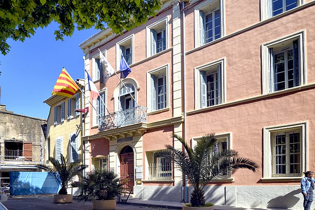
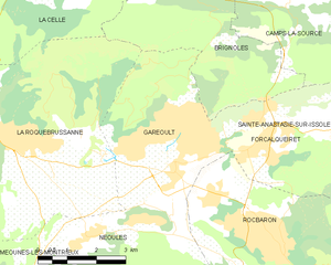
Garéoult
- commune in Var, France
Hiking in Garéoult
Garéoult is a charming commune located in the Var department of the Provence-Alpes-Côte d'Azur region of France. Surrounded by picturesque landscapes and rolling hills, it offers a variety of hiking opportunities suitable for different skill levels....
- Country:
- Postal Code: 83136
- Coordinates: 43° 19' 42" N, 6° 2' 46" E
- GPS tracks (wikiloc): [Link]
- Area: 15.75 sq km
- Population: 5369
- Web site: [Link]
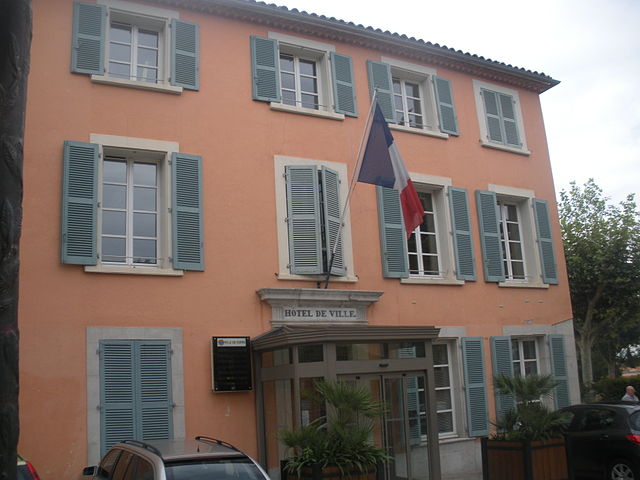
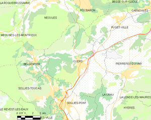
Cuers
- commune in Var, France
Hiking in Cuers
Cuers, located in the Var department of the Provence-Alpes-Côte d'Azur region in France, offers a unique hiking experience that combines stunning landscapes with rich cultural heritage. Here are some highlights of hiking in Cuers:...
- Country:
- Postal Code: 83390
- Coordinates: 43° 14' 15" N, 6° 4' 15" E
- GPS tracks (wikiloc): [Link]
- Area: 50.53 sq km
- Population: 10832


Méounes-lès-Montrieux
- commune in Var, France
Hiking in Méounes-lès-Montrieux
Méounes-lès-Montrieux is a charming village located in the Var department of the Provence-Alpes-Côte d'Azur region in southeastern France. It is surrounded by beautiful landscapes, making it a great destination for hiking enthusiasts. Here are some important aspects to consider when hiking in and around Méounes-lès-Montrieux:...
- Country:
- Postal Code: 83136
- Coordinates: 43° 16' 52" N, 5° 58' 12" E
- GPS tracks (wikiloc): [Link]
- Area: 40.92 sq km
- Population: 2152


Rocbaron
- commune in Var, France
Hiking in Rocbaron
Rocbaron is a charming village located in the Var department of the Provence-Alpes-Côte d'Azur region in France. It's an excellent spot for hiking enthusiasts, offering a beautiful countryside backdrop that combines lush greenery, vineyards, and breathtaking views of the surrounding landscapes....
- Country:
- Postal Code: 83136
- Coordinates: 43° 18' 15" N, 6° 5' 27" E
- GPS tracks (wikiloc): [Link]
- Area: 20.28 sq km
- Population: 4866


La Roquebrussanne
- commune in Var, France
Hiking in La Roquebrussanne
La Roquebrussanne, a charming village located in the Var department of the Provence-Alpes-Côte d'Azur region in southeastern France, is surrounded by picturesque landscapes that are perfect for hiking enthusiasts. The area features a variety of trails that cater to different skill levels, offering opportunities to explore beautiful natural scenery, including forests, hills, and vineyards....
- Country:
- Postal Code: 83136
- Coordinates: 43° 20' 25" N, 5° 58' 35" E
- GPS tracks (wikiloc): [Link]
- Area: 37.05 sq km
- Population: 2540