La Roquebrussanne (La Roquebrussanne)
- commune in Var, France
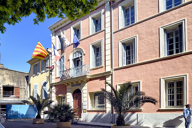
La Roquebrussanne, a charming village located in the Var department of the Provence-Alpes-Côte d'Azur region in southeastern France, is surrounded by picturesque landscapes that are perfect for hiking enthusiasts. The area features a variety of trails that cater to different skill levels, offering opportunities to explore beautiful natural scenery, including forests, hills, and vineyards.
Hiking Highlights in La Roquebrussanne:
-
Varied Terrain: The region is characterized by rolling hills, oak forests, and vineyards, providing diverse landscapes to explore. You'll find trails that range from easy walks to more challenging hikes.
-
Panoramic Views: Many trails in the area offer stunning views of the surrounding countryside, including the nearby Sainte-Baume mountain range and the hills of Provençal vineyards.
-
Local Flora and Fauna: As you hike, you'll have the chance to observe a variety of wildlife and local plants, especially in the spring when wildflowers bloom.
-
Cultural Discoveries: Some trails lead to cultural landmarks, including chapels and old ruins, providing a glimpse into the region’s history.
-
Accessibility: The trails vary in distance and difficulty, making it suitable for families and casual hikers as well as more experienced ones looking for a workout. Local maps and signage often mark the paths, making navigation easier.
-
Nearby Hiking Options: If you're looking to extend your hiking adventures, the nearby Parc Naturel Régional de la Sainte-Baume offers extensive hiking networks with breathtaking scenery, more challenging terrains, and additional wildlife viewing opportunities.
Tips for Hiking in La Roquebrussanne:
- Check the Weather: The weather can change quickly in Provence; ensure you have appropriate gear and check forecasts before heading out.
- Hydration and Snacks: Carry plenty of water and some snacks, especially if you plan on taking longer hikes.
- Appropriate Footwear: Wear sturdy hiking boots for comfort and safety, particularly on uneven or rocky paths.
- Stay on Marked Trails: To preserve the environment and for your safety, stick to marked trails and respect local wildlife.
Resources:
You can often find local maps at the tourist information center in town or check online resources and hiking apps for trail updates. If you're new to the area or hiking in general, consider joining local hiking groups for guided hikes. Enjoy your adventures in La Roquebrussanne!
- Country:

- Postal Code: 83136
- Coordinates: 43° 20' 25" N, 5° 58' 35" E


- GPS tracks (wikiloc): [Link]
- Area: 37.05 sq km
- Population: 2540
- Wikipedia en: wiki(en)
- Wikipedia: wiki(fr)
- Wikidata storage: Wikidata: Q817930
- Wikipedia Commons Category: [Link]
- Freebase ID: [/m/03qhf8g]
- GeoNames ID: Alt: [6456546]
- SIREN number: [218301083]
- BnF ID: [15277935g]
- VIAF ID: Alt: [242305285]
- WOEID: [599834]
- INSEE municipality code: 83108
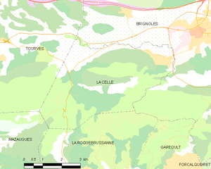
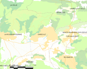
Shares border with regions:

Mazaugues
- commune in Var, France
Mazaugues is a charming village located in the Var department of the Provence-Alpes-Côte d'Azur region in southeastern France. It is surrounded by beautiful landscapes, making it a great destination for hiking enthusiasts. Here are some highlights about hiking in and around Mazaugues:...
- Country:

- Postal Code: 83136
- Coordinates: 43° 20' 51" N, 5° 55' 19" E


- GPS tracks (wikiloc): [Link]
- Area: 53.79 sq km
- Population: 887


La Celle
- commune in Var, France
La Celle, a charming village nestled in the Var department of Provence-Alpes-Côte d'Azur, offers beautiful hiking opportunities amidst stunning natural scenery. The region is characterized by its picturesque landscapes, rolling hills, vineyards, and historical sites. Here are some highlights and tips for hiking in and around La Celle:...
- Country:

- Postal Code: 83170
- Coordinates: 43° 23' 39" N, 6° 2' 26" E


- GPS tracks (wikiloc): [Link]
- Area: 21 sq km
- Population: 1433


Brignoles
- commune in Var, France
Brignoles, located in the Var department in southeastern France, is surrounded by beautiful landscapes that offer excellent opportunities for hiking and outdoor activities. Here are some highlights and tips for hiking around Brignoles:...
- Country:

- Postal Code: 83170
- Coordinates: 43° 24' 21" N, 6° 3' 42" E


- GPS tracks (wikiloc): [Link]
- Area: 70.53 sq km
- Population: 17093
- Web site: [Link]


Garéoult
- commune in Var, France
Garéoult is a charming commune located in the Var department of the Provence-Alpes-Côte d'Azur region of France. Surrounded by picturesque landscapes and rolling hills, it offers a variety of hiking opportunities suitable for different skill levels....
- Country:

- Postal Code: 83136
- Coordinates: 43° 19' 42" N, 6° 2' 46" E


- GPS tracks (wikiloc): [Link]
- Area: 15.75 sq km
- Population: 5369
- Web site: [Link]


Méounes-lès-Montrieux
- commune in Var, France
 Hiking in Méounes-lès-Montrieux
Méounes-lès-Montrieux is a charming village located in the Var department of the Provence-Alpes-Côte d'Azur region in southeastern France. It is surrounded by beautiful landscapes, making it a great destination for hiking enthusiasts. Here are some important aspects to consider when hiking in and around Méounes-lès-Montrieux:...
- Country:

- Postal Code: 83136
- Coordinates: 43° 16' 52" N, 5° 58' 12" E


- GPS tracks (wikiloc): [Link]
- Area: 40.92 sq km
- Population: 2152


Signes
- commune in Var, France
Signes is a charming village located in the Var department of the Provence-Alpes-Côte d'Azur region in southeastern France. It offers a variety of hiking opportunities, showcasing the region's stunning natural landscapes, rich flora, and diverse fauna....
- Country:

- Postal Code: 83870
- Coordinates: 43° 17' 29" N, 5° 51' 46" E


- GPS tracks (wikiloc): [Link]
- Area: 133.1 sq km
- Population: 2779


Néoules
- commune in Var, France
Néoules, located in the Var department of the Provence-Alpes-Côte d'Azur region of France, offers some beautiful hiking opportunities amidst picturesque landscapes. The area is characterized by its Mediterranean climate, rolling hills, vineyards, and scenic views, making it a lovely destination for outdoor enthusiasts....
- Country:

- Postal Code: 83136
- Coordinates: 43° 18' 40" N, 6° 0' 46" E


- GPS tracks (wikiloc): [Link]
- Area: 25.08 sq km
- Population: 2651
