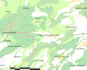
Nans-sous-Sainte-Anne (Nans-sous-Sainte-Anne)
- commune in Doubs, France
 Hiking in Nans-sous-Sainte-Anne
Nans-sous-Sainte-Anne is a charming village located in the Jura region of France, known for its stunning natural landscapes, rich biodiversity, and various hiking opportunities. The village is nestled within the Jura Mountains, which offer a mix of lush forests, rolling hills, rivers, and captivating rock formations.
Hiking Opportunities
-
Trails: There are several marked trails in and around Nans-sous-Sainte-Anne, catering to different skill levels. The trails vary in difficulty, with options for beginners and more experienced hikers.
-
Lac de Saint-Point: This nearby lake is a popular destination for day hikes. The paths around the lake are relatively easy and offer beautiful views of the water and the surrounding mountains. You might even spot local wildlife along the way.
-
Cascades du Hérisson: While a bit farther out, this stunning series of waterfalls is worth the trip. The hike to the cascades features breathtaking views and an opportunity to experience the region's diverse flora and fauna.
-
Rock Formations: The area is also known for its impressive geological features, including cliffs and rocky outcrops. Some trails take you right up to these formations, offering great vantage points.
-
Seasonal Considerations: Spring and summer are ideal for hiking in Nans-sous-Sainte-Anne due to the pleasant weather and blooming landscapes. Autumn offers beautiful foliage, while winter hiking can be beautiful but may require snow gear depending on conditions.
Practical Tips
- Maps and Guides: It’s advisable to have a detailed map or a hiking app to track your routes, as trail markings can sometimes be sparse.
- Local Information: Checking in with local tourist offices can provide updated trail information and recommendations.
- Gear: Comfortable hiking shoes, weather-appropriate clothing, and possibly trekking poles are recommended, especially for more challenging trails.
- Hydration and Nutrition: Always bring enough water and snacks, particularly on longer hikes, as services can be sparse in more remote areas.
Conclusion
Hiking in Nans-sous-Sainte-Anne offers a fantastic experience for nature lovers and adventure seekers alike. With its diverse trails and stunning scenery, it’s a great destination for both casual walkers and serious hikers.
- Country:

- Postal Code: 25330
- Coordinates: 46° 58' 36" N, 5° 59' 56" E


- GPS tracks (wikiloc): [Link]
- Area: 8.86 sq km
- Population: 139
- Wikipedia en: wiki(en)
- Wikipedia: wiki(fr)
- Wikidata storage: Wikidata: Q908874
- Wikipedia Commons Category: [Link]
- Freebase ID: [/m/03mhbpv]
- Freebase ID: [/m/03mhbpv]
- GeoNames ID: Alt: [6429910]
- GeoNames ID: Alt: [6429910]
- SIREN number: [212504203]
- SIREN number: [212504203]
- BnF ID: [15252646p]
- BnF ID: [15252646p]
- VIAF ID: Alt: [123216055]
- VIAF ID: Alt: [123216055]
- Library of Congress authority ID: Alt: [n85061230]
- Library of Congress authority ID: Alt: [n85061230]
- PACTOLS thesaurus ID: [pcrt6H7K6mk9Jx]
- PACTOLS thesaurus ID: [pcrt6H7K6mk9Jx]
- Quora topic ID: [Nans-sous-Sainte-Anne]
- Quora topic ID: [Nans-sous-Sainte-Anne]
- INSEE municipality code: 25420
- INSEE municipality code: 25420
Shares border with regions:


Éternoz
- commune in Doubs, France
Éternoz is a charming commune located in the Jura department in the region of Bourgogne-Franche-Comté, eastern France. The surrounding landscape is characterized by lush forests, rolling hills, and picturesque views, making it a great spot for hiking enthusiasts....
- Country:

- Postal Code: 25330
- Coordinates: 47° 0' 26" N, 6° 1' 46" E


- GPS tracks (wikiloc): [Link]
- Area: 29.26 sq km
- Population: 337


Geraise
- commune in Jura, France
Geraise, while not a widely recognized hiking destination, may refer to a specific area or trail that could be known locally or under a different name. If it is meant to indicate a less popular or regional hiking area, local resources or hiking clubs can provide you with detailed trail maps, difficulty levels, and any unique features of that environment....
- Country:

- Postal Code: 39110
- Coordinates: 46° 57' 24" N, 5° 56' 54" E


- GPS tracks (wikiloc): [Link]
- Area: 6.04 sq km
- Population: 40


Sainte-Anne
- commune in Doubs, France
Sainte-Anne, located in the Doubs department in eastern France, offers a range of hiking opportunities that showcase the stunning natural beauty of the Jura Mountains. The area is characterized by its picturesque landscapes, lush forests, and diverse wildlife, making it a fantastic destination for outdoor enthusiasts....
- Country:

- Postal Code: 25270
- Coordinates: 46° 57' 16" N, 5° 59' 7" E


- GPS tracks (wikiloc): [Link]
- Area: 6.64 sq km
- Population: 39


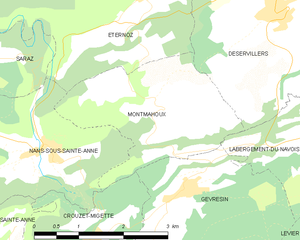
Montmahoux
- commune in Doubs, France
Montmahoux, located in the French Alps, is a lesser-known but stunning destination for hiking enthusiasts. The region boasts beautiful landscapes, magnificent mountain views, and diverse ecosystems that make it ideal for outdoor activities....
- Country:

- Postal Code: 25270
- Coordinates: 46° 59' 0" N, 6° 2' 3" E


- GPS tracks (wikiloc): [Link]
- Area: 6.52 sq km
- Population: 100
- Web site: [Link]


Saizenay
- commune in Jura, France
Saizenay is a picturesque area that offers an array of hiking opportunities amid beautiful natural scenery. While specific trails may not be as well-documented as those in more popular hiking destinations, there are still plenty of routes and paths to explore. Here are a few general tips and ideas for hiking in Saizenay:...
- Country:

- Postal Code: 39110
- Coordinates: 46° 57' 43" N, 5° 54' 54" E


- GPS tracks (wikiloc): [Link]
- Area: 4.88 sq km
- Population: 100


Salins-les-Bains
- commune in Jura, France
Salins-les-Bains, located in the Jura region of France, is known for its beautiful landscapes, rich historical heritage, and therapeutic salt springs. Hiking in this area offers a mix of natural beauty, cultural landmarks, and opportunities to enjoy the unique geology of the Jura Mountains....
- Country:

- Postal Code: 39110
- Coordinates: 46° 56' 28" N, 5° 52' 42" E


- GPS tracks (wikiloc): [Link]
- AboveSeaLevel: 350 м m
- Area: 24.68 sq km
- Population: 2718
- Web site: [Link]


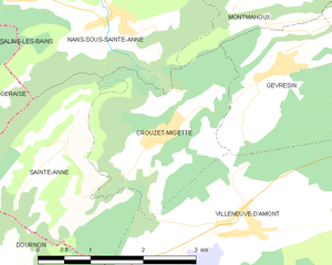
Crouzet-Migette
- commune in Doubs, France
Crouzet-Migette is a beautiful area in the Jura Mountains of France, known for its stunning landscapes, diverse wildlife, and rich cultural heritage. It's less well-known than other hiking destinations in France, making it a great spot for those seeking a quieter experience in nature....
- Country:

- Postal Code: 25270
- Coordinates: 46° 57' 25" N, 6° 0' 42" E


- GPS tracks (wikiloc): [Link]
- Area: 5.67 sq km
- Population: 120


Saraz
- commune in Doubs, France
Hiking in Saraz, a region that is often characterized by stunning landscapes, rich biodiversity, and varying terrains, can offer an array of experiences for both beginner and experienced hikers. While specific information about the trails and conditions in Saraz may depend on the particular area or country you are referring to (as "Saraz" can indicate different locations), here are some general tips and insights regarding hiking in a mountainous or scenic area like Saraz:...
- Country:

- Postal Code: 25330
- Coordinates: 46° 59' 48" N, 5° 58' 58" E


- GPS tracks (wikiloc): [Link]
- Area: 6.02 sq km
- Population: 11
