Neckar-Odenwald (Neckar-Odenwald-Kreis)
- district of Baden-Württemberg, Germany
Neckar-Odenwald-Kreis, located in the state of Baden-Württemberg, Germany, is a fantastic destination for hiking enthusiasts. The region is characterized by its scenic landscapes, which include dense forests, rolling hills, and the beautiful Neckar River valley. Here are some key points to know about hiking in this area:
Hiking Trails
-
General Hiking Networks: The region boasts a well-developed network of hiking trails, including marked paths that range from easy walks to more challenging hikes. You can find routes suitable for all levels of hikers.
-
Odenwald Trail (Odenwaldweg): This long-distance trail stretches through the Odenwald region and offers various segments that can be tackled as day hikes. You'll traverse through picturesque villages, ancient woodlands, and enjoy panoramic views.
-
Neckar Valley: The trail along the Neckar River offers a beautiful mix of riverbank views, vineyards, and historical sites. It's particularly lovely in the spring and autumn.
-
Local Themes: There are themed hiking trails that focus on natural history or local culture, giving you a chance to explore specific aspects of the area, like the “Walderlebnispfad” (Forest Experience Path).
Natural Attractions
- Nature Reserves: There are several nature reserves in the region that protect the rich biodiversity, including both flora and fauna typical for the Odenwald.
- Lookout Points: The Odenwald is known for its beautiful lookout points which provide stunning vistas of the surrounding countryside.
Tips for Hikers
- Trail Markings: Trails are usually well-marked, but it's always a good idea to carry a map or a GPS device, especially for longer hikes.
- Weather Preparation: The weather can change quickly, so dress in layers and be prepared for rain or chilly conditions.
- Local Amenities: Many villages along the hiking routes have guesthouses, cafes, or restaurants where you can rest and refuel.
Cultural Highlights
While hiking, you may encounter charming towns and villages, historical castles, and ruins like the Heidelberg Castle nearby. These add cultural richness to your hiking experience.
Accessibility
Most hiking trails are accessible by public transport, making it easier to reach starting points without needing a car. Be sure to check local transportation schedules to plan your hike effectively.
Conclusion
Hiking in Neckar-Odenwald-Kreis offers a delightful blend of nature, culture, and history. Whether you're looking for a leisurely walk or an adventurous hike, this region has something to offer every outdoor lover.
- Country:

- Capital: Mosbach
- Licence Plate Code: MOS
- Coordinates: 49° 29' 0" N, 9° 17' 0" E


- GPS tracks (wikiloc): [Link]
- AboveSeaLevel: 416 м m
- Area: 1126.29 sq km
- Population: 141847
- Web site: http://www.neckar-odenwald-kreis.de/
- Wikipedia en: wiki(en)
- Wikipedia: wiki(de)
- Wikidata storage: Wikidata: Q8174
- Wikipedia Commons Category: [Link]
- Freebase ID: [/m/01j431]
- GeoNames ID: Alt: [3220723]
- VIAF ID: Alt: [240325914]
- OSM relation ID: [62626]
- GND ID: Alt: [4041524-7]
- archINFORM location ID: [5686]
- Library of Congress authority ID: Alt: [n83012857]
- PACTOLS thesaurus ID: [pcrt73IgZzJRFH]
- TGN ID: [7077342]
- ISNI: Alt: [0000 0004 0480 5068]
- NUTS code: [DE127]
- German district key: 08225
Includes regions:


Buchen
- municipality in Germany
Buchen, located in the Odenwald region of Germany, offers a variety of hiking opportunities for outdoor enthusiasts. The area is characterized by its beautiful landscapes, rich forests, and numerous trails suitable for hikers of all levels....
- Country:

- Postal Code: 74722
- Local Dialing Code: 06292; 06287; 06286; 06281
- Coordinates: 49° 31' 18" N, 9° 19' 24" E


- GPS tracks (wikiloc): [Link]
- AboveSeaLevel: 337 м m
- Area: 138.93 sq km
- Population: 17851
- Web site: [Link]


Hüffenhardt
- municipality in Germany
Hüffenhardt is a small town in the Baden-Württemberg region of Germany, known for its picturesque landscapes and outdoor recreational opportunities. Hiking in and around Hüffenhardt offers a chance to explore the scenic beauty of the area, including rolling hills, forests, and charming countryside....
- Country:

- Postal Code: 74928
- Local Dialing Code: 06268
- Coordinates: 49° 17' 31" N, 9° 4' 54" E


- GPS tracks (wikiloc): [Link]
- AboveSeaLevel: 292 м m
- Area: 17.62 sq km
- Population: 2077
- Web site: [Link]


Mosbach
- town in Germany
Mosbach is a charming town located in the Neckar-Odenwald region of Germany, and it's a great starting point for hiking enthusiasts. Here are some key points to consider if you're planning to hike in and around Mosbach:...
- Country:

- Postal Code: 74821
- Local Dialing Code: 06261
- Licence Plate Code: MOS
- Coordinates: 49° 21' 0" N, 9° 8' 0" E


- GPS tracks (wikiloc): [Link]
- AboveSeaLevel: 156 м m
- Area: 62.23 sq km
- Population: 22781
- Web site: [Link]


Zwingenberg
- municipality in Germany
Zwingenberg, located in Baden-Württemberg, Germany, is a picturesque village that offers a variety of hiking opportunities amidst beautiful natural landscapes, including the nearby Odenwald hills. Here’s what you need to know about hiking in Zwingenberg:...
- Country:

- Postal Code: 69439
- Local Dialing Code: 06263
- Coordinates: 49° 24' 55" N, 9° 2' 35" E


- GPS tracks (wikiloc): [Link]
- AboveSeaLevel: 148 м m
- Area: 4.7 sq km
- Population: 704
- Web site: [Link]
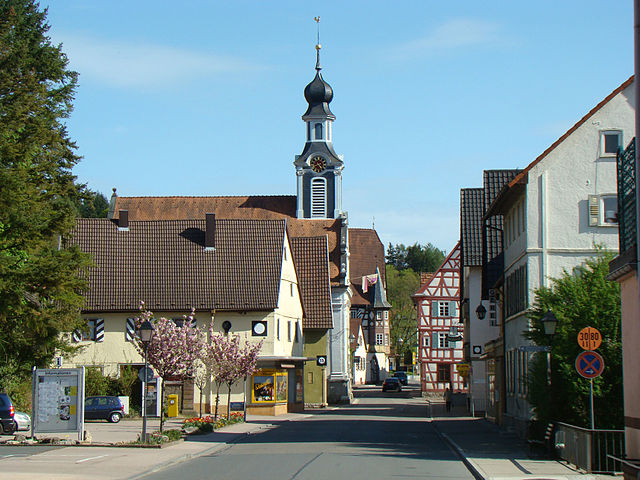

Adelsheim
- municipality in Germany
Adelsheim, located in the Baden-Württemberg region of Germany, is a charming town that offers some wonderful opportunities for hiking enthusiasts. The area is characterized by picturesque landscapes, lush forests, and rolling hills, making it a great destination for nature lovers....
- Country:

- Postal Code: 74740
- Local Dialing Code: 06291
- Coordinates: 49° 24' 17" N, 9° 23' 21" E


- GPS tracks (wikiloc): [Link]
- AboveSeaLevel: 226 м m
- Area: 43.84 sq km
- Population: 4935
- Web site: [Link]


Aglasterhausen
- municipality in Germany
Aglasterhausen, located in the northern part of Baden-Württemberg, Germany, is surrounded by beautiful landscapes that are perfect for hiking enthusiasts. The area is characterized by rolling hills, woodlands, and scenic trails that take you through charming villages and natural vistas....
- Country:

- Postal Code: 74858; 74856
- Local Dialing Code: 06262
- Coordinates: 49° 21' 14" N, 8° 59' 25" E


- GPS tracks (wikiloc): [Link]
- AboveSeaLevel: 197 м m
- Area: 22.85 sq km
- Population: 4823
- Web site: [Link]
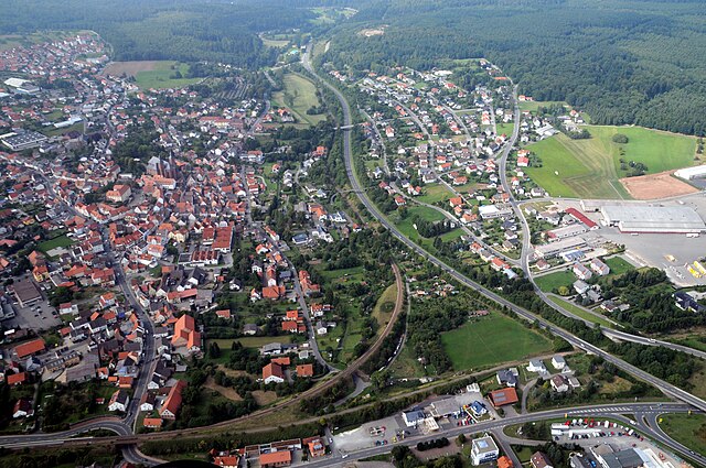

Walldürn
- municipality in Germany
Walldürn, located in the Odenwald region of Germany, offers some beautiful hiking opportunities for outdoor enthusiasts of all levels. The area is characterized by picturesque landscapes, rolling hills, and a mix of forests and farmland, making it a perfect destination for nature lovers....
- Country:

- Postal Code: 74731
- Local Dialing Code: 06286; 06285; 06282
- Coordinates: 49° 34' 59" N, 9° 22' 5" E


- GPS tracks (wikiloc): [Link]
- AboveSeaLevel: 398 м m
- Area: 105.88 sq km
- Population: 11285
- Web site: [Link]


Neckargerach
- municipality in Germany
Neckargerach is a small town located in the beautiful Neckar Valley in southwestern Germany. It’s surrounded by picturesque landscapes, making it a great destination for hiking enthusiasts. The region is characterized by rolling hills, dense forests, and charming vineyards, providing a variety of trails for both beginner and experienced hikers....
- Country:

- Postal Code: 69437
- Local Dialing Code: 06263
- Coordinates: 49° 24' 0" N, 9° 4' 0" E


- GPS tracks (wikiloc): [Link]
- AboveSeaLevel: 133 м m
- Area: 15.32 sq km
- Population: 2280
- Web site: [Link]
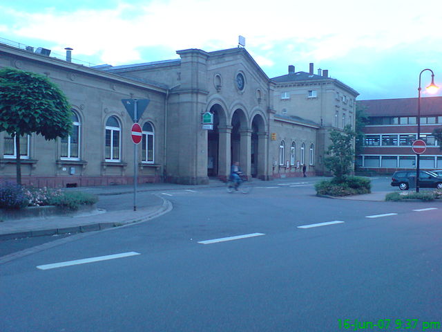
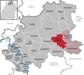
Osterburken
- municipality in Germany
Osterburken is a small town located in the state of Baden-Württemberg, Germany, and offers various opportunities for hiking enthusiasts. The surrounding areas are characterized by beautiful landscapes, historical sites, and a network of well-marked trails....
- Country:

- Postal Code: 74706
- Local Dialing Code: 06295; 06292; 06291
- Coordinates: 49° 25' 51" N, 9° 25' 34" E


- GPS tracks (wikiloc): [Link]
- AboveSeaLevel: 247 м m
- Area: 47.32 sq km
- Population: 6520
- Web site: [Link]


Fahrenbach
- municipality in Germany
Fahrenbach is a picturesque area located in the scenic countryside of Germany, mainly known for its beautiful landscapes and opportunities for outdoor activities, including hiking. While it may not be as widely recognized as some major hiking destinations, it offers a charming experience for those looking to explore nature....
- Country:

- Postal Code: 74864
- Local Dialing Code: 06267
- Licence Plate Code: MOS
- Coordinates: 49° 25' 51" N, 9° 9' 0" E


- GPS tracks (wikiloc): [Link]
- AboveSeaLevel: 315 м m
- Area: 16.41 sq km
- Population: 2733
- Web site: [Link]


Höpfingen
- municipality in Germany
Höpfingen, a small municipality located in the Odenwald region of Germany, offers a variety of scenic hiking opportunities for outdoor enthusiasts. Here are some key points to consider when planning a hiking trip in this area:...
- Country:

- Postal Code: 74746
- Local Dialing Code: 06283
- Coordinates: 49° 36' 5" N, 9° 25' 51" E


- GPS tracks (wikiloc): [Link]
- AboveSeaLevel: 377 м m
- Area: 30.49 sq km
- Population: 3020
- Web site: [Link]


Elztal
- municipality in Germany
Elztal, a picturesque area located in the Baden-Württemberg region of Germany, is known for its stunning landscapes, rich biodiversity, and charming villages. Hiking in Elztal offers a fantastic opportunity to explore nature and enjoy the serene countryside....
- Country:

- Postal Code: 74834
- Local Dialing Code: 06293; 06267; 06261
- Licence Plate Code: MOS
- Coordinates: 49° 23' 9" N, 9° 11' 25" E


- GPS tracks (wikiloc): [Link]
- AboveSeaLevel: 198 м m
- Area: 46.63 sq km
- Population: 5864
- Web site: [Link]


Neckarzimmern
- municipality in Germany
Neckarzimmern, a picturesque village located in the Neckar Valley of Baden-Württemberg, Germany, offers a variety of hiking opportunities that cater to different skill levels. The region is known for its beautiful landscapes, lush forests, and the scenic banks of the Neckar River. Here are some highlights for hiking in Neckarzimmern:...
- Country:

- Postal Code: 74865
- Local Dialing Code: 06261
- Coordinates: 49° 19' 6" N, 9° 7' 57" E


- GPS tracks (wikiloc): [Link]
- AboveSeaLevel: 160 м m
- Area: 8.17 sq km
- Population: 1521
- Web site: [Link]

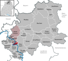
Binau
- municipality in Germany
Binau is a small town in the district of Neckar-Odenwald in Baden-Württemberg, Germany. It is surrounded by beautiful nature, making it a great location for hiking enthusiasts. Here are some highlights and tips for hiking in the Binau area:...
- Country:

- Postal Code: 74862
- Local Dialing Code: 06263
- Coordinates: 49° 22' 0" N, 9° 3' 26" E


- GPS tracks (wikiloc): [Link]
- AboveSeaLevel: 253 м m
- Area: 4.83 sq km
- Population: 1419
- Web site: [Link]


Billigheim
- municipality in Germany
Billigheim is a quaint village located in the beautiful region of Baden-Württemberg, Germany. Surrounded by picturesque landscapes, it offers various hiking opportunities that cater to different skill levels. Here are some highlights for hikers considering a trip to Billigheim:...
- Country:

- Postal Code: 74842
- Local Dialing Code: 06265
- Coordinates: 49° 20' 52" N, 9° 15' 16" E


- GPS tracks (wikiloc): [Link]
- AboveSeaLevel: 226 м m
- Area: 48.95 sq km
- Population: 5900
- Web site: [Link]


Haßmersheim
- municipality in Germany
Haßmersheim is a charming village located in the Baden-Württemberg region of Germany, nestled along the Neckar River. It's a great destination for hikers, offering a mix of scenic views, historical sites, and diverse trails that cater to various skill levels. Here are some highlights and tips for hiking in and around Haßmersheim:...
- Country:

- Postal Code: 74855
- Local Dialing Code: 06266
- Coordinates: 49° 18' 0" N, 9° 9' 0" E


- GPS tracks (wikiloc): [Link]
- AboveSeaLevel: 145 м m
- Area: 19.15 sq km
- Population: 5000
- Web site: [Link]


Hardheim
- municipality in Germany
Hardheim, located in the Odenwald region of Germany, is a picturesque area that offers a variety of hiking opportunities. The region is characterized by its rolling hills, dense forests, and scenic valleys, making it a great destination for outdoor enthusiasts. Here are some key points about hiking in Hardheim:...
- Country:

- Postal Code: 74736
- Local Dialing Code: 06283
- Coordinates: 49° 36' 43" N, 9° 28' 19" E


- GPS tracks (wikiloc): [Link]
- AboveSeaLevel: 294 м m
- Area: 87.02 sq km
- Population: 6936
- Web site: [Link]
Mudau
- municipality in Germany
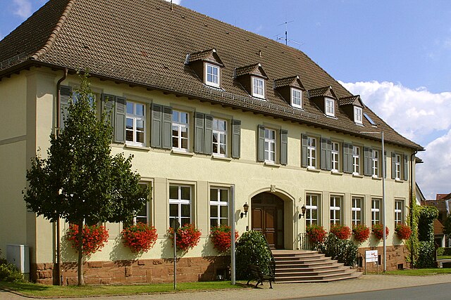
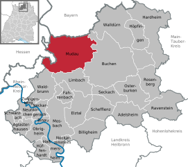
Mudau is a picturesque village located in the Odenwald region of Germany, known for its beautiful landscapes and hiking opportunities. The surrounding area is characterized by dense forests, rolling hills, and charming rural scenery, making it an excellent destination for outdoor enthusiasts....
- Country:

- Postal Code: 69427
- Local Dialing Code: 06284
- Coordinates: 49° 32' 4" N, 9° 12' 16" E


- GPS tracks (wikiloc): [Link]
- AboveSeaLevel: 452 м m
- Area: 107.55 sq km
- Population: 4828
- Web site: [Link]


Obrigheim
- municipality in Baden-Württemberg, Germany
Obrigado is a charming village located in the Rhine-Neckar region of Germany, offering a variety of hiking opportunities for outdoor enthusiasts. Here’s a brief overview of what you can expect when hiking in and around Obrigheim:...
- Country:

- Postal Code: 74847
- Local Dialing Code: 06262; 06261
- Coordinates: 49° 21' 8" N, 9° 5' 34" E


- GPS tracks (wikiloc): [Link]
- AboveSeaLevel: 147 м m
- Area: 24.27 sq km
- Population: 5264
- Web site: [Link]

Schwarzach
- municipality in Germany
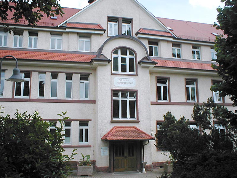
Schwarzach, located in the Baden-Württemberg region of Germany, is a picturesque area known for its beautiful landscapes, charming villages, and outdoor recreational opportunities, including hiking. Here are some key points about hiking in Schwarzach:...
- Country:

- Postal Code: 74869
- Local Dialing Code: 06262
- Coordinates: 49° 22' 23" N, 8° 58' 59" E


- GPS tracks (wikiloc): [Link]
- AboveSeaLevel: 219 м m
- Area: 8.37 sq km
- Population: 2878
- Web site: [Link]


Waldbrunn
- municipality in Germany
Waldbrunn, located in the heart of Baden-Württemberg, is a charming destination for hikers. Nestled within the picturesque landscapes of the Odenwald region, it offers a variety of hiking trails that cater to different levels of experience and fitness....
- Country:

- Postal Code: 69429
- Local Dialing Code: 06274
- Coordinates: 49° 27' 55" N, 9° 4' 53" E


- GPS tracks (wikiloc): [Link]
- AboveSeaLevel: 514 м m
- Area: 44.32 sq km
- Population: 4658
- Web site: [Link]


Schefflenz
- municipality in Germany
Schefflenz is a charming village in the Neckar-Odenwald district of Baden-Württemberg, Germany, surrounded by beautiful landscapes that make it a great spot for hiking enthusiasts. Here are some highlights about hiking in the Schefflenz area:...
- Country:

- Postal Code: 74850
- Local Dialing Code: 06293
- Coordinates: 49° 24' 9" N, 9° 16' 43" E


- GPS tracks (wikiloc): [Link]
- AboveSeaLevel: 273 м m
- Area: 36.97 sq km
- Population: 3960
- Web site: [Link]

Ravenstein
- municipality in Germany
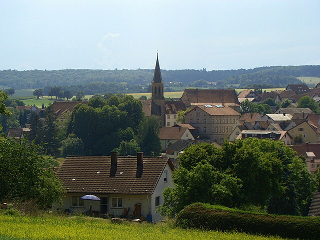
Ravenstein, located in the northern part of the Baden-Württemberg state in Germany, is a picturesque area that offers beautiful hiking opportunities. Here are some key points to consider when hiking in Ravenstein:...
- Country:

- Postal Code: 74747
- Local Dialing Code: 06297
- Coordinates: 49° 24' 4" N, 9° 30' 28" E


- GPS tracks (wikiloc): [Link]
- AboveSeaLevel: 286 м m
- Area: 55.97 sq km
- Population: 2865
- Web site: [Link]


Seckach
- municipality in Germany
Seckach is a small town located in the state of Baden-Württemberg, Germany. While it may not be as famous as some other hiking destinations in the country, it offers beautiful natural landscapes and opportunities for outdoor activities, including hiking. Here are some highlights to consider when hiking in and around Seckach:...
- Country:

- Postal Code: 74743
- Local Dialing Code: 06292
- Coordinates: 49° 26' 42" N, 9° 20' 7" E


- GPS tracks (wikiloc): [Link]
- AboveSeaLevel: 300 м m
- Area: 27.85 sq km
- Population: 4129
- Web site: [Link]


Neunkirchen
- municipality in the Neckar-Odenwald district of Baden-Württemberg, Germany
Neunkirchen, located in the Baden-Württemberg region of Germany, offers some beautiful hiking opportunities for outdoor enthusiasts. Though it’s a small community, it is surrounded by picturesque landscapes, including forests, hills, and valleys, making it an excellent base for various hiking adventures....
- Country:

- Postal Code: 74867
- Local Dialing Code: 06262
- Coordinates: 49° 23' 21" N, 9° 0' 28" E


- GPS tracks (wikiloc): [Link]
- AboveSeaLevel: 316 м m
- Area: 15.95 sq km
- Population: 1824
- Web site: [Link]
Limbach
- municipality in Germany
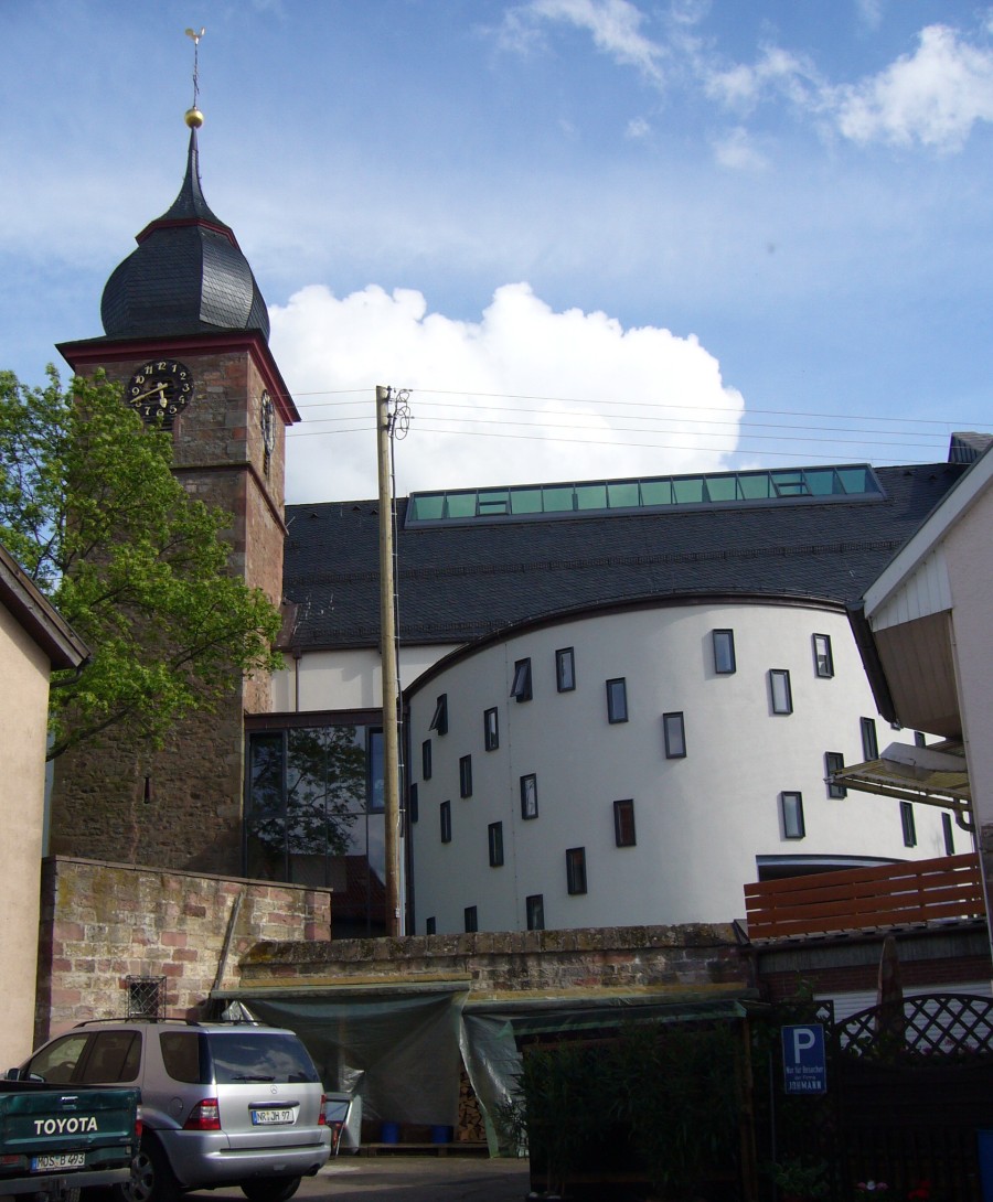
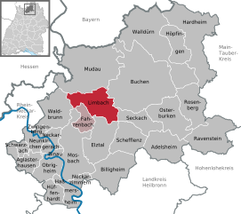
Limbach, located in the Baden-Württemberg region of Germany, is a charming village surrounded by scenic landscapes that are perfect for hiking enthusiasts. The area is characterized by lush forests, rolling hills, and picturesque views, making it an ideal spot for outdoor activities....
- Country:

- Postal Code: 74838
- Local Dialing Code: 06287
- Coordinates: 49° 27' 42" N, 9° 12' 41" E


- GPS tracks (wikiloc): [Link]
- AboveSeaLevel: 361 м m
- Area: 43.61 sq km
- Population: 4446
- Web site: [Link]


Rosenberg
- municipality in the district of Neckar-Odenwald-Kreis, Germany
Rosenberg in Baden, located in the beautiful Baden-Württemberg region of Germany, is known for its picturesque landscapes and numerous outdoor activities, including hiking. The area is characterized by rolling hills, scenic vineyards, dense forests, and charming villages, making it ideal for hikers of all levels....
- Country:

- Postal Code: 74749
- Local Dialing Code: 06295
- Licence Plate Code: MOS
- Coordinates: 49° 27' 23" N, 9° 28' 28" E


- GPS tracks (wikiloc): [Link]
- AboveSeaLevel: 352 м m
- Area: 40.97 sq km
- Population: 2090
- Web site: [Link]
Shares border with regions:


Miltenberg
- district in Bavaria, Germany
Miltenberg, located in the Bavaria region of Germany, is a charming town nestled along the Main River and surrounded by picturesque landscapes, making it an excellent destination for hiking enthusiasts. Here are some highlights about hiking in the Miltenberg district:...
- Country:

- Capital: Miltenberg
- Licence Plate Code: MIL
- Coordinates: 49° 45' 0" N, 9° 15' 0" E


- GPS tracks (wikiloc): [Link]
- AboveSeaLevel: 224 м m
- Area: 716.00 sq km
- Population: 114255
- Web site: [Link]

