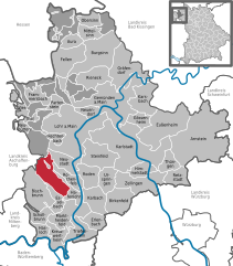
Neustadt am Main (Neustadt am Main)
- municipality of Germany
Neustadt am Main, nestled in Bavaria, Germany, offers a variety of scenic hiking opportunities for outdoor enthusiasts. The region is characterized by its charming landscapes, rolling hills, and proximity to the Main River, making it an attractive destination for both leisurely strolls and more challenging hikes.
Key Highlights for Hiking in Neustadt am Main:
-
Scenic Trails:
- Main Cycle Path: While primarily a cycling route, parts of the Main River bike path are also suitable for walking and provide beautiful views of the river and surrounding countryside.
- Local Hiking Trails: There are several well-marked hiking trails in the area that cater to different skill levels. The trails often lead you through picturesque vineyards, orchards, and forested areas.
-
Nature and Landscape: The area around Neustadt am Main is rich in flora and fauna. Hikers can enjoy trails that wind through serene forests, rolling hills, and by the riverside, with plenty of opportunities to observe local wildlife.
-
Historic Sites: As you hike, you may encounter several historic sites, including old farms and remnants of medieval structures, providing a cultural context to your outdoor experience.
-
Nearby Attractions: If you're looking to extend your hiking trip, consider exploring nearby natural parks or visiting local towns with rich history, such as Miltenberg or Wertheim, both of which are a short drive away and offer additional hiking opportunities.
-
Tips for Hiking in the Area:
- Preparation: Ensure you have a good map or GPS device, as while many trails are marked, it’s good to be prepared.
- Weather Considerations: Check the weather forecast before heading out, as conditions can change, particularly in spring and autumn.
- Gear: Wear appropriate hiking gear including sturdy shoes, and carry water and snacks, especially if you plan on hiking longer trails.
-
Local Guidance: Consider joining local hiking clubs or guided hikes if you’re unfamiliar with the area. This is a great way to meet locals and learn more about the region’s natural history.
-
Accessibility: Many trails are accessible from the town center, making it convenient for those who want to start their hike without much travel.
Overall, Neustadt am Main provides a lovely backdrop for hiking, whether you're looking for a day trip or a longer hiking journey. With its picturesque scenery, rich culture, and welcoming community, you’re sure to enjoy your time outdoors!
- Country:

- Postal Code: 97845
- Local Dialing Code: 09393
- Licence Plate Code: MSP
- Coordinates: 49° 55' 51" N, 9° 34' 3" E


- GPS tracks (wikiloc): [Link]
- AboveSeaLevel: 150 м m
- Area: 19.81 sq km
- Population: 1301
- Web site: http://www.neustadt-erlach.de
- Wikipedia en: wiki(en)
- Wikipedia: wiki(de)
- Wikidata storage: Wikidata: Q508822
- Wikipedia Commons Category: [Link]
- Freebase ID: [/m/02q4jb2]
- GeoNames ID: Alt: [2864060]
- VIAF ID: Alt: [125648940]
- OSM relation ID: [335458]
- GND ID: Alt: [4233247-3]
- archINFORM location ID: [13518]
- Library of Congress authority ID: Alt: [n95078615]
- TGN ID: [5001796]
- Bavarikon ID: [ODB_A00000448]
- German municipality key: 09677166
Includes regions:
Erlach
- Ortsteil of Neustadt am Main
Erlach am Main is a charming area in Germany that offers various hiking opportunities, particularly for those who enjoy picturesque landscapes and river views. Here are some highlights of hiking in and around Erlach am Main:...
- Country:

- Coordinates: 49° 55' 51" N, 9° 34' 28" E


- GPS tracks (wikiloc): [Link]
- AboveSeaLevel: 152 м m
Neustadt
- Ortsteil of Neustadt am Main
Neustadt am Main is a charming town located in Bavaria, Germany, and it offers several beautiful hiking opportunities in the surrounding areas. Here’s what you need to know about hiking in and around Neustadt:...
- Country:

- Postal Code: 97845
- Local Dialing Code: 09393
- Coordinates: 49° 55' 48" N, 9° 34' 12" E


- GPS tracks (wikiloc): [Link]
- AboveSeaLevel: 150 м m
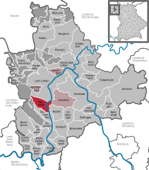
Shares border with regions:
Forst Lohrerstraße
- unincorporated area in Germany
Forst Lohrerstraße is located in the beautiful region of Bavaria, Germany. While it may not be as widely known as some of the larger national parks or hiking regions, it offers a scenic environment for outdoor enthusiasts. Here are some highlights and tips for hiking in and around Forst Lohrerstraße:...
- Country:

- Coordinates: 49° 58' 17" N, 9° 29' 4" E


- GPS tracks (wikiloc): [Link]


Fürstlich Löwensteinscher Park
- unincorporated area in Germany
 Hiking in Fürstlich Löwensteinscher Park
Fürstlich Löwensteinscher Park, located near the town of Weikersheim in Germany, is a beautiful park that offers a serene environment for hiking and outdoor activities. The park is known for its picturesque landscapes, well-maintained paths, and historical significance....
- Country:

- Coordinates: 49° 54' 15" N, 9° 29' 49" E


- GPS tracks (wikiloc): [Link]


Lohr am Main
- town in Bavaria, Germany
Lohr am Main, located in Bavaria, Germany, is a picturesque town that offers beautiful hiking opportunities amid stunning landscapes. The area surrounding Lohr is characterized by its scenic views of the Main River, lush forests, and rolling hills. Here are some highlights for hiking in and around Lohr am Main:...
- Country:

- Postal Code: 97816
- Local Dialing Code: 09352
- Licence Plate Code: MSP
- Coordinates: 49° 59' 37" N, 9° 34' 42" E


- GPS tracks (wikiloc): [Link]
- AboveSeaLevel: 167 м m
- Area: 90.44 sq km
- Population: 15719
- Web site: [Link]


Marktheidenfeld
- human settlement in Germany
Marktheidenfeld is a charming town in Bavaria, Germany, located along the banks of the Main River. The surrounding area offers some beautiful hiking opportunities, particularly due to its picturesque landscapes and scenic routes. Here’s a brief overview of what you can expect when hiking in and around Marktheidenfeld:...
- Country:

- Postal Code: 97828
- Local Dialing Code: 0 93 91
- Coordinates: 49° 51' 0" N, 9° 36' 0" E


- GPS tracks (wikiloc): [Link]
- AboveSeaLevel: 162 м m
- Area: 37.54 sq km
- Population: 10901
- Web site: [Link]


Steinfeld
- municipality of Germany
Steinfeld is a charming village located in the Bavaria region of Germany, surrounded by picturesque landscapes and opportunities for outdoor activities, particularly hiking. The area is characterized by rolling hills, lush forests, and scenic views, making it an attractive destination for both seasoned hikers and those looking to enjoy a leisurely walk in nature....
- Country:

- Postal Code: 97854
- Local Dialing Code: 09359
- Licence Plate Code: MSP
- Coordinates: 49° 57' 0" N, 9° 40' 0" E


- GPS tracks (wikiloc): [Link]
- AboveSeaLevel: 277 м m
- Area: 33.69 sq km
- Population: 2060
- Web site: [Link]


Roden
- municipality of Germany
Hiking in Roden, Bavaria, offers beautiful landscapes and a chance to experience the natural beauty that Bavaria is known for. Although Roden is a smaller village, it's situated near larger natural reserves and scenic trails. Here are a few highlights about hiking in this area:...
- Country:

- Postal Code: 97849
- Local Dialing Code: 09396
- Licence Plate Code: MSP
- Coordinates: 49° 53' 0" N, 9° 37' 0" E


- GPS tracks (wikiloc): [Link]
- AboveSeaLevel: 252 м m
- Area: 20.05 sq km
- Population: 872
- Web site: [Link]


Rothenfels
- town in Bavaria, Germany
Rothenfels is a picturesque village located in Bavaria, Germany, nestled within the beautiful landscape of the Fränkische Schweiz (Franconian Switzerland) region. This area is known for its dramatic limestone cliffs, dense forests, and charming medieval architecture....
- Country:

- Postal Code: 97851
- Local Dialing Code: 09393
- Licence Plate Code: MSP
- Coordinates: 49° 53' 0" N, 9° 35' 0" E


- GPS tracks (wikiloc): [Link]
- AboveSeaLevel: 154 м m
- Area: 12.07 sq km
- Population: 1011
- Web site: [Link]
