Forst Lohrerstraße (Forst Lohrerstraße)

- unincorporated area in Germany
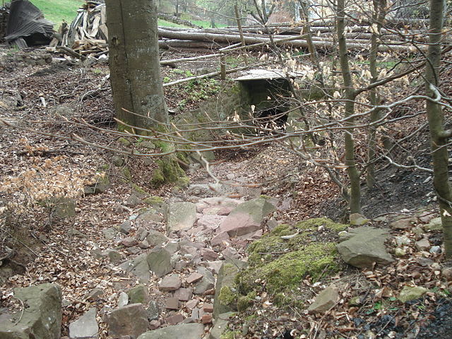
 Hiking in Forst Lohrerstraße
Forst Lohrerstraße is located in the beautiful region of Bavaria, Germany. While it may not be as widely known as some of the larger national parks or hiking regions, it offers a scenic environment for outdoor enthusiasts. Here are some highlights and tips for hiking in and around Forst Lohrerstraße:
Hiking Trails
- Varied Terrain: The area consists of woodlands, meadows, and gentle hills, providing a moderate difficulty level suitable for hikers of various skill levels.
- Marked Trails: Look for signposted hiking paths that guide you through the forest. Depending on your starting point, you can find trails that range from short walks to longer hikes that might span several hours.
Wildlife and Nature
- The forest is home to a variety of wildlife, so keep an eye out for deer, birds, and other animals. The landscape is rich with flora, especially during the spring and summer months when wildflowers bloom.
Useful Tips
- Footwear: Wear sturdy hiking boots or shoes with good traction, as some parts of the trails may be uneven or muddy.
- Weather Awareness: Check the weather forecast before you head out. In case of rain, trails can become slippery, so it’s advisable to be cautious.
- Stay Hydrated: Bring enough water, especially if you're planning a longer hike. Snack on energy bars or fruits to keep your energy up.
- Map and Navigation: While many trails are marked, having a map or a hiking app can help you navigate and allow you to explore different parts of the forest.
Accessibility
- Check local resources or visitor centers for any access restrictions or maintenance updates on trails. Some parts of the forest might be closed during certain seasons for conservation efforts.
Local Amenities
- Look for nearby towns or villages for dining or overnight accommodations if you're planning a longer stay.
Hiking in Forst Lohrerstraße can provide a wonderful way to connect with nature, enjoy the beauty of the Bavarian landscape, and experience the tranquility of the forest. Always remember to follow Leave No Trace principles to preserve the natural beauty of the area. Enjoy your hike!
- Country:

- Coordinates: 49° 58' 17" N, 9° 29' 4" E


- GPS tracks (wikiloc): [Link]
- Wikidata storage: Wikidata: Q1438220
- Wikipedia Commons Category: [Link]
- OSM relation ID: [2607274]
Shares border with regions:

Fürstlich Löwensteinscher Park
- unincorporated area in Germany
Hiking in Fürstlich Löwensteinscher Park
Fürstlich Löwensteinscher Park, located near the town of Weikersheim in Germany, is a beautiful park that offers a serene environment for hiking and outdoor activities. The park is known for its picturesque landscapes, well-maintained paths, and historical significance....
- Country:
- Coordinates: 49° 54' 15" N, 9° 29' 49" E
- GPS tracks (wikiloc): [Link]

Partensteiner Forst
- unincorporated area in Germany
Hiking in Partensteiner Forst
Partensteiner Forst, located in Bavaria, Germany, is a beautiful area for hiking, characterized by its dense forests, picturesque landscapes, and a variety of trails suitable for different skill levels. Here are some details to help you plan your hiking experience in this region:...
- Country:
- Coordinates: 50° 1' 8" N, 9° 28' 26" E
- GPS tracks (wikiloc): [Link]

Lohr am Main
- town in Bavaria, Germany
Hiking in Lohr am Main
Lohr am Main, located in Bavaria, Germany, is a picturesque town that offers beautiful hiking opportunities amid stunning landscapes. The area surrounding Lohr is characterized by its scenic views of the Main River, lush forests, and rolling hills. Here are some highlights for hiking in and around Lohr am Main:...
- Country:
- Postal Code: 97816
- Local Dialing Code: 09352
- Licence Plate Code: MSP
- Coordinates: 49° 59' 37" N, 9° 34' 42" E
- GPS tracks (wikiloc): [Link]
- AboveSeaLevel: 167 м m
- Area: 90.44 sq km
- Population: 15719
- Web site: [Link]

Hafenlohr
- municipality of Germany
Hiking in Hafenlohr
Hafenlohr, located in the Bavarian region of Germany, offers some beautiful hiking opportunities that showcase the natural beauty and scenic landscapes of the area. Here are some key points to consider when planning a hike in Hafenlohr:...
- Country:
- Postal Code: 97840
- Local Dialing Code: 09391
- Licence Plate Code: MSP
- Coordinates: 49° 52' 0" N, 9° 36' 0" E
- GPS tracks (wikiloc): [Link]
- AboveSeaLevel: 170 м m
- Area: 11.33 sq km
- Population: 1867
- Web site: [Link]

Neustadt am Main
- municipality of Germany
Hiking in Neustadt am Main
Neustadt am Main, nestled in Bavaria, Germany, offers a variety of scenic hiking opportunities for outdoor enthusiasts. The region is characterized by its charming landscapes, rolling hills, and proximity to the Main River, making it an attractive destination for both leisurely strolls and more challenging hikes....
- Country:
- Postal Code: 97845
- Local Dialing Code: 09393
- Licence Plate Code: MSP
- Coordinates: 49° 55' 51" N, 9° 34' 3" E
- GPS tracks (wikiloc): [Link]
- AboveSeaLevel: 150 м m
- Area: 19.81 sq km
- Population: 1301
- Web site: [Link]
Rechtenbach
- municipality of Germany
Hiking in Rechtenbach
Rechtenbach is a charming area that offers various hiking opportunities, especially for those who enjoy nature and picturesque landscapes. While it might not be as widely known as some larger hiking destinations, its natural beauty is certainly worth exploring....
- Country:
- Postal Code: 97848
- Local Dialing Code: 09352
- Licence Plate Code: MSP
- Coordinates: 49° 59' 0" N, 9° 30' 0" E
- GPS tracks (wikiloc): [Link]
- AboveSeaLevel: 345 м m
- Area: 2.09 sq km
- Population: 1107
- Web site: [Link]

Neuhütten
- municipality of Germany
Hiking in Neuhütten
Neuhütten, located in Germany, offers a variety of hiking opportunities for outdoor enthusiasts. Nestled in the picturesque Spessart forest region, it features dense woods, rolling hills, and beautiful landscapes. Here are some highlights and tips for hiking in Neuhütten:...
- Country:
- Postal Code: 97843
- Local Dialing Code: 06020
- Licence Plate Code: MSP
- Coordinates: 50° 0' 0" N, 9° 25' 0" E
- GPS tracks (wikiloc): [Link]
- AboveSeaLevel: 270 м m
- Area: 5.95 sq km
- Population: 1092
- Web site: [Link]


Rothenbuch
- municipality of Germany
Hiking in Rothenbuch
Rothenbuch, situated in Bavaria, Germany, is a lovely destination for hiking enthusiasts. Nestled in the Spessart mountain range, it offers a variety of scenic trails suitable for all levels of hikers....
- Country:
- Postal Code: 63860
- Local Dialing Code: 06094
- Licence Plate Code: AB
- Coordinates: 49° 58' 0" N, 9° 24' 0" E
- GPS tracks (wikiloc): [Link]
- AboveSeaLevel: 359 м m
- Area: 7.05 sq km
- Population: 1764
- Web site: [Link]


Rothenbucher Forst
- unincorporated area in Germany
Hiking in Rothenbucher Forst
Rothenbucher Forst is a beautiful forest area located in Bavaria, Germany, known for its lush landscapes and diverse ecosystems. It offers a variety of hiking trails suitable for different skill levels, making it a great destination for both beginners and experienced hikers. Here are some highlights and tips for hiking in Rothenbucher Forst:...
- Country:
- Coordinates: 49° 58' 42" N, 9° 25' 7" E
- GPS tracks (wikiloc): [Link]