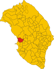
Neviano (Neviano)
.svg)
- Italian comune
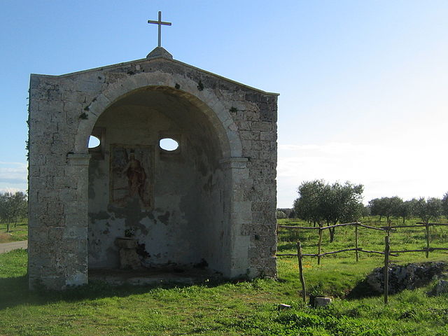
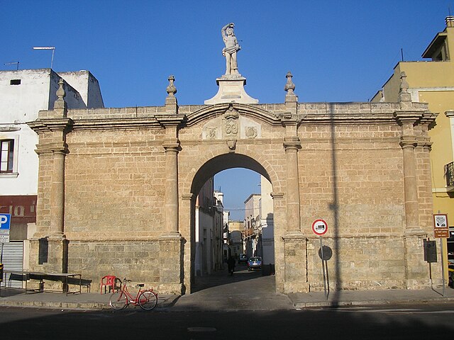
 Hiking in Neviano
Neviano, located in the province of Lecce in the beautiful region of Puglia, Italy, is not one of the most commonly known hiking destinations—instead, it's often recognized for its charming historical architecture and stunning landscapes typical of the Salento area. However, there are still great opportunities for outdoor enthusiasts to enjoy the natural beauty of the surrounding areas while hiking.
Key Features of Hiking in the Neviano Area:
-
Scenic Landscapes: The region around Neviano offers rolling hills, olive groves, and views of the Adriatic Sea. Many trails can give you opportunities to appreciate the unique Mediterranean flora and fauna.
-
Cultural Experiences: As you hike, you’ll likely pass traditional masserie (farmhouses) and other historical sites that provide a glimpse into the rich agricultural heritage of the area.
-
Nearby Hiking Trails: While Neviano itself may not have extensive trails, you can explore nearby areas. The Parco Naturale Regionale Costa Otranto - Santa Maria di Leuca offers several paths that lead to breathtaking coastal views. Moreover, you can venture into the nearby Murge region, known for its rocky terrain and hiking paths.
-
Accessibility: The terrain around Neviano can vary. Some trails are easier and suitable for beginners, while others may be more challenging and require decent hiking shoes. It is essential to have a good map or use GPS navigation for your hikes in less-marked areas.
-
Local Climate: The best time for hiking in this region is during spring (April to June) or fall (September to October), as summers can be scorching and may limit your daytime hiking hours. Always carry enough water and sun protection.
-
Cultural Events: Participating in local festivals or seasonal events during your hikes can enrich your experience, allowing you to taste local foods and meet residents who can offer further insights about the area.
Tips for Hiking in Neviano:
- Stay Hydrated: Always carry water, especially during the warmer months.
- Dress Appropriately: Wear breathable, comfortable clothing and sturdy hiking shoes.
- Be Mindful of Wildlife: The region is home to various wildlife; maintain a respectful distance.
- Check Local Guides: If you’re looking for guided hikes or specific recommendations, check with local tourist information centers or hiking clubs.
While Neviano may not be your first thought for a hiking destination, its charm and the surrounding natural beauty can make for a delightful outdoor experience.
- Country:

- Postal Code: 73040
- Local Dialing Code: 0836
- Licence Plate Code: LE
- Coordinates: 40° 6' 0" N, 18° 7' 0" E


- GPS tracks (wikiloc): [Link]
- AboveSeaLevel: 108 м m
- Area: 16.3 sq km
- Population: 5228
- Web site: http://www.comune.neviano.le.it/
- Wikipedia en: wiki(en)
- Wikipedia: wiki(it)
- Wikidata storage: Wikidata: Q52170
- Wikipedia Commons Category: [Link]
- Freebase ID: [/m/0f_9rr]
- GeoNames ID: Alt: [6541265]
- OSM relation ID: [40260]
- WOEID: [719315]
- ISTAT ID: 075053
- Italian cadastre code: F881
Shares border with regions:


Aradeo
- Italian comune
Hiking in Aradeo
Aradeo is a charming town located in the Apulia region of Italy, known for its rich history and beautiful landscapes. While it may not be a primary hiking destination, there are still plenty of opportunities for walking and exploring the surrounding countryside. Here are some general points to consider if you're planning to hike in or near Aradeo:...
- Country:
- Postal Code: 73040
- Local Dialing Code: 0836
- Licence Plate Code: LE
- Coordinates: 40° 8' 0" N, 18° 8' 0" E
- GPS tracks (wikiloc): [Link]
- AboveSeaLevel: 78 м m
- Area: 8.58 sq km
- Population: 9381
- Web site: [Link]

Collepasso
- Italian comune
Hiking in Collepasso
Collepasso is a charming town located in the Apulia region of Italy, characterized by its picturesque landscapes, rich history, and a warm Mediterranean climate. While it might not be as famous for hiking as some of Italy's more renowned regions, there are still opportunities to explore the natural beauty surrounding the town....
- Country:
- Postal Code: 73040
- Local Dialing Code: 0833
- Licence Plate Code: LE
- Coordinates: 40° 4' 0" N, 18° 10' 0" E
- GPS tracks (wikiloc): [Link]
- AboveSeaLevel: 120 м m
- Area: 12.79 sq km
- Population: 5979
- Web site: [Link]

Cutrofiano
- Italian comune
Hiking in Cutrofiano
Cutrofiano is a charming town located in the Apulia region of Italy, known for its beautiful landscapes, historic architecture, and rich cultural heritage. While it may not be as famous for hiking as some other regions of Italy, there are still opportunities for outdoor enthusiasts to explore the countryside and enjoy nature....
- Country:
- Postal Code: 73020
- Local Dialing Code: 0836
- Licence Plate Code: LE
- Coordinates: 40° 8' 0" N, 18° 12' 0" E
- GPS tracks (wikiloc): [Link]
- AboveSeaLevel: 81 м m
- Area: 56.81 sq km
- Population: 8992
- Web site: [Link]

Galatone
- Italian comune
Hiking in Galatone
Galatone is a charming town located in the province of Lecce in the Apulia region of southern Italy. While Galatone itself is more known for its historical architecture and proximity to the coast, it also offers opportunities for hiking and exploring the beautiful natural landscapes of the surrounding area....
- Country:
- Postal Code: 73044
- Local Dialing Code: 0833
- Licence Plate Code: LE
- Coordinates: 40° 9' 0" N, 18° 4' 0" E
- GPS tracks (wikiloc): [Link]
- AboveSeaLevel: 58 м m
- Area: 47.08 sq km
- Population: 15544
- Web site: [Link]


Parabita
- Italian comune
Hiking in Parabita
Parabita is a charming town located in the Apulia region of Italy, known for its rich history and beautiful scenery. While not widely recognized as a hiking destination, the surrounding areas offer opportunities for outdoor enthusiasts to explore the natural beauty of this part of Italy....
- Country:
- Postal Code: 73052
- Local Dialing Code: 0833
- Licence Plate Code: LE
- Coordinates: 40° 3' 0" N, 18° 8' 0" E
- GPS tracks (wikiloc): [Link]
- AboveSeaLevel: 80 м m
- Area: 21.09 sq km
- Population: 9047
- Web site: [Link]

Sannicola
- Italian comune
Hiking in Sannicola
Sannicola, a charming town in the Apulia region of southern Italy, is surrounded by beautiful landscapes perfect for hiking enthusiasts. While Sannicola itself may not feature extensive hiking trails, it offers easy access to the nearby areas that are ripe for exploration....
- Country:
- Postal Code: 73017
- Local Dialing Code: 0833
- Licence Plate Code: LE
- Coordinates: 40° 6' 0" N, 18° 4' 0" E
- GPS tracks (wikiloc): [Link]
- AboveSeaLevel: 75 м m
- Area: 27.64 sq km
- Population: 5864
- Web site: [Link]
Seclì
- Italian comune
Hiking in Seclì
Seclì is a small municipality located in the Apulia region of Italy, known for its charming landscapes and rural scenery. While it may not be a primary destination for hiking, there are plenty of opportunities for nature enthusiasts to explore the surrounding areas. Here are some tips and insights about hiking in and around Seclì:...
- Country:
- Postal Code: 73050
- Local Dialing Code: 0836
- Licence Plate Code: LE
- Coordinates: 40° 8' 0" N, 18° 6' 0" E
- GPS tracks (wikiloc): [Link]
- AboveSeaLevel: 76 м m
- Area: 8.78 sq km
- Population: 1877
- Web site: [Link]

Tuglie
- Italian comune
Hiking in Tuglie
Tuglie, located in the Apulia region of southern Italy, offers beautiful landscapes and a taste of local culture. While it may not be as widely known as some other hiking destinations, it lies in close proximity to various natural parks and scenic trails....
- Country:
- Postal Code: 73058
- Local Dialing Code: 0833
- Licence Plate Code: LE
- Coordinates: 40° 4' 24" N, 18° 5' 55" E
- GPS tracks (wikiloc): [Link]
- AboveSeaLevel: 74 м m
- Area: 8.5 sq km
- Population: 5213
- Web site: [Link]