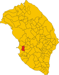
Tuglie (Tuglie)
- Italian comune
 Hiking in Tuglie
Tuglie, located in the Apulia region of southern Italy, offers beautiful landscapes and a taste of local culture. While it may not be as widely known as some other hiking destinations, it lies in close proximity to various natural parks and scenic trails.
Hiking Opportunities in Tuglie:
-
Local Trails:
- While specific hiking trails in Tuglie might not be extensively mapped, the surrounding countryside features several paths ideal for those looking to explore on foot. You can often find trails that lead through olive groves, vineyards, and rural farmland.
-
Cento Messeri - Nature Reserve:
- Just a short distance from Tuglie, the Cento Messeri Nature Reserve offers a variety of hiking paths amidst stunning scenery, featuring diverse flora and fauna. This area is excellent for more experienced hikers and those seeking a chance to spot local wildlife.
-
Gallipoli Coast:
- A short drive away from Tuglie, the Gallipoli coastal area provides beautiful seaside trails with breathtaking views of the Adriatic Sea. The coastal paths allow hikers to enjoy both the natural beauty and historic sites along the way.
-
Leuca - Otranto Coastal Path:
- For those willing to travel a bit further, the Leuca-Otranto coastal path is a stunning itinerary that showcases dramatic coastal scenery, cliffs, and crystal-clear waters. It's well-suited for day hikes.
Tips for Hiking in Tuglie:
-
Best Time to Hike: Autumn and spring are the most pleasant seasons for hiking in this region. Summer can be quite hot, so early morning or late afternoon hikes may be more comfortable.
-
Preparation: Ensure you have enough water, appropriate footwear, and sunscreen. Some paths can be rocky and uneven, so good hiking boots are a must.
-
Local Insights: Engage with local guides or hiking communities for recommendations on trails, especially hidden gems that may not be well-known.
-
Respect the Environment: As in all natural settings, practice Leave No Trace principles to protect the landscape and preserve it for future hikers.
Hiking in and around Tuglie can be a rewarding experience that combines the beauty of nature with the rich cultural backdrop of the Apulia region. Happy hiking!
- Country:

- Postal Code: 73058
- Local Dialing Code: 0833
- Licence Plate Code: LE
- Coordinates: 40° 4' 24" N, 18° 5' 55" E


- GPS tracks (wikiloc): [Link]
- AboveSeaLevel: 74 м m
- Area: 8.5 sq km
- Population: 5213
- Web site: http://www.tuglie.com
- Wikipedia en: wiki(en)
- Wikipedia: wiki(it)
- Wikidata storage: Wikidata: Q52215
- Wikipedia Commons Category: [Link]
- Freebase ID: [/m/0f_mjh]
- GeoNames ID: Alt: [6541268]
- BnF ID: [135084474]
- VIAF ID: Alt: [141889957]
- OSM relation ID: [40254]
- UN/LOCODE: [ITTYL]
- ISTAT ID: 075089
- Italian cadastre code: L462
Shares border with regions:

Alezio
- Italian comune
Hiking in Alezio
Alezio is a small town located in the Apulia region of Italy, near the Ionian coast and not far from the more famous town of Gallipoli. While Alezio itself may not be known specifically for extensive hiking trails, it offers several opportunities for outdoor enthusiasts, especially given its proximity to natural parks and scenic coastal areas....
- Country:
- Postal Code: 73011
- Local Dialing Code: 0833
- Licence Plate Code: LE
- Coordinates: 40° 4' 0" N, 18° 3' 0" E
- GPS tracks (wikiloc): [Link]
- AboveSeaLevel: 75 м m
- Area: 16.79 sq km
- Population: 5732
- Web site: [Link]


Neviano
- Italian comune
Hiking in Neviano
Neviano, located in the province of Lecce in the beautiful region of Puglia, Italy, is not one of the most commonly known hiking destinations—instead, it's often recognized for its charming historical architecture and stunning landscapes typical of the Salento area. However, there are still great opportunities for outdoor enthusiasts to enjoy the natural beauty of the surrounding areas while hiking....
- Country:
- Postal Code: 73040
- Local Dialing Code: 0836
- Licence Plate Code: LE
- Coordinates: 40° 6' 0" N, 18° 7' 0" E
- GPS tracks (wikiloc): [Link]
- AboveSeaLevel: 108 м m
- Area: 16.3 sq km
- Population: 5228
- Web site: [Link]


Parabita
- Italian comune
Hiking in Parabita
Parabita is a charming town located in the Apulia region of Italy, known for its rich history and beautiful scenery. While not widely recognized as a hiking destination, the surrounding areas offer opportunities for outdoor enthusiasts to explore the natural beauty of this part of Italy....
- Country:
- Postal Code: 73052
- Local Dialing Code: 0833
- Licence Plate Code: LE
- Coordinates: 40° 3' 0" N, 18° 8' 0" E
- GPS tracks (wikiloc): [Link]
- AboveSeaLevel: 80 м m
- Area: 21.09 sq km
- Population: 9047
- Web site: [Link]


Sannicola
- Italian comune
Hiking in Sannicola
Sannicola, a charming town in the Apulia region of southern Italy, is surrounded by beautiful landscapes perfect for hiking enthusiasts. While Sannicola itself may not feature extensive hiking trails, it offers easy access to the nearby areas that are ripe for exploration....
- Country:
- Postal Code: 73017
- Local Dialing Code: 0833
- Licence Plate Code: LE
- Coordinates: 40° 6' 0" N, 18° 4' 0" E
- GPS tracks (wikiloc): [Link]
- AboveSeaLevel: 75 м m
- Area: 27.64 sq km
- Population: 5864
- Web site: [Link]