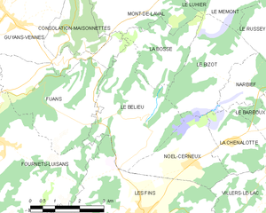
Noël-Cerneux (Noël-Cerneux)

- commune in Doubs, France
 Hiking in Noël-Cerneux
Noël-Cerneux is a picturesque commune located in the Doubs department of the Bourgogne-Franche-Comté region in eastern France. Known for its stunning natural beauty, it offers a range of outdoor activities, including hiking.
Hiking Trails
The area around Noël-Cerneux features several hiking trails that cater to various skill levels, from beginners to experienced hikers. The trails often wind through beautiful forests, rolling hills, and past scenic viewpoints.
Popular Hikes
- Le Sentier des Noues: This trail takes you through the lush forests and fields, where you can enjoy the local flora and fauna.
- Les Crêtes du Jura: A longer hike that offers breathtaking vistas of the Jura mountains and is ideal for those looking for a more challenging hike.
- Local Nature Trails: There are various shorter trails around Noël-Cerneux that are perfect for families and casual walkers.
Considerations
- Weather: Always check weather conditions before heading out, as they can change rapidly in mountainous areas.
- Gear: Invest in a good pair of hiking boots, weather-appropriate clothing, and carry enough water and snacks.
- Maps and Navigation: Make sure to bring a map or a GPS device, as some trails might not be well-marked.
Wildlife
Hiking in this region gives you the chance to spot local wildlife, including deer, various birds, and even rare species in the more remote areas.
Local Amenities
After a day of hiking, you can find local accommodations and restaurants to recharge, enjoying regional cuisine and hospitality.
Nearby Attractions
If you have time, consider exploring other nearby natural parks or towns to enhance your hiking experience. The region's rich history and cultural sites can add depth to your visit beyond just outdoor activities.
Always remember to hike responsibly by following Leave No Trace principles, respecting wildlife, and staying on marked trails. Enjoy your time in Noël-Cerneux!
- Country:

- Postal Code: 25500
- Coordinates: 47° 6' 5" N, 6° 39' 49" E


- GPS tracks (wikiloc): [Link]
- Area: 6.36 sq km
- Population: 409
- Wikipedia en: wiki(en)
- Wikipedia: wiki(fr)
- Wikidata storage: Wikidata: Q664762
- Wikipedia Commons Category: [Link]
- Freebase ID: [/m/03mgc1p]
- Freebase ID: [/m/03mgc1p]
- GeoNames ID: Alt: [6429914]
- GeoNames ID: Alt: [6429914]
- SIREN number: [212504252]
- SIREN number: [212504252]
- BnF ID: [152526518]
- BnF ID: [152526518]
- INSEE municipality code: 25425
- INSEE municipality code: 25425
Shares border with regions:


Le Bizot
- commune in Doubs, France
Hiking in Le Bizot
Le Bizot is a small village located in the eastern part of France, in the Bourgogne-Franche-Comté region. It’s not typically a major hiking destination, but its surroundings offer beautiful landscapes and opportunities for outdoor activities, including hiking....
- Country:
- Postal Code: 25210
- Coordinates: 47° 8' 9" N, 6° 40' 18" E
- GPS tracks (wikiloc): [Link]
- Area: 7.85 sq km
- Population: 302

Le Bélieu
- commune in Doubs, France
Hiking in Le Bélieu
Le Bélieu is a beautiful region located in the Jura Mountains of Switzerland, known for its stunning landscapes, diverse ecosystems, and excellent hiking opportunities. Here are some highlights and tips for hiking in Le Bélieu:...
- Country:
- Postal Code: 25500
- Coordinates: 47° 7' 9" N, 6° 38' 5" E
- GPS tracks (wikiloc): [Link]
- Area: 10.72 sq km
- Population: 422

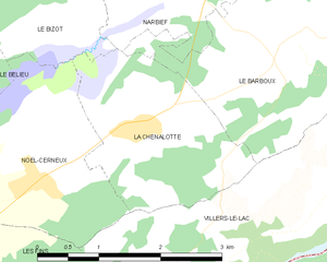
La Chenalotte
- commune in Doubs, France
Hiking in La Chenalotte
La Chenalotte is a beautiful area known for its stunning landscapes and diverse hiking trails, perfect for both beginners and experienced hikers. Located in the heart of nature, the region offers a variety of terrains, including lush forests, rocky paths, and picturesque viewpoints....
- Country:
- Postal Code: 25500
- Coordinates: 47° 6' 31" N, 6° 41' 3" E
- GPS tracks (wikiloc): [Link]
- Area: 4.88 sq km
- Population: 476
- Web site: [Link]


Villers-le-Lac
- commune in Doubs, France
Hiking in Villers-le-Lac
Villers-le-Lac is a charming village located in the Doubs department in the Franche-Comté region of eastern France. It's an ideal base for hiking enthusiasts due to its stunning natural surroundings, including the Jura Mountains and proximity to the Swiss border....
- Country:
- Postal Code: 25130
- Coordinates: 47° 3' 39" N, 6° 40' 13" E
- GPS tracks (wikiloc): [Link]
- Area: 30.17 sq km
- Population: 4819
- Web site: [Link]


Les Fins
- commune in Doubs, France
Hiking in Les Fins
Les Fins is a charming village located in the Doubs department of the Bourgogne-Franche-Comté region in eastern France, near the Swiss border. The area is known for its beautiful natural landscapes, rolling hills, and rich flora and fauna, making it a great destination for hiking enthusiasts....
- Country:
- Postal Code: 25500
- Coordinates: 47° 4' 51" N, 6° 37' 42" E
- GPS tracks (wikiloc): [Link]
- Area: 25.39 sq km
- Population: 3055