
Nogaro (Nogaro)

- commune in Gers, France
- Country:

- Postal Code: 32110
- Coordinates: 43° 45' 30" N, 0° 2' 2" E


- GPS tracks (wikiloc): [Link]
- Area: 11.06 sq km
- Population: 1980
- Web site: http://www.nogaro-armagnac.fr/
- Wikipedia en: wiki(en)
- Wikipedia: wiki(fr)
- Wikidata storage: Wikidata: Q324167
- Wikipedia Commons Category: [Link]
- Freebase ID: [/m/03nrrpz]
- GeoNames ID: Alt: [6432039]
- SIREN number: [213202963]
- BnF ID: [15255882t]
- VIAF ID: Alt: [240543489]
- INSEE municipality code: 32296
- US National Archives Identifier: 10037915
Shares border with regions:


Urgosse
- commune in Gers, France
- Country:
- Postal Code: 32110
- Coordinates: 43° 44' 13" N, 0° 1' 25" E
- GPS tracks (wikiloc): [Link]
- Area: 6.7 sq km
- Population: 246

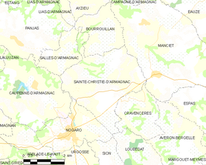
Sainte-Christie-d'Armagnac
- commune in Gers, France
- Country:
- Postal Code: 32370
- Coordinates: 43° 47' 5" N, 0° 0' 31" E
- GPS tracks (wikiloc): [Link]
- Area: 22.5 sq km
- Population: 393


Loubédat
- commune in Gers, France
- Country:
- Postal Code: 32110
- Coordinates: 43° 44' 46" N, 0° 1' 34" E
- GPS tracks (wikiloc): [Link]
- Area: 9.46 sq km
- Population: 112

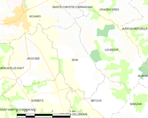
Sion
- commune in Gers, France
- Country:
- Postal Code: 32110
- Coordinates: 43° 44' 22" N, 0° 0' 32" E
- GPS tracks (wikiloc): [Link]
- AboveSeaLevel: 140 м m
- Area: 7.05 sq km
- Population: 108


Arblade-le-Haut
- commune in Gers, France
- Country:
- Postal Code: 32110
- Coordinates: 43° 44' 20" N, 0° 3' 35" E
- GPS tracks (wikiloc): [Link]
- Area: 12.2 sq km
- Population: 291

Caupenne-d'Armagnac
- commune in Gers, France
- Country:
- Postal Code: 32110
- Coordinates: 43° 47' 16" N, 0° 4' 1" E
- GPS tracks (wikiloc): [Link]
- Area: 21.65 sq km
- Population: 427