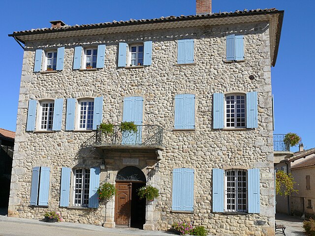
Nossage-et-Bénévent (Nossage-et-Bénévent)
- commune in Hautes-Alpes, France
Nossage-et-Bénévent is a charming commune located in the Vosges department of France. Surrounded by natural beauty, this area offers a variety of hiking opportunities for both beginners and experienced hikers alike. Here are some highlights for hiking in and around Nossage-et-Bénévent:
Scenic Trails
-
Forested Paths: The region is characterized by lush forests, providing shade and a rich experience of local flora and fauna. Hiking through these paths, you can often encounter diverse wildlife and enjoy the seasonal changes in nature.
-
Rugged Terrain: For those looking for a bit more challenge, there are rugged trails that include rocky sections and varied elevation, perfect for those who enjoy a more strenuous hike.
-
Vistas: Some trails may lead you to viewpoints or higher altitudes that provide stunning views of the surrounding valleys and hills. Early mornings or late afternoons can offer breathtaking light for photography.
Recommendations
- Local Guides: Consider hiring a local guide or joining a hiking group if you're unfamiliar with the area. They can provide insight into the best routes and ensure safety.
- Trail Maps: Always carry a map or use a reliable hiking app to stay on track. Signage may vary, and it’s important to stay oriented.
Duration & Difficulty
- Hikes in Nossage-et-Bénévent can range from short, easy walks (1-2 hours) to more challenging excursions (4-6 hours). Make sure to choose a trail that matches your fitness level.
Safety Tips
- Weather Awareness: Check the weather conditions before setting out, as mountain weather can change rapidly.
- Gear: Wear appropriate footwear and bring enough water, snacks, and maybe a small first aid kit.
- Enjoy Responsibly: Follow the Leave No Trace principles and respect local wildlife and habitats.
Attractions Nearby
After a hike, you may want to explore local attractions, such as small villages, historical sites, or partake in regional cuisine at nearby restaurants.
Whether you're looking for a leisurely stroll through the woods or an adventurous trek, hiking in Nossage-et-Bénévent offers something for everyone who loves the great outdoors!
- Country:

- Postal Code: 05700
- Coordinates: 44° 18' 55" N, 5° 44' 55" E


- GPS tracks (wikiloc): [Link]
- AboveSeaLevel: 690 м m
- Area: 4.31 sq km
- Population: 14
- Wikipedia en: wiki(en)
- Wikipedia: wiki(fr)
- Wikidata storage: Wikidata: Q1086678
- Wikipedia Commons Category: [Link]
- Freebase ID: [/m/03mfpxs]
- Freebase ID: [/m/03mfpxs]
- GeoNames ID: Alt: [6615728]
- GeoNames ID: Alt: [6615728]
- SIREN number: [210500948]
- SIREN number: [210500948]
- INSEE municipality code: 05094
- INSEE municipality code: 05094
Shares border with regions:

Barret-sur-Méouge
- commune in Hautes-Alpes, France
Barret-sur-Méouge is a charming village located in the Drôme department in southeastern France, surrounded by stunning natural landscapes that make it a great destination for hiking enthusiasts. The area is characterized by its mountainous terrain, lush greenery, and the picturesque Méouge Valley, which offers numerous hiking opportunities suitable for various skill levels....
- Country:

- Postal Code: 05300
- Coordinates: 44° 15' 45" N, 5° 44' 1" E


- GPS tracks (wikiloc): [Link]
- Area: 26.72 sq km
- Population: 225

Châteauneuf-de-Chabre
- former commune in Hautes-Alpes, France
 Hiking in Châteauneuf-de-Chabre
Châteauneuf-de-Chabre, located in the Hautes-Alpes region of France, is a hidden gem for outdoor enthusiasts and hikers. The area boasts stunning natural landscapes, including rugged mountains, lush valleys, and picturesque villages, making it an excellent location for both casual walkers and experienced hikers....
- Country:

- Postal Code: 05300
- Coordinates: 44° 16' 58" N, 5° 49' 10" E


- GPS tracks (wikiloc): [Link]
- Area: 23.9 sq km
- Population: 368

Saléon
- commune in Hautes-Alpes, France
Saléon, nestled in the picturesque countryside of France, offers a range of hiking opportunities for outdoor enthusiasts. The region is characterized by its stunning landscapes, including rolling hills, verdant forests, and scenic valleys. Here are some key highlights and tips for hiking in Saléon:...
- Country:

- Postal Code: 05300
- Coordinates: 44° 19' 55" N, 5° 46' 33" E


- GPS tracks (wikiloc): [Link]
- Area: 9.86 sq km
- Population: 91

Orpierre
- commune in Hautes-Alpes, France
Orpierre, located in the Hautes-Alpes region of southeastern France, is a charming village known for its stunning natural surroundings and outdoor activities, particularly hiking. The area is characterized by beautiful limestone cliffs, lush forests, and impressive views of the Provence landscape. Here are some key points to consider when hiking in Orpierre:...
- Country:

- Postal Code: 05700
- Coordinates: 44° 18' 47" N, 5° 41' 27" E


- GPS tracks (wikiloc): [Link]
- Area: 27.57 sq km
- Population: 341
- Web site: [Link]

Lagrand
- former commune in Hautes-Alpes, France
Lagrand is not a widely known hiking location, so I assume you might be referring to an area such as Lagrande in the U.S. state of Oregon or possibly another place with a similar name....
- Country:

- Postal Code: 05300
- Coordinates: 44° 20' 29" N, 5° 45' 21" E


- GPS tracks (wikiloc): [Link]
- Area: 6.92 sq km
- Population: 267