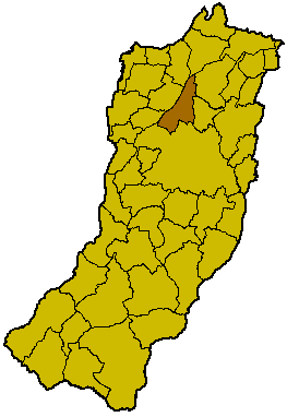
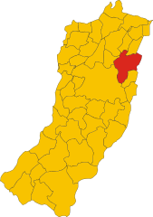
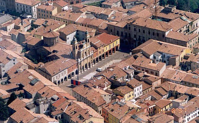
Novellara (Novellara)
- Italian comune
Novellara is a charming town located in the Reggio Emilia region of Italy. While it may not be a major hiking destination like some of Italy's more mountainous areas, it offers some beautiful landscapes and routes that are suitable for walking and hiking enthusiasts.
Hiking Opportunities in Novellara
-
Surrounding Countryside: The flat and fertile plains around Novellara provide easy walking paths. You can explore rural trails that take you through fields, vineyards, and small farms. The landscape is characterized by scenic views, especially during the spring and fall.
-
Local Parks and Green Areas: Take advantage of local parks where you can enjoy short hikes. These areas often feature walking trails, picnic spots, and beautiful gardens, making them perfect for a leisurely day out.
-
Nearby Natural Reserves: Although Novellara itself may not have extensive hiking trails, you can venture a bit farther to nearby natural reserves and parks, such as the Parco del Secchia or the hills of the Appennino Reggiano, which offer more challenging hikes with stunning views.
-
Cultural Walks: Combine hiking with a cultural twist by exploring the historical sites around Novellara. You can create routes that connect various points of interest, including churches and old buildings, adding an educational aspect to your hike.
Tips for Hiking in Novellara
- Stay Hydrated: Always carry enough water, especially during warmer months.
- Check Weather Conditions: The weather can change, so it’s wise to check forecasts and dress appropriately.
- Local Maps: Use local maps for navigation. They can help you discover lesser-known trails.
- Respect Nature: Stick to marked paths to minimize your impact on the environment, and always follow local guidelines for wildlife.
Conclusion
While Novellara might not feature iconic mountainous terrain for hiking, it offers plenty of charming countryside and opportunities for leisurely walks that visitors can enjoy. Whether you're looking to connect with nature or explore the local culture, you can find a fulfilling hiking experience in and around this quaint Italian town.
- Country:

- Postal Code: 42017
- Local Dialing Code: 0522
- Licence Plate Code: RE
- Coordinates: 44° 51' 0" N, 10° 44' 0" E


- GPS tracks (wikiloc): [Link]
- AboveSeaLevel: 24 м m
- Area: 58.11 sq km
- Population: 13721
- Web site: http://www.comunedinovellara.gov.it
- Wikipedia en: wiki(en)
- Wikipedia: wiki(it)
- Wikidata storage: Wikidata: Q111218
- Wikipedia Commons Category: [Link]
- Freebase ID: [/m/0dz436]
- GeoNames ID: Alt: [6538443]
- VIAF ID: Alt: [168411047]
- OSM relation ID: [43651]
- archINFORM location ID: [45531]
- UN/LOCODE: [ITNOV]
- Gran Enciclopèdia Catalana ID: [0265339]
- ISTAT ID: 035028
- Italian cadastre code: F960
Shares border with regions:


Bagnolo in Piano
- Italian comune
Bagnolo in Piano is a charming town located in the Emilia-Romagna region of Italy, known for its picturesque landscapes and proximity to various natural parks, making it a great spot for hiking enthusiasts. Here are some highlights of hiking in and around Bagnolo in Piano:...
- Country:

- Postal Code: 42011
- Local Dialing Code: 0522
- Licence Plate Code: RE
- Coordinates: 44° 46' 0" N, 10° 41' 0" E


- GPS tracks (wikiloc): [Link]
- AboveSeaLevel: 32 м m
- Area: 26.94 sq km
- Population: 9752
- Web site: [Link]


Cadelbosco di Sopra
- Italian comune
Cadelbosco di Sopra, located in the northern part of Italy near the city of Reggio Emilia, offers a mix of scenic landscapes and cultural experiences for hikers. The area features rolling hills, forests, and agricultural fields, providing diverse trails suitable for various skill levels....
- Country:

- Postal Code: 42023
- Local Dialing Code: 0522
- Licence Plate Code: RE
- Coordinates: 44° 46' 0" N, 10° 36' 0" E


- GPS tracks (wikiloc): [Link]
- AboveSeaLevel: 33 м m
- Area: 43.6 sq km
- Population: 10691
- Web site: [Link]
Campagnola Emilia
- Italian comune
Campagnola Emilia is a charming town located in the Emilia-Romagna region of Italy, known for its rich agricultural landscape and beautiful countryside. Hiking in this area can be a delightful experience, as you’ll find rolling hills, vineyards, and historic sites to explore....
- Country:

- Postal Code: 42012
- Local Dialing Code: 0522
- Licence Plate Code: RE
- Coordinates: 44° 50' 10" N, 10° 45' 17" E


- GPS tracks (wikiloc): [Link]
- AboveSeaLevel: 22 м m
- Area: 24.39 sq km
- Population: 5639
- Web site: [Link]


Correggio
- Italian comune
Correggio, located in the Emilia-Romagna region of Italy, is known for its historical significance and beautiful landscapes, but it's not as frequently mentioned in the context of hiking compared to other Italian destinations. However, there are opportunities to explore the natural beauty of the surrounding area....
- Country:

- Postal Code: 42015
- Local Dialing Code: 0522
- Licence Plate Code: RE
- Coordinates: 44° 46' 18" N, 10° 46' 50" E


- GPS tracks (wikiloc): [Link]
- AboveSeaLevel: 33 м m
- Area: 77.51 sq km
- Population: 25664
- Web site: [Link]


Guastalla
- Italian comune
Guastalla is a charming town located in the Emilia-Romagna region of Italy, known for its historical significance and beautiful landscapes along the Po River. While Guastalla itself is not a major hiking destination, there are several opportunities for hiking and enjoying nature in and around the area....
- Country:

- Postal Code: 42016
- Local Dialing Code: 0522
- Licence Plate Code: RE
- Coordinates: 44° 55' 17" N, 10° 39' 15" E


- GPS tracks (wikiloc): [Link]
- AboveSeaLevel: 24 м m
- Area: 52.93 sq km
- Population: 15032
- Web site: [Link]


Reggiolo
- town in the Italian province of Reggio Emilia
Reggiolo, located in the Emilia-Romagna region of Italy, is not traditionally known as a hiking destination since it is a small town primarily surrounded by agricultural landscapes. However, the surrounding countryside offers some opportunities for walking and enjoying nature....
- Country:

- Postal Code: 42046
- Local Dialing Code: 0522
- Licence Plate Code: RE
- Coordinates: 44° 55' 0" N, 10° 49' 0" E


- GPS tracks (wikiloc): [Link]
- AboveSeaLevel: 20 м m
- Area: 42.68 sq km
- Population: 9110
- Web site: [Link]

