Noviglio (Noviglio)
- Italian comune
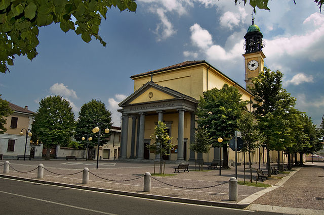
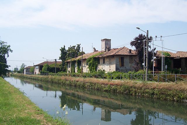
Noviglio, located in the Lombardy region of Italy, offers a scenic backdrop for hiking enthusiasts, though it may not be as well-known as some of the major hiking destinations in the region. The area is characterized by its flat landscapes, vineyards, and agricultural fields, making it ideal for leisurely hikes rather than strenuous mountain trekking.
Hiking Spots and Routes
- Countryside Trails: You'll find numerous paths that wind through the surrounding countryside, perfect for walking or cycling. These trails often pass by quaint farms and vineyards, providing a picturesque setting.
- Ticino Park: Located nearby, Parco del Ticino offers more extensive hiking options. This regional park features a network of trails that follow the Ticino River, with opportunities for birdwatching and exploring diverse flora and fauna.
- Cultural Walks: Consider routes that connect to local historical sites or churches in and around Noviglio. This can provide insight into the region’s rich culture and history.
Hiking Tips
- Appropriate Footwear: Since you’ll be walking on varied terrain, make sure to wear comfortable hiking shoes or boots.
- Weather Preparedness: The weather can vary, so check forecasts before heading out. Bring a light jacket and stay hydrated.
- Local Maps: It's helpful to have a map of the area or download a hiking app that can provide trails and points of interest.
- Respect Nature: Stay on marked paths, dispose of waste properly, and respect local wildlife.
Best Time to Hike
Spring and early fall offer the best conditions for hiking in Noviglio, as temperatures are milder and the landscapes are particularly beautiful with blooming flowers or autumn colors.
Although Noviglio may not boast towering peaks or rugged trails, it offers a tranquil hiking experience enriched by its natural beauty and cultural heritage. Enjoy your adventures in this quaint Italian locale!
- Country:

- Postal Code: 20082
- Local Dialing Code: 02
- Licence Plate Code: MI
- Coordinates: 45° 22' 0" N, 9° 3' 0" E


- GPS tracks (wikiloc): [Link]
- AboveSeaLevel: 103 м m
- Area: 15.86 sq km
- Population: 4584
- Web site: http://www.comune.noviglio.mi.it
- Wikipedia en: wiki(en)
- Wikipedia: wiki(it)
- Wikidata storage: Wikidata: Q42413
- Wikipedia Commons Category: [Link]
- Freebase ID: [/m/0gj6x6]
- GeoNames ID: Alt: [6543739]
- VIAF ID: Alt: [242752769]
- OSM relation ID: [44759]
- GND ID: Alt: [4726370-2]
- archINFORM location ID: [977]
- UN/LOCODE: [ITNVG]
- ISTAT ID: 015158
- Italian cadastre code: F968
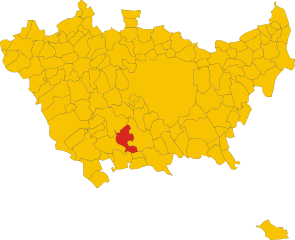
Shares border with regions:


Gaggiano
- Italian comune
Gaggiano, located in the Lombardy region of Italy, is known for its picturesque landscapes and serene surroundings, making it a lovely destination for hiking. Although it may not be a major hiking destination compared to some of the more famous mountains and valleys in Italy, there are still plenty of opportunities for outdoor activities....
- Country:

- Postal Code: 20083
- Local Dialing Code: 02
- Licence Plate Code: MI
- Coordinates: 45° 24' 17" N, 9° 2' 6" E


- GPS tracks (wikiloc): [Link]
- AboveSeaLevel: 117 м m
- Area: 26.26 sq km
- Population: 9131
- Web site: [Link]


Rosate
- Italian comune
Rosate is a small town located in the Lombardy region of Italy, not far from Milan. While it may not be known for extensive hiking trails, the surrounding areas offer several opportunities for outdoor activities and nature exploration. Here are some insights and tips for hiking in and around Rosate:...
- Country:

- Postal Code: 20088
- Local Dialing Code: 02
- Licence Plate Code: MI
- Coordinates: 45° 20' 0" N, 9° 1' 0" E


- GPS tracks (wikiloc): [Link]
- AboveSeaLevel: 107 м m
- Area: 18.68 sq km
- Population: 5762
- Web site: [Link]


Vernate
- Italian comune
Vernate is a small village located in the Lombardy region of Italy, not far from Milan. While it may not be as widely known for hiking as some other areas in Lombardy, it offers a charming landscape with some opportunities for outdoor activities, including hiking....
- Country:

- Postal Code: 20082
- Local Dialing Code: 02
- Licence Plate Code: MI
- Coordinates: 45° 19' 0" N, 9° 4' 0" E


- GPS tracks (wikiloc): [Link]
- AboveSeaLevel: 108 м m
- Area: 14.65 sq km
- Population: 3365
- Web site: [Link]


Binasco
- Italian comune
Binasco, a small town located in the Lombardy region of Italy, is nestled near the banks of the Naviglio Pavese, which provides charming scenery and potential hiking opportunities. While Binasco itself may not be a well-known hiking destination, several routes and areas nearby can offer enjoyable hikes....
- Country:

- Postal Code: 20082
- Local Dialing Code: 02
- Licence Plate Code: MI
- Coordinates: 45° 20' 0" N, 9° 6' 0" E


- GPS tracks (wikiloc): [Link]
- AboveSeaLevel: 101 м m
- Area: 3.87 sq km
- Population: 7251
- Web site: [Link]


Zibido San Giacomo
- Italian comune
Zibido San Giacomo, a small town in the Lombardy region of Italy, is not as well-known for hiking as some other areas in the region, but it does offer opportunities for outdoor activities in its surrounding landscapes. Here are some key points about hiking in and around Zibido San Giacomo:...
- Country:

- Postal Code: 20080
- Local Dialing Code: 02
- Licence Plate Code: MI
- Coordinates: 45° 22' 0" N, 9° 7' 0" E


- GPS tracks (wikiloc): [Link]
- AboveSeaLevel: 111 м m
- Area: 24.58 sq km
- Population: 6856
- Web site: [Link]

