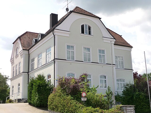
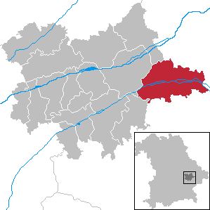
Oberpöring (Oberpöring)

- municipality of Germany
 Hiking in Oberpöring
Oberpöring is located in Bavaria, Germany, and is surrounded by beautiful landscapes that make it an excellent location for hiking enthusiasts. The region features a mix of gentle hills, forests, and agricultural fields, offering a variety of trails suitable for different skill levels.
Hiking Trails:
-
Local Trails: There are several marked hiking trails that start from Oberpöring, ranging from easy walking paths to more challenging routes. These trails often lead through the scenic countryside and provide opportunities to enjoy the local flora and fauna.
-
Nature Reserves: Nearby nature reserves and parks may offer additional hiking opportunities. They often feature well-maintained trails, as well as information boards about the local wildlife and plant life.
-
Long-Distance Trails: If you're looking for more adventure, consider nearby long-distance trails that connect several towns and rural areas in Bavaria. These trails often provide a chance to explore more remote regions and enjoy stunning views.
Tips for Hiking in Oberpöring:
- Check the Weather: Weather can change quickly in Bavaria, so be sure to check the forecast before heading out. Dress in layers, and prepare for rain if necessary.
- Footwear: Wear sturdy hiking boots to ensure comfort and support, especially if you plan to tackle uneven terrain.
- Maps and Navigation: Bring a map or download a hiking app to stay oriented, as some trails may not be well-marked.
- Hydration and Snacks: Carry enough water and snacks, especially on longer hikes.
- Local Wildlife: Maintain a respectful distance from wildlife, and be aware of local fauna.
Nearby Attractions:
- Historic Villages: Explore surrounding villages for a taste of Bavarian culture, including local cuisine and traditional architecture.
- Scenic Viewpoints: Look for spots along your hiking route that offer panoramic views of the countryside.
Hiking in Oberpöring can be a rewarding experience for both novice and experienced hikers, providing a chance to immerse yourself in the natural beauty of Bavaria. Don't forget your camera to capture the picturesque landscapes along the way!
- Country:

- Postal Code: 94562
- Local Dialing Code: 09937
- Licence Plate Code: DEG
- Coordinates: 48° 42' 0" N, 12° 50' 0" E


- GPS tracks (wikiloc): [Link]
- AboveSeaLevel: 349 м m
- Area: 17.39 sq km
- Population: 1151
- Web site: http://www.oberpoering.de
- Wikipedia en: wiki(en)
- Wikipedia: wiki(de)
- Wikidata storage: Wikidata: Q504425
- Wikipedia Commons Category: [Link]
- Freebase ID: [/m/02q0_zs]
- GeoNames ID: Alt: [2859412]
- VIAF ID: Alt: [239036938]
- OSM relation ID: [959827]
- GND ID: Alt: [4116700-4]
- archINFORM location ID: [223]
- Historical Gazetteer (GOV) ID: [object_300521]
- Bavarikon ID: [ODB_A00001448]
- German municipality key: 09271139
Shares border with regions:

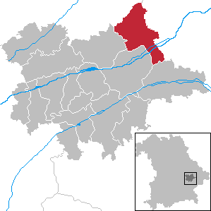
Otzing
- municipality of Germany
Hiking in Otzing
Otzing is a small village located in the beautiful surroundings of Bavaria, Germany. While the area itself may not be as famous as some major hiking destinations, it offers a variety of hiking opportunities suitable for different skill levels. Here’s what you might consider when hiking in and around Otzing:...
- Country:
- Postal Code: 94563
- Local Dialing Code: 09933; 09931
- Licence Plate Code: DEG
- Coordinates: 48° 46' 0" N, 12° 49' 0" E
- GPS tracks (wikiloc): [Link]
- AboveSeaLevel: 330 м m
- Area: 30.43 sq km
- Population: 1898
- Web site: [Link]
Aholming
- municipality in Deggendorf, Germany
Hiking in Aholming
Aholming is a charming village located in Bavaria, Germany, known for its scenic landscapes and opportunities for outdoor activities, including hiking. The region is characterized by its rolling hills, lush forests, and picturesque paths that make it a great spot for both casual walkers and more experienced hikers. Here are some highlights to consider if you plan to hike in Aholming:...
- Country:
- Postal Code: 94527; W–8351; 8351
- Local Dialing Code: 09938; 09931; 09936
- Licence Plate Code: DEG
- Coordinates: 48° 44' 0" N, 12° 55' 0" E
- GPS tracks (wikiloc): [Link]
- AboveSeaLevel: 327 м m
- Area: 29.35 sq km
- Population: 2361
- Web site: [Link]

Eichendorf
- municipality of Germany
Hiking in Eichendorf
Eichendorf, located in Bavaria, Germany, is a charming area surrounded by picturesque landscapes, making it a great destination for hiking enthusiasts. Here are some highlights and information to consider if you're planning to hike in and around Eichendorf:...
- Country:
- Postal Code: 94428
- Local Dialing Code: 09956; 09952; 09937; 08547
- Licence Plate Code: DGF
- Coordinates: 48° 38' 0" N, 12° 51' 0" E
- GPS tracks (wikiloc): [Link]
- AboveSeaLevel: 355 м m
- Area: 98.19 sq km
- Population: 6236
- Web site: [Link]

Wallersdorf
- municipality of Germany
Hiking in Wallersdorf
Wallersdorf is a charming town located in Bavaria, Germany, known for its picturesque landscapes and scenic hiking trails. The region around Wallersdorf offers various hiking opportunities that cater to different levels of experience, from easy walks to more challenging hikes. Here’s what you can expect when hiking in and around Wallersdorf:...
- Country:
- Postal Code: 94522
- Local Dialing Code: 09933
- Licence Plate Code: DGF
- Coordinates: 48° 44' 0" N, 12° 45' 0" E
- GPS tracks (wikiloc): [Link]
- AboveSeaLevel: 334 м m
- Area: 71.16 sq km
- Population: 5646
- Web site: [Link]

Wallerfing
- municipality of Germany
Hiking in Wallerfing
Wallerfing is a small village located in Bavaria, Germany, known for its scenic countryside and natural beauty, making it a great destination for hiking enthusiasts. While it may not be as popular as other destinations, the area around Wallerfing offers a variety of hiking trails that allow you to experience the picturesque landscape, local flora and fauna, and quaint villages....
- Country:
- Postal Code: 94574
- Local Dialing Code: 09936
- Licence Plate Code: DEG
- Coordinates: 48° 41' 0" N, 12° 53' 0" E
- GPS tracks (wikiloc): [Link]
- AboveSeaLevel: 357 м m
- Area: 20.76 sq km
- Population: 1350
- Web site: [Link]