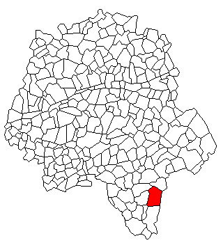
Obterre (Obterre)

- commune in Indre, France
- Country:

- Postal Code: 36290
- Coordinates: 46° 54' 54" N, 1° 2' 13" E


- GPS tracks (wikiloc): [Link]
- AboveSeaLevel: 121.0 м m
- Area: 28.47 sq km
- Population: 214
- Wikipedia en: wiki(en)
- Wikipedia: wiki(fr)
- Wikidata storage: Wikidata: Q1137242
- Wikipedia Commons Category: [Link]
- Freebase ID: [/m/03nvbjp]
- GeoNames ID: Alt: [6612503]
- SIREN number: [213601453]
- BnF ID: [15257449c]
- INSEE municipality code: 36145
Shares border with regions:


Azay-le-Ferron
- commune in Indre, France
- Country:
- Postal Code: 36290
- Coordinates: 46° 51' 6" N, 1° 4' 10" E
- GPS tracks (wikiloc): [Link]
- Area: 60.95 sq km
- Population: 861

Charnizay
- commune in Indre-et-Loire, France
- Country:
- Postal Code: 37290
- Coordinates: 46° 54' 49" N, 0° 59' 10" E
- GPS tracks (wikiloc): [Link]
- Area: 51.71 sq km
- Population: 509

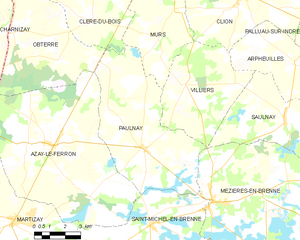
Paulnay
- commune in Indre, France
- Country:
- Postal Code: 36290
- Coordinates: 46° 51' 3" N, 1° 8' 52" E
- GPS tracks (wikiloc): [Link]
- Area: 38.48 sq km
- Population: 333


Saint-Flovier
- commune in Indre-et-Loire, France
- Country:
- Postal Code: 37600
- Coordinates: 46° 58' 5" N, 1° 1' 39" E
- GPS tracks (wikiloc): [Link]
- Area: 29.22 sq km
- Population: 577
Cléré-du-Bois
- commune in Indre, France
- Country:
- Postal Code: 36700
- Coordinates: 46° 55' 24" N, 1° 6' 7" E
- GPS tracks (wikiloc): [Link]
- Area: 36.13 sq km
- Population: 259


Bossay-sur-Claise
- commune in Indre-et-Loire, France
- Country:
- Postal Code: 37290
- Coordinates: 46° 49' 56" N, 0° 57' 44" E
- GPS tracks (wikiloc): [Link]
- Area: 65.56 sq km
- Population: 769
- Web site: [Link]