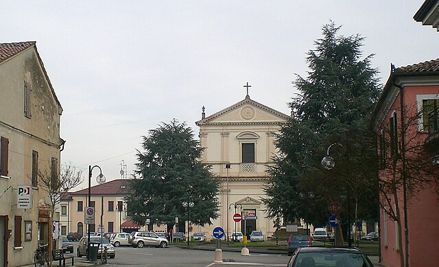
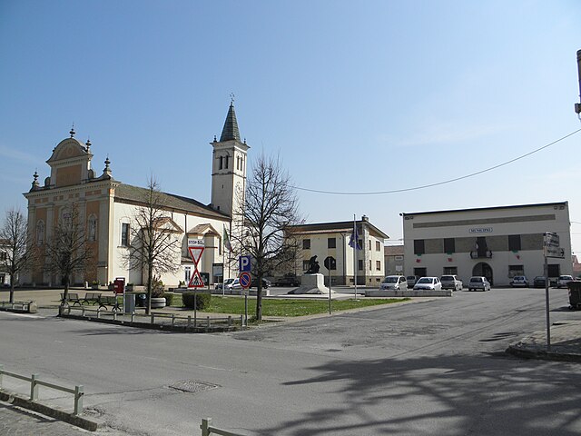
Occhiobello (Occhiobello)
.svg)
- Italian comune
 Hiking in Occhiobello
Occhiobello, located in the Emilia-Romagna region of Italy, is primarily known for its picturesque landscapes along the banks of the Po River. While it is not a major hiking destination, there are opportunities for outdoor activities and nature walks in the surrounding areas. Here are a few points to consider:
-
Surrounding Nature: The Po River and its surrounding wetlands provide a unique ecosystem, which can be explored through various trails and paths. Birdwatching is also popular in this area due to the diverse wildlife.
-
Local Parks: Look for nearby parks or nature reserves that may offer well-marked trails. The nearby Parco Regionale del Delta del Po offers vast wetlands and trails, making it a great option for a day hike.
-
Cycling Potential: If you enjoy biking, the flat terrain around Occhiobello is suitable for cycling tours, and many hikers combine biking with hiking in the area.
-
Nearby Hiking Areas: For more extensive hiking options, you may want to travel a bit further to the hills of the Apennines or the Sassi di Roccamalatina regional park, both of which offer more challenging hikes with stunning views.
-
Planning Your Hike: Always check local trail maps and guides, and consider the season—spring and autumn typically offer the best weather for hiking in the region.
-
Safety and Guidelines: As with any hiking trip, wear appropriate footwear, bring plenty of water, and let someone know your plans. Being mindful of local wildlife and the environment is essential.
If you're near Occhiobello, it can be a peaceful and scenic getaway, especially if you're looking for a leisurely hike or nature walk. Enjoy your outdoor adventure!
- Country:

- Postal Code: 45030
- Local Dialing Code: 0425
- Licence Plate Code: RO
- Coordinates: 44° 55' 18" N, 11° 34' 52" E


- GPS tracks (wikiloc): [Link]
- AboveSeaLevel: 8 м m
- Area: 32.33 sq km
- Population: 11993
- Web site: http://www.comune.occhiobello.ro.it
- Wikipedia en: wiki(en)
- Wikipedia: wiki(it)
- Wikidata storage: Wikidata: Q34592
- Wikipedia Commons Category: [Link]
- Freebase ID: [/m/0gk71k]
- GeoNames ID: Alt: [6537992]
- VIAF ID: Alt: [122433644]
- OSM relation ID: [43827]
- UN/LOCODE: [ITOHB]
- ISTAT ID: 029033
- Italian cadastre code: F994
Shares border with regions:


Ferrara
- Italian comune
Hiking in Ferrara
Ferrara, located in the Emilia-Romagna region of Italy, is not typically renowned for traditional hiking in mountainous terrains, as it features a mostly flat landscape. However, the area offers some beautiful walking and biking routes that allow you to enjoy the countryside, historical architecture, and natural beauty....
- Country:
- Postal Code: 44121-44122-44123-44124
- Local Dialing Code: 0532
- Licence Plate Code: FE
- Coordinates: 44° 50' 7" N, 11° 37' 12" E
- GPS tracks (wikiloc): [Link]
- AboveSeaLevel: 9 м m
- Area: 404.38 sq km
- Population: 132009
- Web site: [Link]

Stienta
- Italian comune
Hiking in Stienta
Stienta, a small town in the province of Ferrara in Italy, may not be widely recognized as a hiking destination, but the surrounding region offers a unique experience for outdoor enthusiasts. Here are some aspects to consider when hiking in and around Stienta:...
- Country:
- Postal Code: 45039
- Local Dialing Code: 0425
- Licence Plate Code: RO
- Coordinates: 44° 56' 0" N, 11° 33' 0" E
- GPS tracks (wikiloc): [Link]
- AboveSeaLevel: 9 м m
- Area: 24.02 sq km
- Population: 3239
- Web site: [Link]


Fiesso Umbertiano
- Italian comune
Hiking in Fiesso Umbertiano
Fiesso Umbertiano is a small town located in the Veneto region of Italy, known for its natural beauty and serene landscapes. While it may not be as famous as some larger hiking destinations, it offers opportunities for comfortable hikes, particularly for those looking to explore the more tranquil and rural side of the region....
- Country:
- Postal Code: 45024
- Local Dialing Code: 0425
- Licence Plate Code: RO
- Coordinates: 44° 58' 0" N, 11° 36' 0" E
- GPS tracks (wikiloc): [Link]
- AboveSeaLevel: 9 м m
- Area: 27.54 sq km
- Population: 3979
- Web site: [Link]

Canaro
- Italian comune
Hiking in Canaro
Canaro is a small town located in the province of Rovigo, in the Veneto region of Italy. While it may not be a well-known hiking destination, it is situated in a picturesque area surrounded by beautiful landscapes that can offer hiking opportunities....
- Country:
- Postal Code: 45034
- Local Dialing Code: 0425
- Licence Plate Code: RO
- Coordinates: 44° 56' 0" N, 11° 40' 0" E
- GPS tracks (wikiloc): [Link]
- AboveSeaLevel: 7 м m
- Area: 32.65 sq km
- Population: 2694
- Web site: [Link]