
Ferrara (Ferrara)
.svg)
- Italian comune
 Hiking in Ferrara
Ferrara, located in the Emilia-Romagna region of Italy, is not typically renowned for traditional hiking in mountainous terrains, as it features a mostly flat landscape. However, the area offers some beautiful walking and biking routes that allow you to enjoy the countryside, historical architecture, and natural beauty.
Best Hiking Options Around Ferrara:
-
Po Delta Park: About an hour's drive from Ferrara, this park is a UNESCO Biosphere Reserve and offers a unique landscape of wetlands, rivers, and diverse wildlife. You can explore numerous trails, bird-watch, and even take guided tours to learn more about this unique ecosystem.
-
Via Romea Germanica: This historical pilgrimage route runs near Ferrara and offers opportunities for hiking. It leads you through charming villages, agricultural land, and forests, providing both a scenic and cultural experience.
-
Baura-Este Cycle Route: While primarily a cycling route, this path through the countryside can also be walked. It takes you along the scenic landscapes and provides a good opportunity for those who enjoy walking in nature.
-
Historical City Walks: Within Ferrara itself, you can embark on walks that allow you to explore the historical city center, including the Estense Castle and the Renaissance-era architecture. The city walls also have walkable paths that provide a different perspective of the city.
Tips for Hiking Around Ferrara:
- Weather Considerations: The best times for hiking are spring (April to June) and fall (September to October) when the weather is milder.
- Stay Hydrated: Bring enough water, especially when hiking in the warmer months.
- Footwear: Even if the terrain is flat, comfortable walking or hiking shoes are important.
- Preparation: Some sections may have limited services, so prepare food, maps, and other essentials in advance.
While Ferrara may not offer challenging mountain hikes, it provides a unique opportunity to experience Italy's countryside and rich history through walking and biking paths. Enjoy your hiking adventure!
- Country:

- Postal Code: 44121-44122-44123-44124
- Local Dialing Code: 0532
- Licence Plate Code: FE
- Coordinates: 44° 50' 7" N, 11° 37' 12" E


- GPS tracks (wikiloc): [Link]
- AboveSeaLevel: 9 м m
- Area: 404.38 sq km
- Population: 132009
- Web site: http://comune.fe.it/
- Wikipedia en: wiki(en)
- Wikipedia: wiki(it)
- Wikidata storage: Wikidata: Q13362
- Wikipedia Commons Gallery: [Link]
- Wikipedia Commons Category: [Link]
- Wikipedia Commons Maps Category: [Link]
- Freebase ID: [/m/0cffd]
- GeoNames ID: Alt: [6542120]
- BnF ID: [128985438]
- VIAF ID: Alt: [131333082]
- OSM relation ID: [43512]
- GND ID: Alt: [4092153-0]
- archINFORM location ID: [898]
- Library of Congress authority ID: Alt: [n80150478]
- MusicBrainz area ID: [3a385259-5254-4655-b11b-51aaa58a2860]
- Quora topic ID: [Ferrara-Italy]
- TGN ID: [7004264]
- UN/LOCODE: [ITFRR]
- SUDOC authorities ID: [142313122]
- Encyclopædia Universalis ID: [ferrare]
- EMLO location ID: [e892fbd4-d86d-452c-a1a7-9863e5a1310c]
- Facebook Places ID: [115534521794581]
- Great Russian Encyclopedia Online ID: [4709843]
- Digital Atlas of the Roman Empire ID: [15967]
- ISNI: Alt: [0000 0001 2248 5377]
- DMOZ ID: Alt: [Regional/Europe/Italy/Regions/Emilia-Romagna/Localities/Ferrara/]
- Treccani ID: [ferrara]
- Enciclopedia Italiana ID: [ferrara]
- World Heritage Site ID: Alt: [733bis-001]
- ISTAT ID: 038008
- Italian cadastre code: D548
Shares border with regions:


Occhiobello
- Italian comune
Hiking in Occhiobello
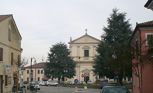
Occhiobello, located in the Emilia-Romagna region of Italy, is primarily known for its picturesque landscapes along the banks of the Po River. While it is not a major hiking destination, there are opportunities for outdoor activities and nature walks in the surrounding areas. Here are a few points to consider:...
- Country:
- Postal Code: 45030
- Local Dialing Code: 0425
- Licence Plate Code: RO
- Coordinates: 44° 55' 18" N, 11° 34' 52" E
- GPS tracks (wikiloc): [Link]
- AboveSeaLevel: 8 м m
- Area: 32.33 sq km
- Population: 11993
- Web site: [Link]


Gaiba
- comune of Italy
Hiking in Gaiba
Gaiba is a small town located in the Province of Rovigo in the Veneto region of Italy. While it may not be as famous for hiking as some other areas in Italy, it still offers beautiful landscapes and trails for those looking for a quieter hiking experience....
- Country:
- Postal Code: 45030
- Local Dialing Code: 0425
- Licence Plate Code: RO
- Coordinates: 44° 57' 0" N, 11° 29' 0" E
- GPS tracks (wikiloc): [Link]
- AboveSeaLevel: 9 м m
- Area: 11.99 sq km
- Population: 1037
- Web site: [Link]


Ficarolo
- Italian comune
Hiking in Ficarolo
Ficarolo is a small municipality in Italy, located in the province of Mantua, Lombardy. While it may not be as widely known as some of Italy’s larger national parks or mountainous regions, it can offer a unique hiking experience, especially for those interested in exploring the countryside and local landscapes....
- Country:
- Postal Code: 45036
- Local Dialing Code: 0425
- Licence Plate Code: RO
- Coordinates: 44° 57' 0" N, 11° 26' 0" E
- GPS tracks (wikiloc): [Link]
- AboveSeaLevel: 10 м m
- Area: 18.08 sq km
- Population: 2407
- Web site: [Link]

Stienta
- Italian comune
Hiking in Stienta
Stienta, a small town in the province of Ferrara in Italy, may not be widely recognized as a hiking destination, but the surrounding region offers a unique experience for outdoor enthusiasts. Here are some aspects to consider when hiking in and around Stienta:...
- Country:
- Postal Code: 45039
- Local Dialing Code: 0425
- Licence Plate Code: RO
- Coordinates: 44° 56' 0" N, 11° 33' 0" E
- GPS tracks (wikiloc): [Link]
- AboveSeaLevel: 9 м m
- Area: 24.02 sq km
- Population: 3239
- Web site: [Link]

Canaro
- Italian comune
Hiking in Canaro
Canaro is a small town located in the province of Rovigo, in the Veneto region of Italy. While it may not be a well-known hiking destination, it is situated in a picturesque area surrounded by beautiful landscapes that can offer hiking opportunities....
- Country:
- Postal Code: 45034
- Local Dialing Code: 0425
- Licence Plate Code: RO
- Coordinates: 44° 56' 0" N, 11° 40' 0" E
- GPS tracks (wikiloc): [Link]
- AboveSeaLevel: 7 м m
- Area: 32.65 sq km
- Population: 2694
- Web site: [Link]


Baricella
- Italian comune
Hiking in Baricella
Baricella is a small town located in the province of Bologna in the Emilia-Romagna region of Italy. While it may not be as widely recognized for hiking as some of the larger national parks or mountainous regions, it offers some charming paths and routes for those looking to enjoy nature....
- Country:
- Postal Code: 40052
- Local Dialing Code: 051
- Licence Plate Code: BO
- Coordinates: 44° 38' 51" N, 11° 32' 7" E
- GPS tracks (wikiloc): [Link]
- AboveSeaLevel: 11 м m
- Area: 45.48 sq km
- Population: 7030
- Web site: [Link]


Argenta
- Italian comune
Hiking in Argenta
Argenta, located in the Emilia-Romagna region of Italy, is primarily known for its rich natural landscapes and historical sites. While it may not be a major hiking destination compared to other mountainous areas in Italy, it offers opportunities for exploring nature and enjoying the surrounding environment....
- Country:
- Postal Code: 44048; 44040; 44016; 44014; 44011; 44010
- Local Dialing Code: 0532
- Licence Plate Code: FE
- Coordinates: 44° 36' 47" N, 11° 50' 11" E
- GPS tracks (wikiloc): [Link]
- AboveSeaLevel: 4 м m
- Area: 311.67 sq km
- Population: 21521
- Web site: [Link]


Bondeno
- Italian comune
Hiking in Bondeno
Bondeno, a town located in the Emilia-Romagna region of Italy, offers a unique outdoor experience for hikers with its diverse landscapes, historical sites, and natural beauty. While it may not be as widely known for hiking as other Italian regions, it has its own charm....
- Country:
- Postal Code: 44012
- Local Dialing Code: 0532
- Licence Plate Code: FE
- Coordinates: 44° 53' 22" N, 11° 24' 56" E
- GPS tracks (wikiloc): [Link]
- AboveSeaLevel: 13 м m
- Area: 174.76 sq km
- Population: 14217
- Web site: [Link]


Copparo
- Italian comune
Hiking in Copparo
Copparo is a small town located in the Emilia-Romagna region of Italy, situated along the banks of the Po River. While it may not be as well-known for hiking as some other Italian destinations, it offers some pleasant trails and opportunities for outdoor activities, especially for those who appreciate a more off-the-beaten-path experience....
- Country:
- Postal Code: 44034
- Local Dialing Code: 0532
- Licence Plate Code: FE
- Coordinates: 44° 54' 0" N, 11° 50' 0" E
- GPS tracks (wikiloc): [Link]
- AboveSeaLevel: 7 м m
- Area: 157.01 sq km
- Population: 16294
- Web site: [Link]
Masi Torello
- Italian comune
Hiking in Masi Torello
Masi Torello, located in the Emilia-Romagna region of Italy, is a charming area known for its picturesque landscapes and tranquil countryside. While it may not be a widely recognized hiking destination compared to more famous Italian national parks, it does offer various opportunities for hiking and enjoying nature....
- Country:
- Postal Code: 44020
- Local Dialing Code: 0532
- Licence Plate Code: FE
- Coordinates: 44° 47' 40" N, 11° 48' 7" E
- GPS tracks (wikiloc): [Link]
- AboveSeaLevel: 3 м m
- Area: 22.71 sq km
- Population: 2299
- Web site: [Link]
Ostellato
- Italian comune
Hiking in Ostellato
Ostellato, located in the Emilia-Romagna region of Italy, offers a unique hiking experience due to its picturesque landscapes and tranquil environment. While the area isn't known for high mountains or rugged terrain, it features flat countryside, rice paddies, and wetlands, making it ideal for leisurely hikes and nature walks....
- Country:
- Postal Code: 44020
- Local Dialing Code: 0533
- Licence Plate Code: FE
- Coordinates: 44° 45' 0" N, 11° 56' 0" E
- GPS tracks (wikiloc): [Link]
- AboveSeaLevel: 2 м m
- Area: 173.34 sq km
- Population: 6030
- Web site: [Link]
Poggio Renatico
- Italian comune
Hiking in Poggio Renatico
Poggio Renatico is a small municipality located in the Emilia-Romagna region of Italy. While it may not be known as a major hiking destination compared to some of Italy’s more famous areas, it still offers opportunities for nature walks and hiking, especially for those who enjoy exploring lesser-known paths and experiencing the local countryside....
- Country:
- Postal Code: 44028
- Local Dialing Code: 0532
- Licence Plate Code: FE
- Coordinates: 44° 45' 54" N, 11° 29' 0" E
- GPS tracks (wikiloc): [Link]
- AboveSeaLevel: 10 м m
- Area: 80.23 sq km
- Population: 9791
- Web site: [Link]

Portomaggiore
- Italian comune
Hiking in Portomaggiore
Portomaggiore is a small town in the Emilia-Romagna region of Italy, located near Ferrara. While it's not a major hiking destination, there are some opportunities to explore the countryside and enjoy nature in the surrounding areas....
- Country:
- Postal Code: 44015
- Local Dialing Code: 0532
- Licence Plate Code: FE
- Coordinates: 44° 42' 0" N, 11° 48' 0" E
- GPS tracks (wikiloc): [Link]
- AboveSeaLevel: 2 м m
- Area: 126.64 sq km
- Population: 11630
- Web site: [Link]
Vigarano Mainarda
- Italian comune
Hiking in Vigarano Mainarda
Vigarano Mainarda is a small municipality located in the Emilia-Romagna region of Italy, not far from Ferrara. While it may not be as famous as some of the larger national parks or hiking destinations in Italy, it can still offer a pleasant experience for outdoor enthusiasts....
- Country:
- Postal Code: 44049
- Local Dialing Code: 0532
- Licence Plate Code: FE
- Coordinates: 44° 51' 0" N, 11° 30' 0" E
- GPS tracks (wikiloc): [Link]
- AboveSeaLevel: 10 м m
- Area: 42.02 sq km
- Population: 7592
- Web site: [Link]


Voghiera
- Italian comune
Hiking in Voghiera
Voghiera, located in the Emilia-Romagna region of Italy, offers a unique hiking experience, particularly for those who appreciate rural landscapes, cultural heritage, and historical sites. While Voghiera itself may not feature extensive mountain trails, its surroundings provide opportunities for pleasant walks and hikes through the picturesque countryside....
- Country:
- Postal Code: 44019
- Local Dialing Code: 0532
- Licence Plate Code: FE
- Coordinates: 44° 46' 0" N, 11° 45' 0" E
- GPS tracks (wikiloc): [Link]
- AboveSeaLevel: 7 м m
- Area: 40.33 sq km
- Population: 3694
- Web site: [Link]