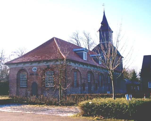
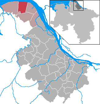
Oederquart (Oederquart)

- municipality of Germany
 Hiking in Oederquart
Oederquart, located in Lower Saxony, Germany, is a small village situated near the estuary of the Elbe River. While Oederquart itself is not widely known as a major hiking destination, its proximity to the surrounding natural areas and cultural sites can offer some enjoyable hiking experiences.
Here are a few highlights regarding hiking in and around Oederquart:
-
Scenic Trails: The region features several rural and scenic trails that allow hikers to experience the beautiful countryside, including diverse landscapes such as fields, forests, and waterways.
-
Elbe River Trails: The nearby Elbe River has paths that can be explored. These trails often provide picturesque views along the riverbanks and opportunities for birdwatching, as this area is home to various bird species.
-
Nature Reserves: Look for nature reserves in the vicinity, where you may find well-marked hiking trails that offer a chance to explore local flora and fauna.
-
Accessibility: Oederquart is close to larger towns like Stade, which provide more amenities, and from where you can access various hiking routes.
-
Cultural Points of Interest: Incorporating cultural sites into your hiking itinerary can enrich your experience. The region features historical towns, museums, and architectural sites that can be visited along the way.
-
Local Tips: For specifics on hiking routes and trail conditions, check local hiking clubs or visitor centers for maps and current information.
Before embarking on your hike, make sure to wear appropriate footwear, pack enough water and snacks, and have a map or a GPS device on hand. It's also a good idea to check the weather conditions as they can change quickly. Happy hiking!
- Country:

- Postal Code: 21734
- Local Dialing Code: 04779
- Licence Plate Code: STD
- Coordinates: 53° 47' 22" N, 9° 16' 45" E


- GPS tracks (wikiloc): [Link]
- AboveSeaLevel: 0 м m
- Area: 37.1 sq km
- Population: 1043
- Web site: http://www.nordkehdingen.de/default.cfm?mid=33912
- Wikipedia en: wiki(en)
- Wikipedia: wiki(de)
- Wikidata storage: Wikidata: Q503942
- Wikipedia Commons Category: [Link]
- Freebase ID: [/m/02r_h89]
- Freebase ID: [/m/02r_h89]
- Freebase ID: [/m/02r_h89]
- GeoNames ID: Alt: [2858071]
- GeoNames ID: Alt: [2858071]
- GeoNames ID: Alt: [2858071]
- VIAF ID: Alt: [228735192]
- VIAF ID: Alt: [228735192]
- VIAF ID: Alt: [228735192]
- OSM relation ID: [446463]
- OSM relation ID: [446463]
- OSM relation ID: [446463]
- GND ID: Alt: [16337730-3]
- GND ID: Alt: [16337730-3]
- GND ID: Alt: [16337730-3]
- TGN ID: [7159427]
- TGN ID: [7159427]
- TGN ID: [7159427]
- Historical Gazetteer (GOV) ID: [OEDARTJO43OT]
- Historical Gazetteer (GOV) ID: [OEDARTJO43OT]
- Historical Gazetteer (GOV) ID: [OEDARTJO43OT]
- German municipality key: 03359035
- German municipality key: 03359035
- German municipality key: 03359035
Shares border with regions:
Krummendeich
- municipality of Germany
Hiking in Krummendeich
Krummendeich is a picturesque area located in Germany, known for its natural landscapes and scenic views, making it an excellent destination for hiking enthusiasts. It is situated near the Elbe River, providing opportunities for both riverside walks and nature trails....
- Country:
- Postal Code: 21732
- Local Dialing Code: 04779
- Licence Plate Code: STD
- Coordinates: 53° 49' 52" N, 9° 12' 38" E
- GPS tracks (wikiloc): [Link]
- AboveSeaLevel: 2 м m
- Area: 30.03 sq km
- Population: 489
- Web site: [Link]