Ognon (Ognon)

- commune in Oise, France
- Country:

- Postal Code: 60810
- Coordinates: 49° 14' 11" N, 2° 38' 36" E


- GPS tracks (wikiloc): [Link]
- Area: 4.82 sq km
- Population: 156
- Web site: http://www.mairie-ognon.fr//
- Wikipedia en: wiki(en)
- Wikipedia: wiki(fr)
- Wikidata storage: Wikidata: Q609348
- Wikipedia Commons Category: [Link]
- Freebase ID: [/m/03qg98r]
- GeoNames ID: Alt: [6438871]
- SIREN number: [216004697]
- BnF ID: [15267710c]
- PACTOLS thesaurus ID: [pcrtymdRZLYTDO]
- INSEE municipality code: 60475
Shares border with regions:


Chamant
- commune in Oise, France
- Country:
- Postal Code: 60300
- Coordinates: 49° 13' 11" N, 2° 36' 39" E
- GPS tracks (wikiloc): [Link]
- Area: 12 sq km
- Population: 908
- Web site: [Link]


Brasseuse
- commune in Oise, France
- Country:
- Postal Code: 60810
- Coordinates: 49° 15' 23" N, 2° 40' 53" E
- GPS tracks (wikiloc): [Link]
- Area: 8.3 sq km
- Population: 98

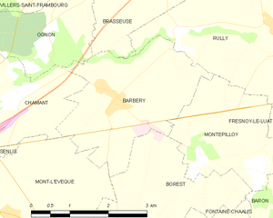
Barbery
- commune in Oise, France
- Country:
- Postal Code: 60810
- Coordinates: 49° 13' 21" N, 2° 40' 7" E
- GPS tracks (wikiloc): [Link]
- Area: 7.6 sq km
- Population: 562


Villers-Saint-Frambourg
- commune in Oise, France
- Country:
- Postal Code: 60810
- Coordinates: 49° 15' 19" N, 2° 38' 21" E
- GPS tracks (wikiloc): [Link]
- Area: 9.72 sq km
- Population: 558
- Web site: [Link]