Onet-le-Château (Onet-le-Château)

- commune in Aveyron, France
- Country:

- Postal Code: 12850
- Coordinates: 44° 21' 56" N, 2° 35' 37" E


- GPS tracks (wikiloc): [Link]
- Area: 40.2 sq km
- Population: 11944
- Web site: http://www.onet-le-chateau.fr
- Wikipedia en: wiki(en)
- Wikipedia: wiki(fr)
- Wikidata storage: Wikidata: Q638992
- Wikipedia Commons Category: [Link]
- Wikipedia Commons Maps Category: [Link]
- Freebase ID: [/m/03m94vr]
- GeoNames ID: Alt: [2989518]
- SIREN number: [211201769]
- BnF ID: [152471527]
- VIAF ID: Alt: [152653373]
- GND ID: Alt: [4267447-5]
- Library of Congress authority ID: Alt: [n2005032694]
- PACTOLS thesaurus ID: [pcrtk6jcXZxmXe]
- MusicBrainz area ID: [3fe9ae03-4c6f-4593-83d5-9baa0c425eeb]
- INSEE municipality code: 12176
Shares border with regions:


Balsac
- former commune in Aveyron, France
- Country:
- Postal Code: 12510
- Coordinates: 44° 24' 11" N, 2° 26' 42" E
- GPS tracks (wikiloc): [Link]
- Area: 15.57 sq km
- Population: 618


Druelle
- former commune in Aveyron, France
- Country:
- Postal Code: 12510
- Coordinates: 44° 20' 40" N, 2° 29' 35" E
- GPS tracks (wikiloc): [Link]
- Area: 35.68 sq km
- Population: 2388
- Web site: [Link]

Sébazac-Concourès
- commune in Aveyron, France
- Country:
- Postal Code: 12740
- Coordinates: 44° 24' 11" N, 2° 36' 0" E
- GPS tracks (wikiloc): [Link]
- Area: 25.82 sq km
- Population: 3216

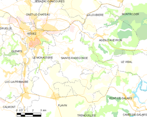
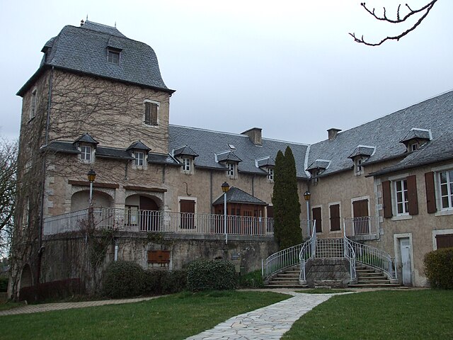
Sainte-Radegonde
- commune in Aveyron, France
- Country:
- Postal Code: 12850
- Coordinates: 44° 20' 14" N, 2° 37' 36" E
- GPS tracks (wikiloc): [Link]
- Area: 30.48 sq km
- Population: 1779
- Web site: [Link]


Rodez
- commune in Aveyron, France
- Country:
- Postal Code: 12000
- Coordinates: 44° 21' 0" N, 2° 34' 27" E
- GPS tracks (wikiloc): [Link]
- AboveSeaLevel: 640 м m
- Area: 11.18 sq km
- Population: 23949
- Web site: [Link]


Salles-la-Source
- commune in Aveyron, France
- Country:
- Postal Code: 12330
- Coordinates: 44° 26' 7" N, 2° 30' 48" E
- GPS tracks (wikiloc): [Link]
- Area: 78.03 sq km
- Population: 2196
- Web site: [Link]


La Loubière
- commune in Aveyron, France
- Country:
- Postal Code: 12740
- Coordinates: 44° 24' 20" N, 2° 37' 49" E
- GPS tracks (wikiloc): [Link]
- Area: 28.71 sq km
- Population: 1476