Orsara di Puglia (Orsara di Puglia)
.svg)
- Italian comune
 Hiking in Orsara di Puglia
Orsara di Puglia is a picturesque village located in the province of Foggia in the Apulia region of Italy. Surrounded by the lush landscapes of the Gargano National Park and the rolling hills of the Daunian Mountains, it offers a variety of hiking opportunities for nature enthusiasts and adventure seekers.
Hiking Routes and Trails
-
Gargano National Park Trails: Located not far from Orsara, the park features numerous trails ranging from easy walks to challenging hikes. You can explore dense forests, limestone cliffs, and stunning views of the Adriatic Sea.
-
Mountain Trails: The nearby Daunian Mountains provide trails that meander through hills and valleys, offering a mix of moderate to strenuous hikes. Popular routes include the trails leading to Monte Cornacchia, the highest peak in the area, where you can experience breathtaking panoramic views.
-
Local Pathways: In and around Orsara, you will find well-marked paths used by locals for walking and cycling, which allow you to experience the charming countryside, olive groves, and vineyards.
Points of Interest
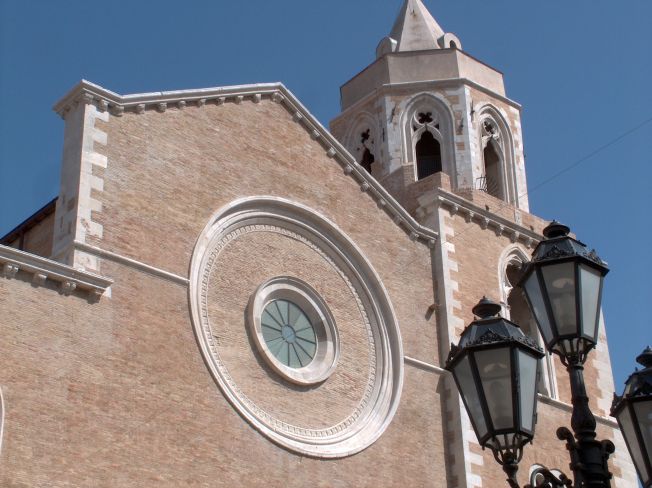
- Historic Sites: While hiking, take the time to visit historical landmarks, such as the Church of Santa Maria Assunta and the ancient stone village architecture.
- Flora and Fauna: The rich biodiversity in this area offers opportunities to observe various plant species, wildflowers, and possibly encounter local wildlife.
- Picnic Spots: Many trails lead to scenic vistas, making them perfect spots for a picnic amidst nature.
Best Time to Hike
The ideal times for hiking in Orsara di Puglia are during spring (April to June) and autumn (September to October) when the weather is milder and nature is at its most vibrant. Summer can be hot, while winter may bring snow to the higher elevations.
Recommendations
- Gear: Wear sturdy hiking boots and bring along plenty of water, sunscreen, and a map or GPS device to navigate the trails.
- Guided Tours: Consider joining guided hiking tours to enhance your experience and learn more about the local ecology and history.
- Local Cuisine: After your hikes, enjoy the local gastronomy, which includes hearty dishes and wines typical of the region.
Whether you are a seasoned hiker or a casual walker, Orsara di Puglia provides a beautiful backdrop for outdoor activities and a chance to immerse yourself in the natural beauty and cultural history of Southern Italy. Happy hiking!
- Country:

- Postal Code: 71027
- Local Dialing Code: 0881
- Licence Plate Code: FG
- Coordinates: 41° 17' 0" N, 15° 16' 0" E


- GPS tracks (wikiloc): [Link]
- AboveSeaLevel: 635 м m
- Area: 83.01 sq km
- Population: 2704
- Web site: http://www.comune.orsaradipuglia.fg.it
- Wikipedia en: wiki(en)
- Wikipedia: wiki(it)
- Wikidata storage: Wikidata: Q51939
- Wikipedia Commons Category: [Link]
- Freebase ID: [/m/0dzhjn]
- GeoNames ID: Alt: [6537541]
- VIAF ID: Alt: [145847681]
- OSM relation ID: [41178]
- MusicBrainz area ID: [ccb43a19-5c23-4fbf-b490-93c158e4768f]
- ISTAT ID: 071035
- Italian cadastre code: G125
Shares border with regions:


Bovino
- Italian comune
Hiking in Bovino
Bovino, a picturesque town in the Apennine Mountains of Italy, is known for its rich history, stunning landscapes, and hiking opportunities that cater to various skill levels. Here’s what you should know about hiking in and around Bovino:...
- Country:
- Postal Code: 71023
- Local Dialing Code: 0881
- Licence Plate Code: FG
- Coordinates: 41° 15' 0" N, 15° 21' 0" E
- GPS tracks (wikiloc): [Link]
- AboveSeaLevel: 647 м m
- Area: 84.93 sq km
- Population: 3256
- Web site: [Link]
Castelluccio dei Sauri
- Italian comune
Hiking in Castelluccio dei Sauri
Castelluccio dei Sauri, a charming village located in the Apennine Mountains of Italy, is an excellent destination for hiking enthusiasts. Nestled in the province of Foggia, in the region of Puglia, this area is characterized by its stunning landscapes, varied terrain, and rich biodiversity....
- Country:
- Postal Code: 71025
- Local Dialing Code: 0881
- Licence Plate Code: FG
- Coordinates: 41° 18' 0" N, 15° 29' 0" E
- GPS tracks (wikiloc): [Link]
- AboveSeaLevel: 284 м m
- Area: 51.47 sq km
- Population: 2102
- Web site: [Link]


Celle di San Vito
- Italian comune
Hiking in Celle di San Vito
Celle di San Vito is a charming village located in the Apennine region of Italy, known for its stunning landscapes and rich natural beauty, making it a great destination for hiking enthusiasts. Here are some highlights and considerations for hiking in and around Celle di San Vito:...
- Country:
- Postal Code: 71020
- Local Dialing Code: 0881
- Licence Plate Code: FG
- Coordinates: 41° 20' 0" N, 15° 11' 0" E
- GPS tracks (wikiloc): [Link]
- AboveSeaLevel: 726 м m
- Area: 18.41 sq km
- Population: 160
- Web site: [Link]


Faeto
- Italian comune
Hiking in Faeto
Faeto is a small village located in the Apulia region of southern Italy, nestled in the hills of the Daunia mountains. This picturesque area offers a variety of hiking opportunities characterized by beautiful landscapes, rich natural diversity, and a somewhat mild climate....
- Country:
- Postal Code: 71020
- Local Dialing Code: 0881
- Licence Plate Code: FG
- Coordinates: 41° 19' 30" N, 15° 9' 39" E
- GPS tracks (wikiloc): [Link]
- AboveSeaLevel: 820 м m
- Area: 26.1 sq km
- Population: 628
- Web site: [Link]

Lucera
- Italian comune
Hiking in Lucera
Lucera, located in the Apulia region of southern Italy, offers a variety of hiking opportunities that allow you to experience the beautiful landscapes, historical sites, and unique flora and fauna of the area. Here are some key points to consider for hiking in and around Lucera:...
- Country:
- Postal Code: 71036
- Local Dialing Code: 0881
- Licence Plate Code: FG
- Coordinates: 41° 30' 0" N, 15° 20' 0" E
- GPS tracks (wikiloc): [Link]
- AboveSeaLevel: 50 м m
- Area: 339.79 sq km
- Population: 33085
- Web site: [Link]


Panni
- Italian comune
Hiking in Panni
Panni, often recognized for its stunning landscapes and rich biodiversity, offers a variety of hiking experiences suitable for adventurers of all levels. Here are some key aspects to consider when planning a hike in this area:...
- Country:
- Postal Code: 71020
- Local Dialing Code: 0881
- Licence Plate Code: FG
- Coordinates: 41° 13' 15" N, 15° 16' 32" E
- GPS tracks (wikiloc): [Link]
- AboveSeaLevel: 801 м m
- Area: 32.71 sq km
- Population: 774
- Web site: [Link]


Troia, Apulia
- Italian comune
Hiking in Troia, Apulia
Troia is a charming town located in the Apulia region of southern Italy, known for its rich history and beautiful landscapes. Hiking in and around Troia offers a mix of cultural experiences and natural beauty, making it a great destination for outdoor enthusiasts. Here are some highlights for hiking in this area:...
- Country:
- Postal Code: 71029
- Local Dialing Code: 0881
- Licence Plate Code: FG
- Coordinates: 41° 22' 0" N, 15° 18' 0" E
- GPS tracks (wikiloc): [Link]
- AboveSeaLevel: 439 м m
- Area: 168.25 sq km
- Population: 7100
- Web site: [Link]

Greci
- Italian comune
Hiking in Greci
Hiking in Greci, a charming village located in the province of Avellino in Campania, Italy, offers a wonderful opportunity to explore the beautiful natural landscapes of the region. Nestled in the hills of the Irpinia area, Greci is surrounded by lush greenery, forests, and scenic vistas, making it a great destination for outdoor enthusiasts....
- Country:
- Postal Code: 83030
- Local Dialing Code: 0825
- Licence Plate Code: AV
- Coordinates: 41° 15' 10" N, 15° 10' 12" E
- GPS tracks (wikiloc): [Link]
- AboveSeaLevel: 823 м m
- Area: 30.27 sq km
- Population: 659
- Web site: [Link]

Montaguto
- Italian comune
Hiking in Montaguto
Montaguto is a picturesque village located in the Campania region of Italy, specifically in the province of Avellino. The area is known for its beautiful landscapes, rich history, and the opportunity for various outdoor activities, including hiking....
- Country:
- Postal Code: 83030
- Local Dialing Code: 0825
- Licence Plate Code: AV
- Coordinates: 41° 14' 59" N, 15° 14' 57" E
- GPS tracks (wikiloc): [Link]
- AboveSeaLevel: 730 м m
- Area: 18.38 sq km
- Population: 408
- Web site: [Link]