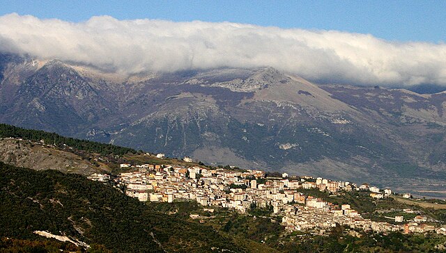
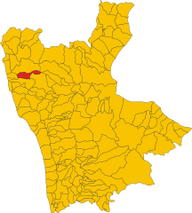
Orsomarso (Orsomarso)
.svg)
- Italian comune
 Hiking in Orsomarso
Orsomarso, located in the Calabria region of Italy, is a beautiful destination for hiking enthusiasts. Nestled in the heart of the Pollino National Park, it offers stunning landscapes, diverse flora, and fauna, as well as a variety of hiking trails suitable for different skill levels.
Highlights of Hiking in Orsomarso:
-
Natural Beauty: The area is characterized by rugged mountains, deep gorges, cascading rivers, and rich forests. Hikers can enjoy breathtaking views of the surrounding landscape, including the Pollino massif and the Tyrrhenian Sea in the distance.
-
Trail Variety: There are numerous marked trails ranging from easy walks to more challenging treks. Popular routes include the trail leading up to Monte Fosspela, which offers panoramic views, and paths along the Gole del Raganello, a scenic gorge.
-
Flora and Fauna: The biodiversity in Orsomarso is exceptional, with many endemic species of plants and wildlife. Keep an eye out for the Golden Eagle, wolves, and various species of plants unique to this mountainous terrain.
-
Cultural Sites: Besides natural beauty, the area is rich in history. You may encounter ancient villages, churches, and ruins that reflect the cultural heritage of the region. Combine your hiking experience with visits to these sites for a more enriching experience.
-
Recommended Time to Visit: Spring (April to June) and early autumn (September to October) are ideal for hiking, with mild temperatures and blooming wildflowers. Summer can be hot, while winter may bring snow, particularly at higher altitudes.
-
Safety Precautions: Always check trail conditions and weather forecasts before heading out. It’s advisable to carry plenty of water, snacks, a map, and a first aid kit. Be prepared with appropriate hiking gear, including sturdy boots.
-
Local Tips: Consider hiring a local guide if you're unfamiliar with the area or want to learn more about its unique biodiversity and cultural history.
Whether you're looking for a leisurely hike or a more strenuous adventure, Orsomarso provides an excellent opportunity to explore the natural beauty of Italy’s southern region.
- Country:

- Postal Code: 87020
- Local Dialing Code: 0985
- Licence Plate Code: CS
- Coordinates: 39° 48' 0" N, 15° 55' 0" E


- GPS tracks (wikiloc): [Link]
- AboveSeaLevel: 120 м m
- Area: 90.41 sq km
- Population: 1243
- Web site: http://www.comune.orsomarso.cs.it
- Wikipedia en: wiki(en)
- Wikipedia: wiki(it)
- Wikidata storage: Wikidata: Q53925
- Wikipedia Commons Category: [Link]
- Freebase ID: [/m/0f_nvy]
- GeoNames ID: Alt: [6537679]
- VIAF ID: Alt: [240551205]
- OSM relation ID: [40078]
- WOEID: [719610]
- ISTAT ID: 078088
- Italian cadastre code: G129
Shares border with regions:


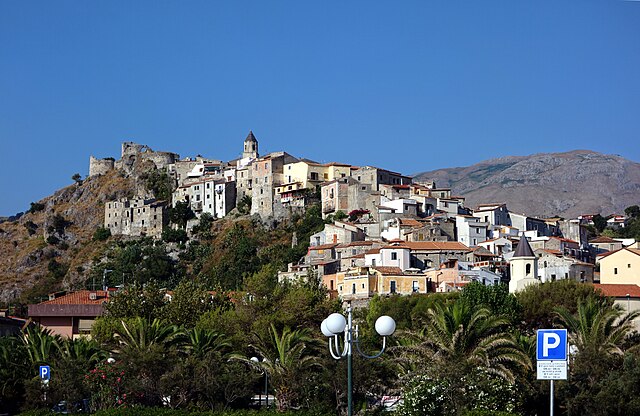
Lungro
- Italian comune
Hiking in Lungro
Lungro is a charming town located in the Calabria region of southern Italy, known for its beautiful landscapes and rich cultural heritage. Hiking in and around Lungro offers a variety of trails that cater to different skill levels, allowing you to experience the stunning natural scenery of the Sila National Park and the surrounding areas....
- Country:
- Postal Code: 87010
- Local Dialing Code: 0981
- Licence Plate Code: CS
- Coordinates: 39° 45' 0" N, 16° 7' 0" E
- GPS tracks (wikiloc): [Link]
- AboveSeaLevel: 650 м m
- Area: 35.65 sq km
- Population: 2504
- Web site: [Link]
Mormanno
- Italian comune
Hiking in Mormanno
Mormanno is a charming town situated in the Calabria region of southern Italy, nestled within the Pollino National Park. This area is known for its stunning natural landscapes, rich biodiversity, and well-maintained hiking trails. Here are some key points to consider when hiking in and around Mormanno:...
- Country:
- Postal Code: 87026
- Local Dialing Code: 0981
- Licence Plate Code: CS
- Coordinates: 39° 53' 0" N, 15° 59' 0" E
- GPS tracks (wikiloc): [Link]
- AboveSeaLevel: 840 м m
- Area: 78.88 sq km
- Population: 2955
- Web site: [Link]


Papasidero
- Italian comune
Hiking in Papasidero
Papasidero, located in Calabria, Italy, is a beautiful destination for hiking enthusiasts. Nestled in the Aspromonte National Park and near the Pollino National Park, it offers a variety of trails that suit different skill levels, making it perfect for both novice and experienced hikers....
- Country:
- Postal Code: 87020
- Local Dialing Code: 0981
- Licence Plate Code: CS
- Coordinates: 39° 52' 0" N, 15° 54' 0" E
- GPS tracks (wikiloc): [Link]
- AboveSeaLevel: 210 м m
- Area: 55.22 sq km
- Population: 696
- Web site: [Link]
San Donato di Ninea
- Italian comune
Hiking in San Donato di Ninea
San Donato di Ninea is a picturesque town located in the Calabria region of southern Italy, known for its beautiful landscapes, rich history, and unique cultural heritage. Hiking in and around San Donato di Ninea offers a wonderful opportunity to explore the natural beauty of the area, as well as its historical sites....
- Country:
- Postal Code: 87010
- Local Dialing Code: 0981
- Licence Plate Code: CS
- Coordinates: 39° 43' 0" N, 16° 2' 0" E
- GPS tracks (wikiloc): [Link]
- AboveSeaLevel: 720 м m
- Area: 82.4 sq km
- Population: 1283
- Web site: [Link]
Santa Domenica Talao
- Italian comune
Hiking in Santa Domenica Talao
Santa Domenica Talao is a charming village located in the Calabria region of southern Italy. Known for its stunning natural landscapes, it offers a variety of hiking opportunities that cater to different skill levels. Here are some highlights for hiking in and around Santa Domenica Talao:...
- Country:
- Postal Code: 87020
- Local Dialing Code: 0985
- Licence Plate Code: CS
- Coordinates: 39° 49' 0" N, 15° 51' 0" E
- GPS tracks (wikiloc): [Link]
- AboveSeaLevel: 304 м m
- Area: 36.12 sq km
- Population: 1216
- Web site: [Link]
Santa Maria del Cedro
- Italian comune
Hiking in Santa Maria del Cedro
Santa Maria del Cedro is a charming town located in the Calabria region of southern Italy. Nestled between the Tyrrhenian Sea and the rugged interior mountains, it offers some beautiful hiking opportunities amid stunning landscapes....
- Country:
- Postal Code: 87020
- Local Dialing Code: 0985
- Licence Plate Code: CS
- Coordinates: 39° 45' 0" N, 15° 50' 0" E
- GPS tracks (wikiloc): [Link]
- AboveSeaLevel: 110 м m
- Area: 18.42 sq km
- Population: 4961
- Web site: [Link]

Saracena
- Italian comune
Hiking in Saracena
Saracena is a charming village located in the Calabria region of southern Italy. Nestled in the Pollino National Park, it offers stunning natural scenery, rich cultural heritage, and a variety of hiking opportunities. Here are some key points to consider if you're interested in hiking in Saracena:...
- Country:
- Postal Code: 87010
- Local Dialing Code: 0981
- Licence Plate Code: CS
- Coordinates: 39° 46' 0" N, 16° 9' 0" E
- GPS tracks (wikiloc): [Link]
- AboveSeaLevel: 606 м m
- Area: 109.15 sq km
- Population: 3744
- Web site: [Link]

Scalea
- Italian comune
Hiking in Scalea
Scalea, located on the Tyrrhenian coast of Italy in the Calabria region, offers beautiful landscapes and a variety of hiking opportunities that cater to different skill levels. The area is known for its stunning coastal scenery, rugged mountains, and lush countryside....
- Country:
- Postal Code: 87029
- Local Dialing Code: 0985
- Licence Plate Code: CS
- Coordinates: 39° 49' 0" N, 15° 48' 0" E
- GPS tracks (wikiloc): [Link]
- AboveSeaLevel: 25 м m
- Area: 22.56 sq km
- Population: 11022
- Web site: [Link]

Verbicaro
- Italian comune
Hiking in Verbicaro
Verbicaro is a charming village in Calabria, Italy, nestled in the Pollino National Park region. It offers picturesque landscapes, rich culture, and various hiking opportunities that cater to different skill levels. Here are some highlights and tips for hiking in and around Verbicaro:...
- Country:
- Postal Code: 87020
- Local Dialing Code: 0985
- Licence Plate Code: CS
- Coordinates: 39° 45' 0" N, 15° 55' 0" E
- GPS tracks (wikiloc): [Link]
- AboveSeaLevel: 420 м m
- Area: 32.64 sq km
- Population: 2948
- Web site: [Link]