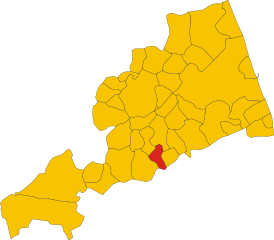
Ortezzano (Ortezzano)
.svg)
- Italian comune
 Hiking in Ortezzano
Ortezzano is a picturesque village located in the Marche region of Italy. This area offers stunning landscapes, rich cultural heritage, and various hiking opportunities for outdoor enthusiasts. Here are some key points about hiking in and around Ortezzano:
1. Scenic Trails
The trails around Ortezzano often showcase the natural beauty of the Marche region, including rolling hills, vineyards, olive groves, and beautiful flora and fauna. You can find trails that range in difficulty, catering to both novice and experienced hikers.
2. Historical Routes
Hiking in Ortezzano can also involve walking historical paths that connect the village to nearby towns and sites. Many trails lead to ancient ruins, churches, and historic landmarks that add cultural significance to your hiking experience.
3. Local Nature Reserves
Nearby nature reserves and protected areas, such as the Sibillini Mountains National Park, provide additional hiking options. Here, you can enjoy more challenging hikes that lead to breathtaking mountain vistas and unique geological formations.
4. Wildlife Watching
The region is home to diverse wildlife, making it an excellent location for bird watching and observing other animals. Cautious hikers may catch sight of species native to the area.
5. Local Cuisine
After your hike, you can indulge in local Marche cuisine in one of the nearby agriturismos or trattorias. Sampling regional dishes and local wines can be a rewarding way to end your hiking day.
6. Best Time to Hike
The ideal times to hike in Ortezzano typically are during spring (March to June) and fall (September to November), when temperatures are mild, and the scenery is at its finest.
Tips for Hiking in Ortezzano:
- Equipment: Wear comfortable, sturdy hiking shoes and carry a backpack with water, snacks, a basic first-aid kit, and a map or GPS device.
- Local Guides: Consider hiring a local guide or joining organized hiking groups to gain insights into the area's history and ecology.
- Weather Awareness: Always check the weather forecast before heading out, and be prepared for changing conditions.
Enjoy your hiking adventures in Ortezzano!
- Country:

- Postal Code: 63851
- Local Dialing Code: 0734
- Licence Plate Code: FM
- Coordinates: 43° 1' 53" N, 13° 36' 27" E


- GPS tracks (wikiloc): [Link]
- AboveSeaLevel: 301 м m
- Area: 7.08 sq km
- Population: 765
- Web site: http://www.comune.ortezzano.fm.it
- Wikipedia en: wiki(en)
- Wikipedia: wiki(it)
- Wikidata storage: Wikidata: Q59275
- Wikipedia Commons Category: [Link]
- Freebase ID: [/m/0gl8nw]
- GeoNames ID: Alt: [6538544]
- VIAF ID: Alt: [307304691]
- OSM relation ID: [42281]
- UN/LOCODE: [ITORX]
- Google Maps Customer ID: [8807939796473606817]
- ISTAT ID: 109029
- Italian cadastre code: G137
Shares border with regions:


Carassai
- Italian comune
Hiking in Carassai
Carassai, located in the Marche region of Italy, offers a unique hiking experience with its beautiful landscapes, rolling hills, and cultural heritage. While the town itself is relatively small, the surrounding area provides various trails that can cater to different skill levels....
- Country:
- Postal Code: 63063
- Local Dialing Code: 0734
- Licence Plate Code: AP
- Coordinates: 43° 1' 56" N, 13° 41' 1" E
- GPS tracks (wikiloc): [Link]
- AboveSeaLevel: 365 м m
- Area: 22.24 sq km
- Population: 1055
- Web site: [Link]


Montalto delle Marche
- Italian comune
Hiking in Montalto delle Marche
Montalto delle Marche is a beautiful destination for hiking enthusiasts, located in the Marche region of Italy. This area is characterized by its stunning landscapes, rolling hills, and a rich cultural heritage. Here are some key points to consider if you're planning to hike in and around Montalto delle Marche:...
- Country:
- Postal Code: 63068
- Local Dialing Code: 0736
- Licence Plate Code: AP
- Coordinates: 42° 59' 14" N, 13° 36' 25" E
- GPS tracks (wikiloc): [Link]
- AboveSeaLevel: 512 м m
- Area: 33.94 sq km
- Population: 2078
- Web site: [Link]

Monte Rinaldo
- Italian comune
Hiking in Monte Rinaldo
Monte Rinaldo is part of the Monti Sibillini National Park, located in central Italy, specifically in the Marche region. This area is loved for its stunning landscapes, diverse flora and fauna, and a variety of hiking trails suitable for different levels of experience....
- Country:
- Postal Code: 63852
- Local Dialing Code: 0734
- Licence Plate Code: FM
- Coordinates: 43° 1' 42" N, 13° 34' 51" E
- GPS tracks (wikiloc): [Link]
- AboveSeaLevel: 485 м m
- Area: 8 sq km
- Population: 359
- Web site: [Link]


Monte Vidon Combatte
- Italian comune
Hiking in Monte Vidon Combatte
Monte Vidon Combatte is a picturesque area located in the Marche region of Italy, offering a delightful mix of natural beauty, cultural heritage, and outdoor recreation opportunities. Here are some key points to consider for hiking in this area:...
- Country:
- Postal Code: 63847
- Local Dialing Code: 0734
- Licence Plate Code: FM
- Coordinates: 43° 2' 59" N, 13° 37' 49" E
- GPS tracks (wikiloc): [Link]
- AboveSeaLevel: 393 м m
- Area: 11.17 sq km
- Population: 434
- Web site: [Link]


Montottone
- Italian comune
Hiking in Montottone
Montottone is a charming hilltop village located in the Marche region of Italy. Known for its picturesque landscapes, rich history, and beautiful architecture, it offers a variety of hiking opportunities for outdoor enthusiasts. Here are some aspects to consider if you're planning to hike in and around Montottone:...
- Country:
- Postal Code: 63843
- Local Dialing Code: 0734
- Licence Plate Code: FM
- Coordinates: 43° 3' 43" N, 13° 35' 5" E
- GPS tracks (wikiloc): [Link]
- AboveSeaLevel: 277 м m
- Area: 16.38 sq km
- Population: 978
- Web site: [Link]