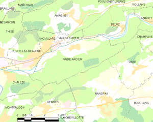
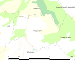
Osse (Osse)

- commune in Doubs, France
 Hiking in Osse
Osse, located in the Doubs department of the Bourgogne-Franche-Comté region in eastern France, offers various hiking opportunities in a picturesque natural setting. The area's landscape is characterized by rolling hills, dense forests, and stunning views of the surrounding Jura Mountains.
Hiking Trails
-
Les Circuits de randonnée: The region has well-marked hiking trails that cater to different hiking levels, from beginners to more experienced trekkers. You can find trails that lead through forests, along rivers, and up to viewpoints offering panoramic views.
-
Planches Prémanon and Mont d'Or: Nearby attractions can be explored via hiking trails that connect to the famous trails around the Mont d'Or, known for its breathtaking alpine scenery.
-
Local flora and fauna: While hiking in Osse, you may encounter diverse wildlife and a variety of plant species, particularly in the richer parts of the forests and wetlands.
Tips for Hiking in Osse
- Prepare accordingly: Check the weather before heading out, and dress in layers, as conditions can change rapidly in the hills.
- Stay hydrated: Always carry enough water with you, especially on longer hikes.
- Maps and guides: Utilize local hiking maps and guides to ensure you are on the right path and to discover points of interest.
- Respect nature: Follow the Leave No Trace principles to preserve the beauty of the surroundings.
Nearby Attractions
If you have extra time, you might consider exploring nearby attractions, such as:
- The Doubs River: Perfect for fishing or relaxing by the water after your hike.
- Château de Joux: A historic fortress offering fascinating insights into the regional history.
- Local villages: Experience the charm of local villages with their unique architecture and regional cuisine.
Hiking in Osse offers a fantastic way to enjoy the natural beauty of the Doubs region, making it a worthwhile adventure for both seasoned hikers and casual walkers. Always remember to check for local trail conditions and advice before you head out!
- Country:

- Postal Code: 25360
- Coordinates: 47° 16' 1" N, 6° 12' 46" E


- GPS tracks (wikiloc): [Link]
- Area: 8.21 sq km
- Population: 328
- Wikipedia en: wiki(en)
- Wikipedia: wiki(fr)
- Wikidata storage: Wikidata: Q906742
- Wikipedia Commons Category: [Link]
- Freebase ID: [/m/03mhbwb]
- Freebase ID: [/m/03mhbwb]
- GeoNames ID: Alt: [6429925]
- GeoNames ID: Alt: [6429925]
- SIREN number: [212504377]
- SIREN number: [212504377]
- BnF ID: [152526638]
- BnF ID: [152526638]
- INSEE municipality code: 25437
- INSEE municipality code: 25437
Shares border with regions:


Champlive
- commune in Doubs, France
Hiking in Champlive
Champlive is a beautiful area known for its stunning landscapes and diverse hiking trails. While it may not be as widely recognized as some other hiking destinations, it offers a range of options suitable for all skill levels, from beginners to experienced hikers....
- Country:
- Postal Code: 25360
- Coordinates: 47° 17' 21" N, 6° 14' 46" E
- GPS tracks (wikiloc): [Link]
- Area: 8.2 sq km
- Population: 257


Deluz
- commune in Doubs, France
Hiking in Deluz
Deluz, located in the Doubs department of the Bourgogne-Franche-Comté region in France, offers a beautiful setting for hiking enthusiasts. The area is characterized by its picturesque landscapes, rolling hills, dense forests, and varied terrain, making it a great destination for outdoor activities....
- Country:
- Postal Code: 25960
- Coordinates: 47° 17' 40" N, 6° 12' 3" E
- GPS tracks (wikiloc): [Link]
- Area: 8.03 sq km
- Population: 625


Bouclans
- former commune in Doubs, France
Hiking in Bouclans
Bouclans is a small commune located in the Doubs department in the Bourgogne-Franche-Comté region of eastern France. Although it may not be as widely known as some larger hiking destinations, it offers a unique experience for those looking to explore the natural beauty of the region....
- Country:
- Postal Code: 25360
- Coordinates: 47° 14' 50" N, 6° 14' 11" E
- GPS tracks (wikiloc): [Link]
- Area: 21.4 sq km
- Population: 957

Vaire-Arcier
- former commune in Doubs, France
Hiking in Vaire-Arcier
Vaire-Arcier is a lesser-known hiking destination located in the Franche-Comté region of France, often favored for its peaceful landscapes and natural surroundings. While it may not be as famous as some larger national parks, it offers a variety of trails that can provide a satisfying hiking experience....
- Country:
- Postal Code: 25220
- Coordinates: 47° 16' 59" N, 6° 9' 9" E
- GPS tracks (wikiloc): [Link]
- AboveSeaLevel: 248 м m
- Area: 12.78 sq km
- Population: 542

Vauchamps
- former commune in Doubs, France
Hiking in Vauchamps
Vauchamps is a beautiful village located in the Doubs department of eastern France, surrounded by picturesque landscapes and forests, making it a great spot for hiking enthusiasts. The area is part of the Jura Mountains, which are known for their varied terrain that includes rolling hills, calm valleys, and magnificent viewpoints....
- Country:
- Postal Code: 25360
- Coordinates: 47° 16' 21" N, 6° 14' 25" E
- GPS tracks (wikiloc): [Link]
- Area: 2.94 sq km
- Population: 128


Nancray
- commune in Doubs, France
Hiking in Nancray
Nancray, located in the Doubs department of the Bourgogne-Franche-Comté region in eastern France, offers a picturesque setting for hiking enthusiasts. The area is characterized by rolling hills, lush forests, and quaint villages, making it a great spot for both casual walkers and seasoned hikers. Here are some key points to consider when hiking in Nancray:...
- Country:
- Postal Code: 25360
- Coordinates: 47° 14' 43" N, 6° 10' 53" E
- GPS tracks (wikiloc): [Link]
- Area: 16.48 sq km
- Population: 1276
- Web site: [Link]