Deluz (Deluz)
- commune in Doubs, France
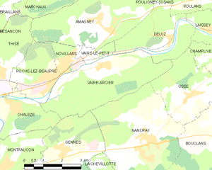
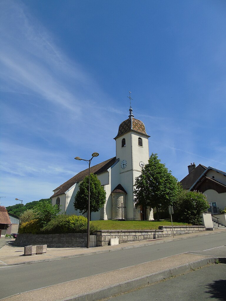
Deluz, located in the Doubs department of the Bourgogne-Franche-Comté region in France, offers a beautiful setting for hiking enthusiasts. The area is characterized by its picturesque landscapes, rolling hills, dense forests, and varied terrain, making it a great destination for outdoor activities.
Popular Hiking Trails in Deluz
-
Le Val de Loue: This scenic route follows the Loue River, offering stunning views of the water and surrounding nature. The trail features a mix of forest paths and riverside walking, perfect for enjoying the tranquility of the area.
-
Les Crêtes de la Franche-Comté: A bit farther out, this trail offers panoramic views of the Jura Mountains and the valleys below. It's suitable for those looking for a more challenging hike.
-
Sentier des Impressionnistes: This trail takes you through the landscapes that inspired famous Impressionist painters. It’s a lovely route that combines art and nature, showcasing the beauty of the region.
Tips for Hiking in Deluz
-
Best Time to Visit: Spring and early fall offer mild weather and beautiful scenery with blooming flowers and autumn foliage. Summer can be warm, while winter may bring snow, which can also make for some stunning hikes if you’re prepared.
-
What to Bring: Always carry enough water, snacks, a map or GPS device, sunblock, and appropriate hiking gear. Consider bringing a camera, as the scenery is incredibly picturesque.
-
Local Wildlife: Keep an eye out for diverse wildlife, including various bird species, deer, and wildflowers along the trails.
-
Safety: Always inform someone about your hiking plans, especially if venturing into less populated areas. Familiarize yourself with the trail conditions and difficulty before heading out.
-
Respect Nature: Follow "Leave No Trace" principles to preserve the natural beauty of the area. Stick to marked trails, pack out all trash, and respect wildlife.
Hiking in Deluz offers a unique opportunity to enjoy nature, explore beautiful landscapes, and experience the culture of the Bourgogne-Franche-Comté region! Whether you're an experienced hiker or just looking for a leisurely stroll, you'll find trails that suit your preferences.
- Country:

- Postal Code: 25960
- Coordinates: 47° 17' 40" N, 6° 12' 3" E


- GPS tracks (wikiloc): [Link]
- Area: 8.03 sq km
- Population: 625
- Wikipedia en: wiki(en)
- Wikipedia: wiki(fr)
- Wikidata storage: Wikidata: Q836627
- Wikipedia Commons Category: [Link]
- Freebase ID: [/m/03mgt25]
- Freebase ID: [/m/03mgt25]
- GeoNames ID: Alt: [6429751]
- GeoNames ID: Alt: [6429751]
- SIREN number: [212501977]
- SIREN number: [212501977]
- BnF ID: [15252423g]
- BnF ID: [15252423g]
- INSEE municipality code: 25197
- INSEE municipality code: 25197
Shares border with regions:


Roulans
- commune in Doubs, France
Roulans is a small commune located in the Doubs department in the Bourgogne-Franche-Comté region of eastern France. While it may not be as widely known for hiking as some other areas in France, it offers natural beauty and a peaceful environment for outdoor activities....
- Country:

- Postal Code: 25640
- Coordinates: 47° 18' 59" N, 6° 14' 0" E


- GPS tracks (wikiloc): [Link]
- AboveSeaLevel: 350 м m
- Area: 8.31 sq km
- Population: 1125
- Web site: [Link]


Vaire-le-Petit
- former commune in Doubs, France
Vaire-le-Petit is a charming village in northeastern France, located in the Grand Est region. While it might not be as widely recognized as some other hiking destinations, it is surrounded by beautiful natural landscapes, making it a great spot for outdoor enthusiasts....
- Country:

- Postal Code: 25220
- Coordinates: 47° 17' 13" N, 6° 8' 46" E


- GPS tracks (wikiloc): [Link]
- Area: 1.26 sq km
- Population: 226


Vaire-Arcier
- former commune in Doubs, France
Vaire-Arcier is a lesser-known hiking destination located in the Franche-Comté region of France, often favored for its peaceful landscapes and natural surroundings. While it may not be as famous as some larger national parks, it offers a variety of trails that can provide a satisfying hiking experience....
- Country:

- Postal Code: 25220
- Coordinates: 47° 16' 59" N, 6° 9' 9" E


- GPS tracks (wikiloc): [Link]
- AboveSeaLevel: 248 м m
- Area: 12.78 sq km
- Population: 542


Pouligney-Lusans
- commune in Doubs, France
Pouligney-Lusans is a small commune located in the Doubs department of the Bourgogne-Franche-Comté region in eastern France. While it may not be a widely recognized hiking destination, the surrounding area does offer opportunities for nature walks and hiking experiences....
- Country:

- Postal Code: 25640
- Coordinates: 47° 19' 43" N, 6° 12' 14" E


- GPS tracks (wikiloc): [Link]
- Area: 11.6 sq km
- Population: 835


Osse
- commune in Doubs, France
Osse, located in the Doubs department of the Bourgogne-Franche-Comté region in eastern France, offers various hiking opportunities in a picturesque natural setting. The area's landscape is characterized by rolling hills, dense forests, and stunning views of the surrounding Jura Mountains....
- Country:

- Postal Code: 25360
- Coordinates: 47° 16' 1" N, 6° 12' 46" E


- GPS tracks (wikiloc): [Link]
- Area: 8.21 sq km
- Population: 328

